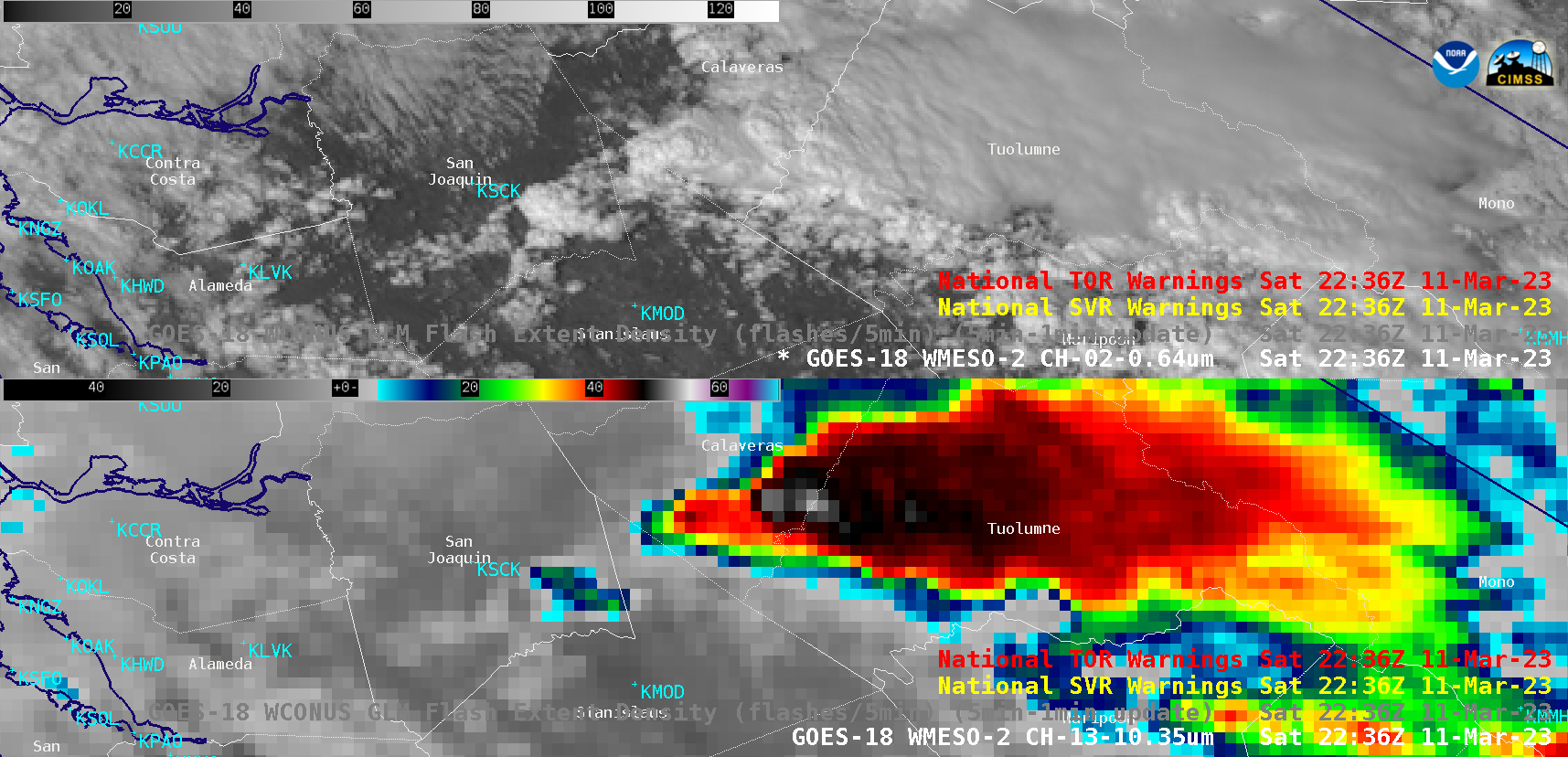
Severe thunderstorms across Oklahoma and Texas
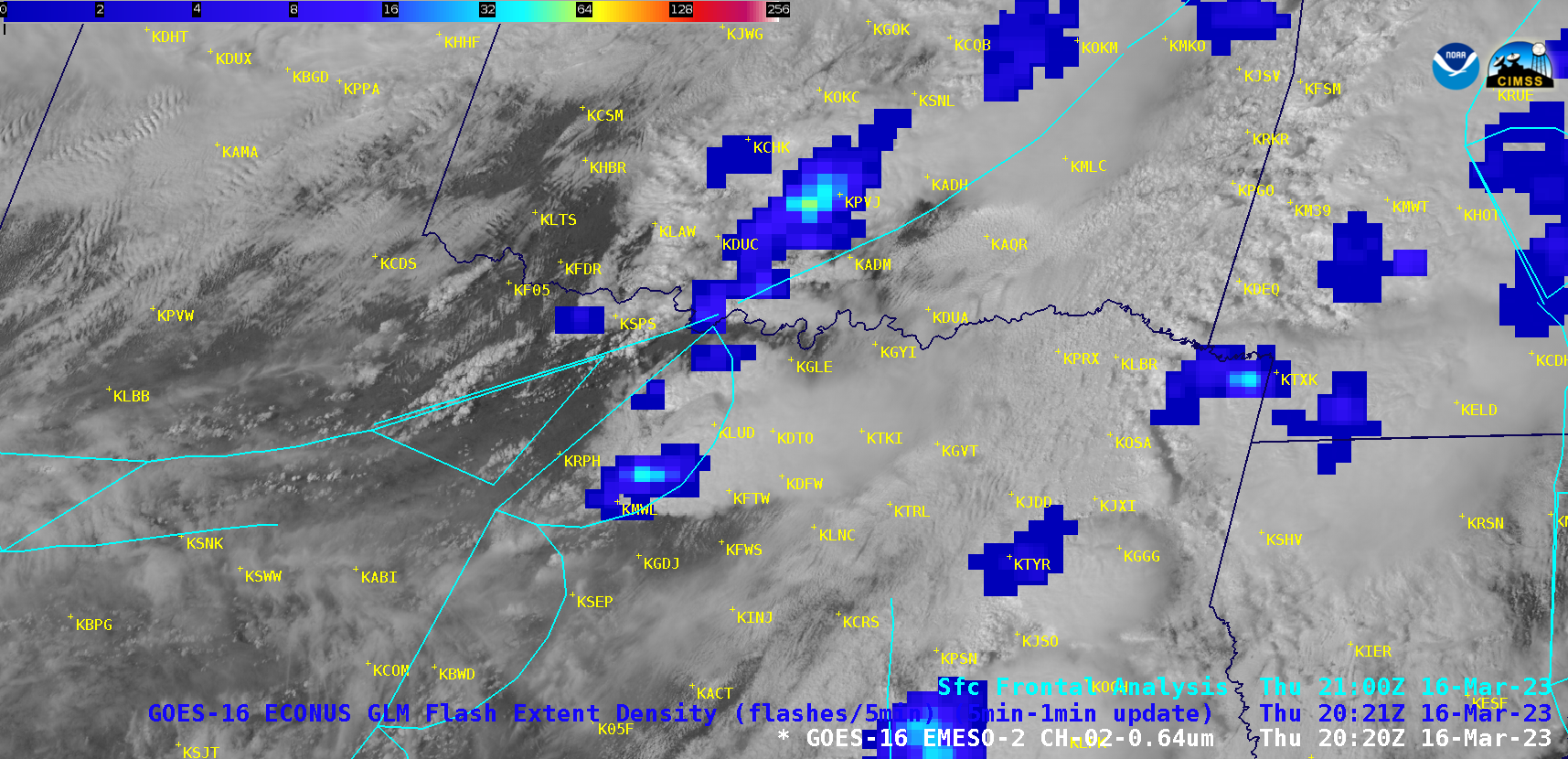
1-minute Mesoscale Domain Sector GOES-16 (GOES-East) “Red” Visible (0.64 µm) images (above) included an overlay of GLM Flash Extent Density and surface fronts — which showed severe thunderstorms that developed across southern Oklahoma (along and ahead of a cold front) and North Texas (ahead of a dryline) during the afternoon and... Read More
