Blowing dust across Mongolia and China
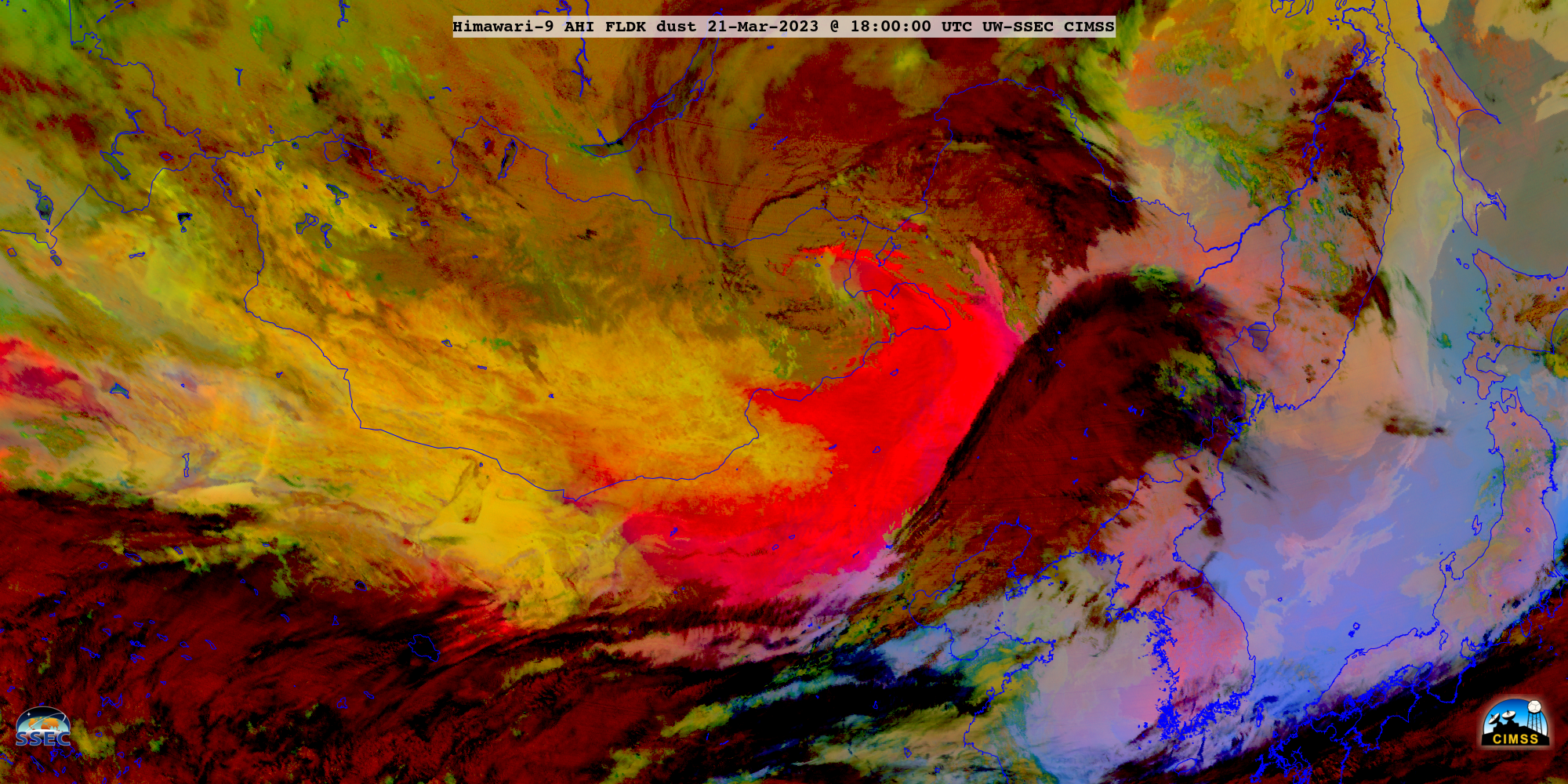
JMA Himawari-9 Dust RGB images created using Geo2Grid (above) spanned the period from 2100 UTC on 20 March to 2350 UTC on 22 March 2023 — and showed a large area of dense blowing dust (brighter shades of magenta to pink) across parts of eastern Mongolia and northern/northeastern China (eventually crossing... Read More