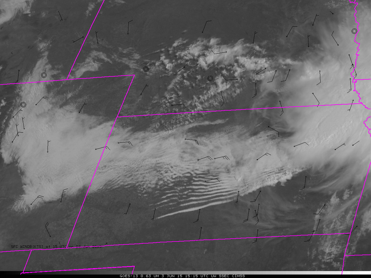
Category: General interpretation
Possible Sting Jet Associated with strong storm in Europe
Sting jets are wind maxima near the end of bent-back fronts in cases of strong cyclones. As noted earlier on this blog, they can acquire a characteristic look in water vapor imagery, vaguely reminiscent of a scorpion’s stinger. In addition, strongly sinking air around the jet, usually associated with both a tropopause fold and a... Read More
Widespread power outages across Syria
McIDAS-V “before” (22 October 2013) and “after” (23 October 2013) night-time images of Suomi NPP VIIRS 0.7 µm Day/Night Band data (above; courtesy of William Straka, CIMSS) showed the coverage of power outages across much of Syria, caused by a rebel attack on a gas pipeline (near Damascus International Airport)... Read More
Flooding rains in southern Texas
Flooding rains have occurred over south Texas during the past two days, and the animation of GOES water vapor imagery, above, and of MIMIC Total Precipitable Water, below, shows two airstreams moving moisture into that region. The GOES-15/GOES-13 Water Vapor image animation, above, shows upper-level moisture moving in from the... Read More