Pyrocumulonimbus cloud in Bolivia
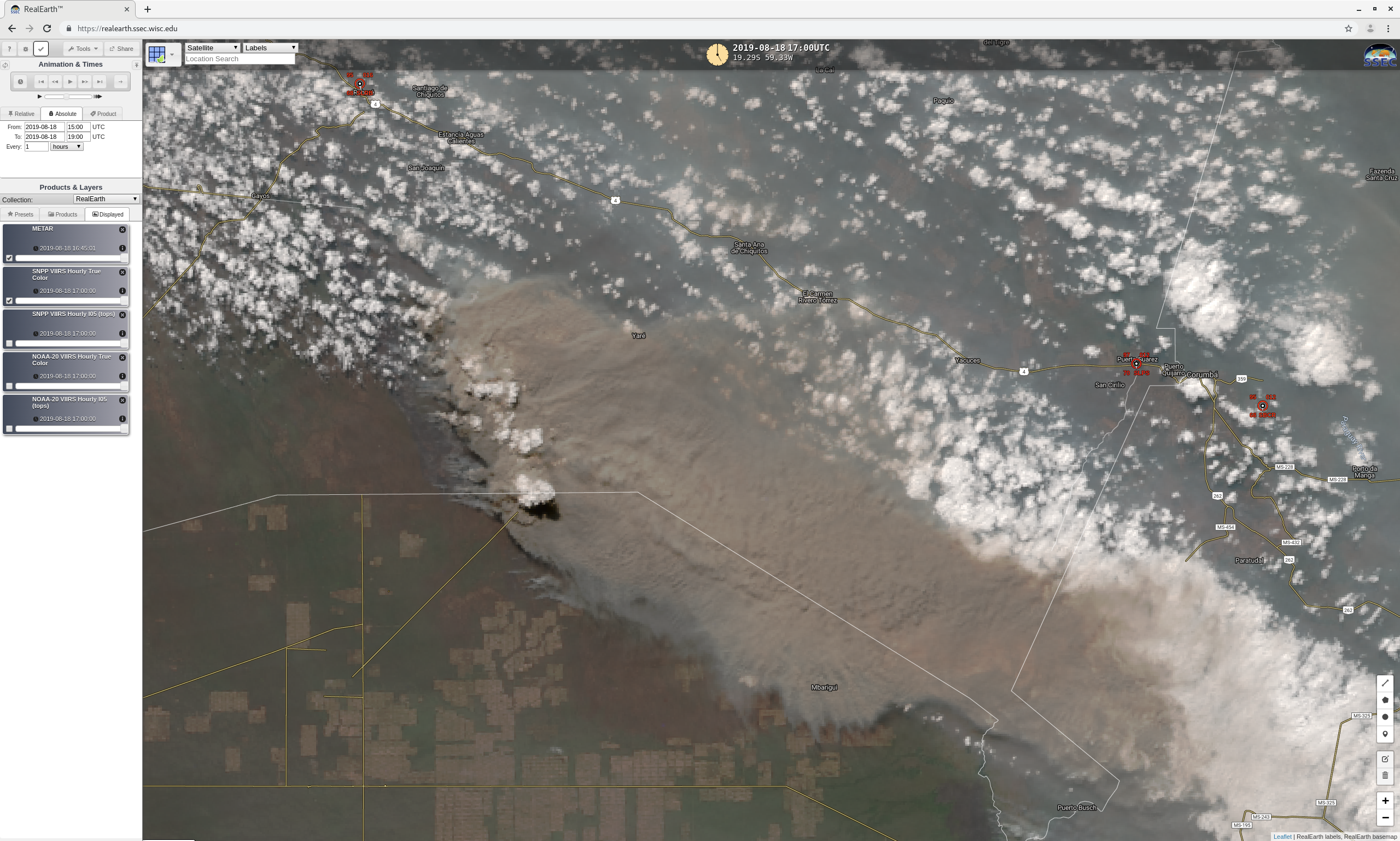
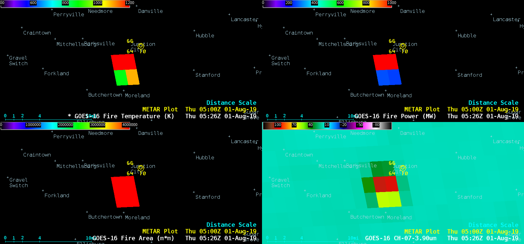
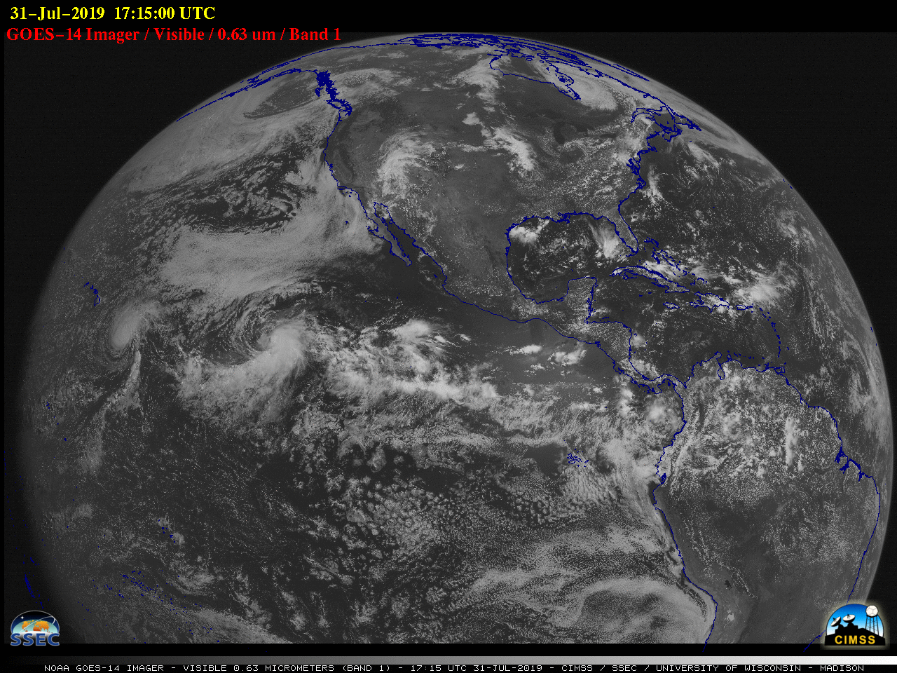
GOES-16 (GOES-East) “Red” Visible (0.64 µm), Shortwave Infrared (3.9 µm) and “Clean” Infrared Window (10.35 µm) images (above) showed the formation of a pyrocumulonimbus (pyroCb) cloud over far southeastern Bolivia on 18 August 2019. The small anvil cloud briefly surpassed the -40ºC pyroCb threshold from 1800-1820 UTC, attaining a minimum cloud-top infrared... Read More