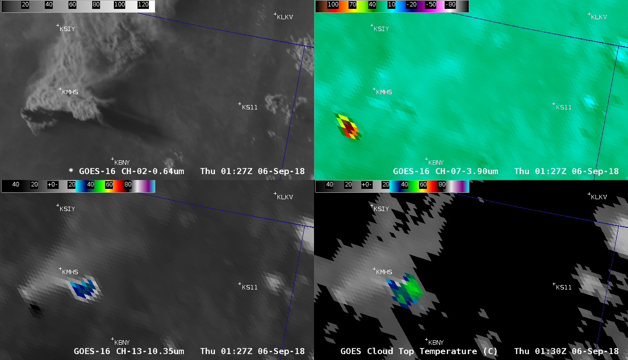
Delta Fire pyroCumulonimbus cloud in California

GOES-16 “Red” Visible (0.64 µm, top left), Shortwave Infrared (3.9 µm, top right), “Clean” Infrared Window (10.3 µm, bottom left) and Cloud Top Temperature product (bottom right) [click to play animation | MP4]
Massive plume of smoke over the #DeltaFire. ?: Jeff Mandrell pic.twitter.com/2QN66HcwM4
— Active NorCal (@ActiveNorCal) September 6, 2018
A longer animation of GOES-16 “Red” Visible, Shortwave Infrared and “Clean” Infrared Window images displayed using McIDAS (below) showed that the first hot (red) Shortwave Infrared pixels appeared at 2027 UTC. The fire caused a 5-mile section of Interstate 5 to be closed.
GOES-16 “Red” Visible (0.64 µm, top), Shortwave Infrared (3.9 µm, middle) and “Clean” Infrared Window (10.3 µm, bottom) images; Interstate 5 is plotted in cyan [click to play animation | MP4]
GOES-17 “Red” Visible (0.64 µm, top), Shortwave Infrared (3.9 µm, middle) and “Clean” Infrared Window (10.3 µm, bottom) images; Interstate 5 is plotted in cyan [click to play animation | MP4]
* GOES-17 images shown here are preliminary and non-operational *

