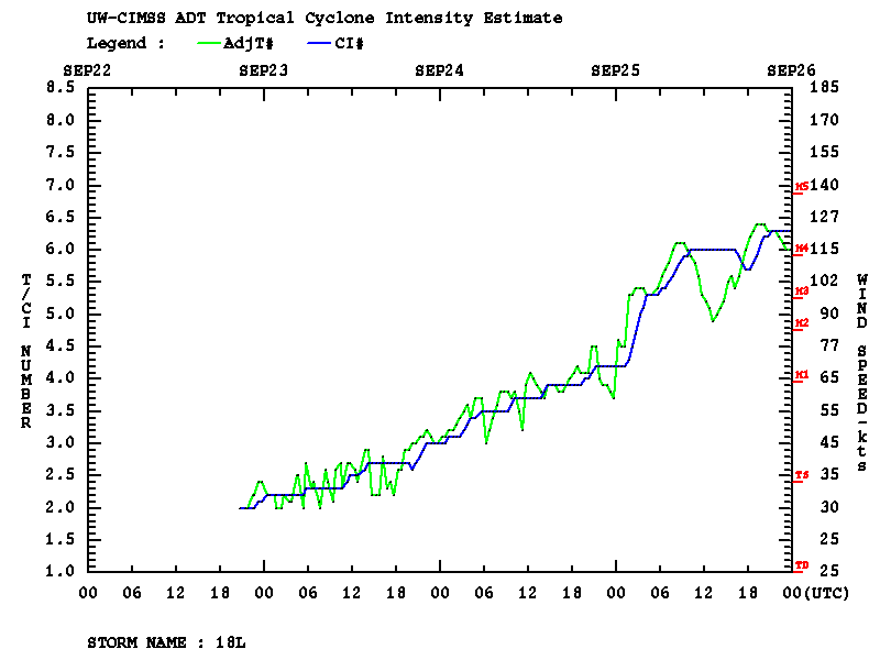
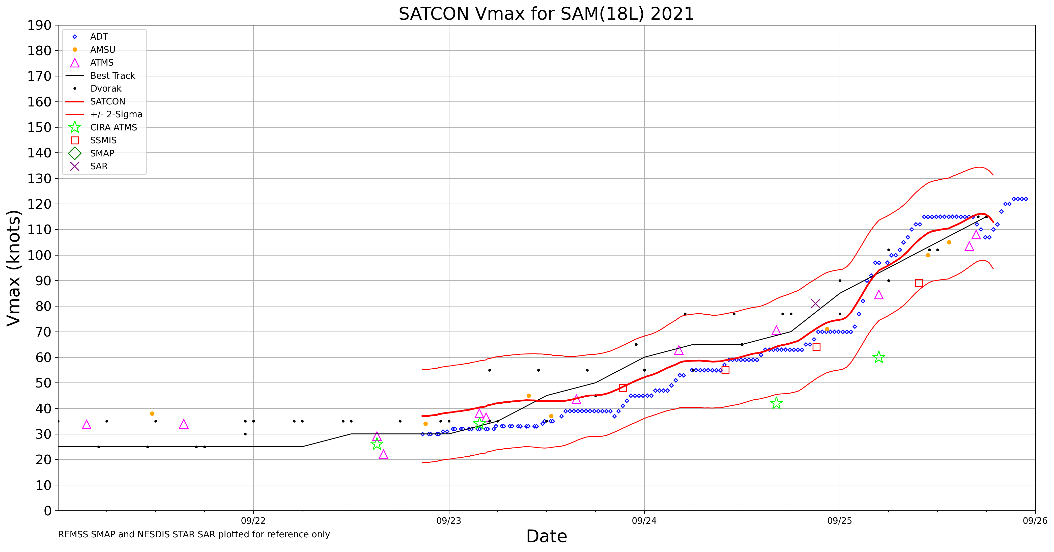
Hurricane Sam reaches Category 4 intensity
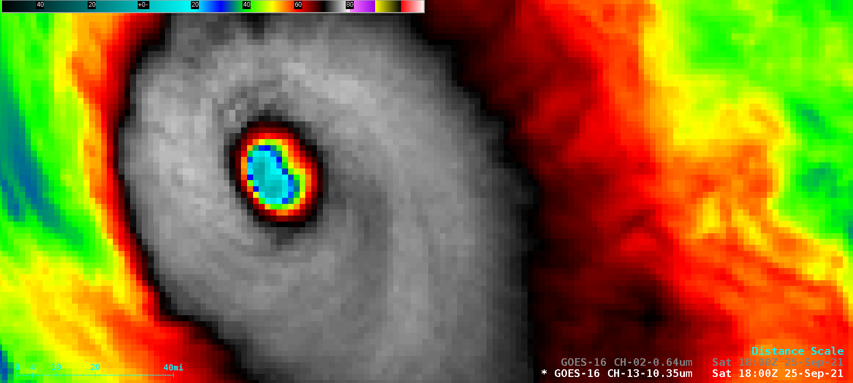
1–minute Mesoscale Domain Sector GOES-16 (GOES-East) “Red” Visible (0.64 µm) and “Clean” Infrared Window (10.35 µm) images (above) showed Hurricane Sam as it intensified from a Category 3 to a Category 4 storm (ADT | SATCON) in the central Atlantic Ocean on 25 September 2021. The eye became cloud-filled during the middle portion of... Read More
