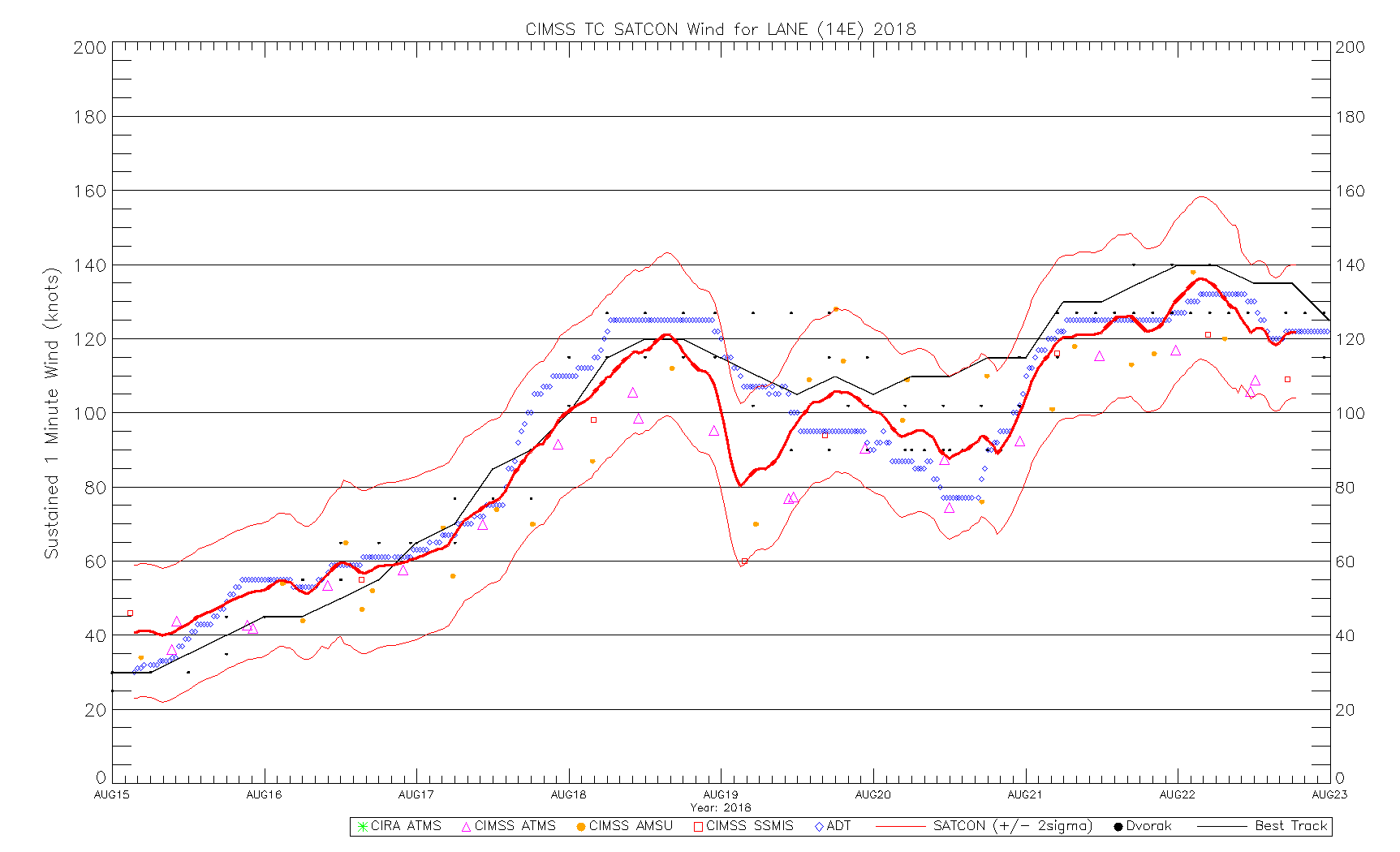
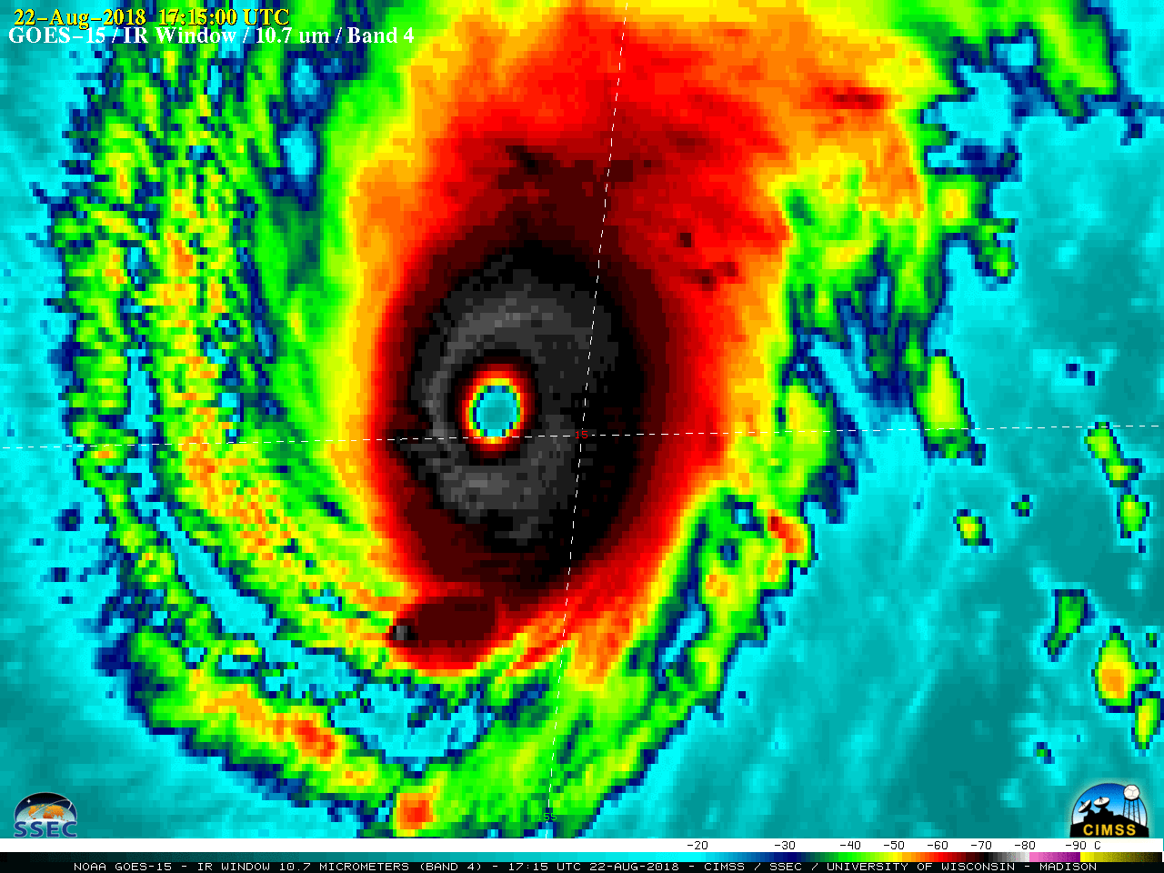
This website works best with a newer web browser such as Chrome, Firefox, Safari or Microsoft Edge. Internet Explorer is not supported by this website.

Category: DMSP

Hurricane Irma in the eastern Atlantic Ocean

A toggle between nighttime images of Suomi NPP VIIRS Infrared Window (11.45 µm) and Day/Night Band (0.7 µm) data at 0347 UTC (courtesy of William Straka, SSEC/CIMSS) showed a high-resolution view of the eye of Category 3 Hurricane Irma. GOES-16 data (ABI and GLM) posted on this page are preliminary, non-operational... Read More

Hurricane Gert

GOES-16 data posted on this page are preliminary, non-operational and are undergoing testingHurricane Gert, a Category-1 storm on the Saffir-Simpson scale, is over the open Atlantic Ocean east of Cape Hatteras. It is close enough to the USA, however, that it is within GOES-16’s CONUS domain where 5-minute sampling is... Read More

Hurricane Dora

** GOES-16 data posted on this page are preliminary, non-operational data and are undergoing testing **Dora became the first hurricane of the Eastern Pacific 2017 season on 26 June, and was also the first hurricane to be sampled by GOES-16. On Visible (0.64 µm) and Infrared Window (10.3 µm) images (above), Dora... Read More

Tropical Storm Arlene

** The GOES-16 data posted on this page are preliminary, non-operational data and are undergoing testing. **A comparison of GOES-16 Visible (0.64 um) and Infrared Window (10.3 um) images (above) showed the development of Tropical Storm Arlene in the Atlantic Ocean on 20 April 2017.  Arlene has been one of only two... Read More