GOES-14 SRSOR: Thunderstorm development over Kentucky
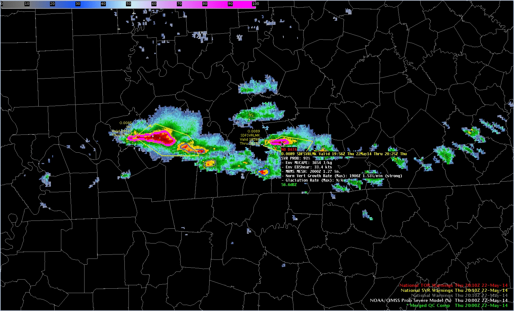
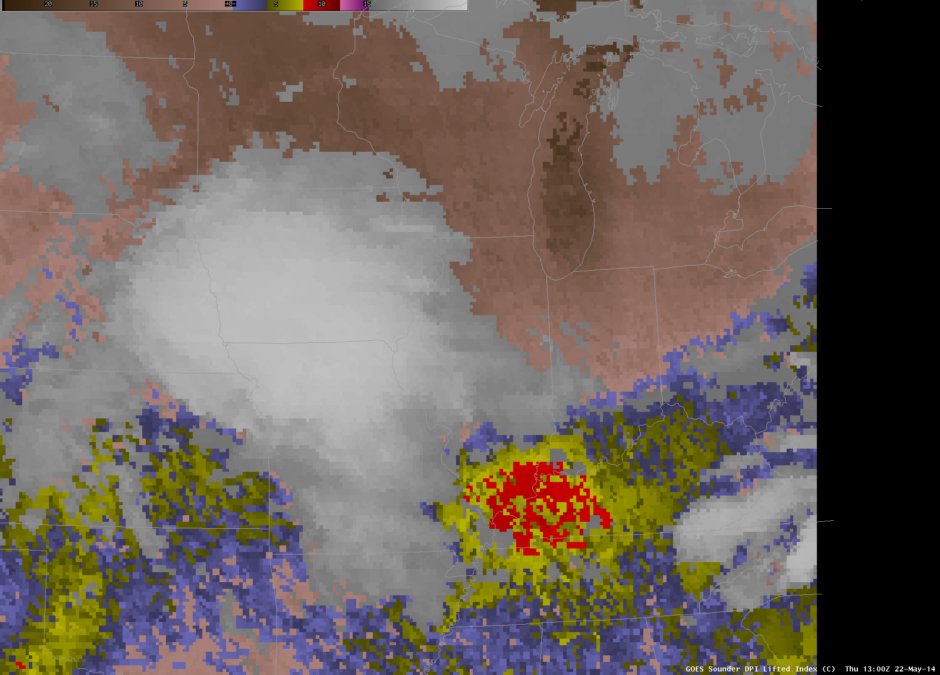
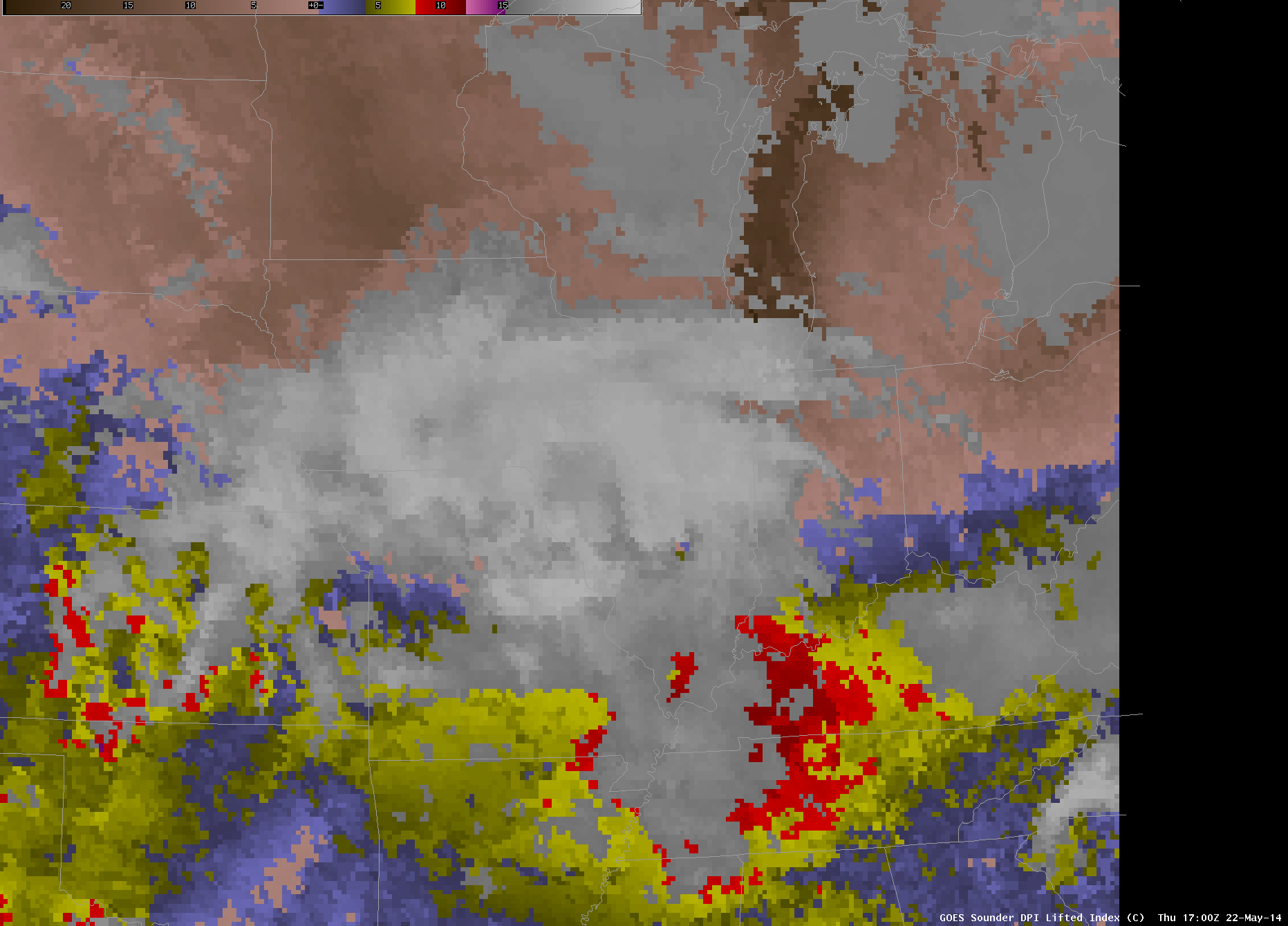
GOES-14 operations in SRSOR mode deliver the ability to monitor convective development at very short time-scales. A good example of this occurred over the lower Ohio Valley/western Kentucky on May 22nd. The animation of GOES-13 Sounder Derived Product Imagery of CAPE (above) and of Lifted Index (1300 and 1700 UTC) showed considerable... Read More
