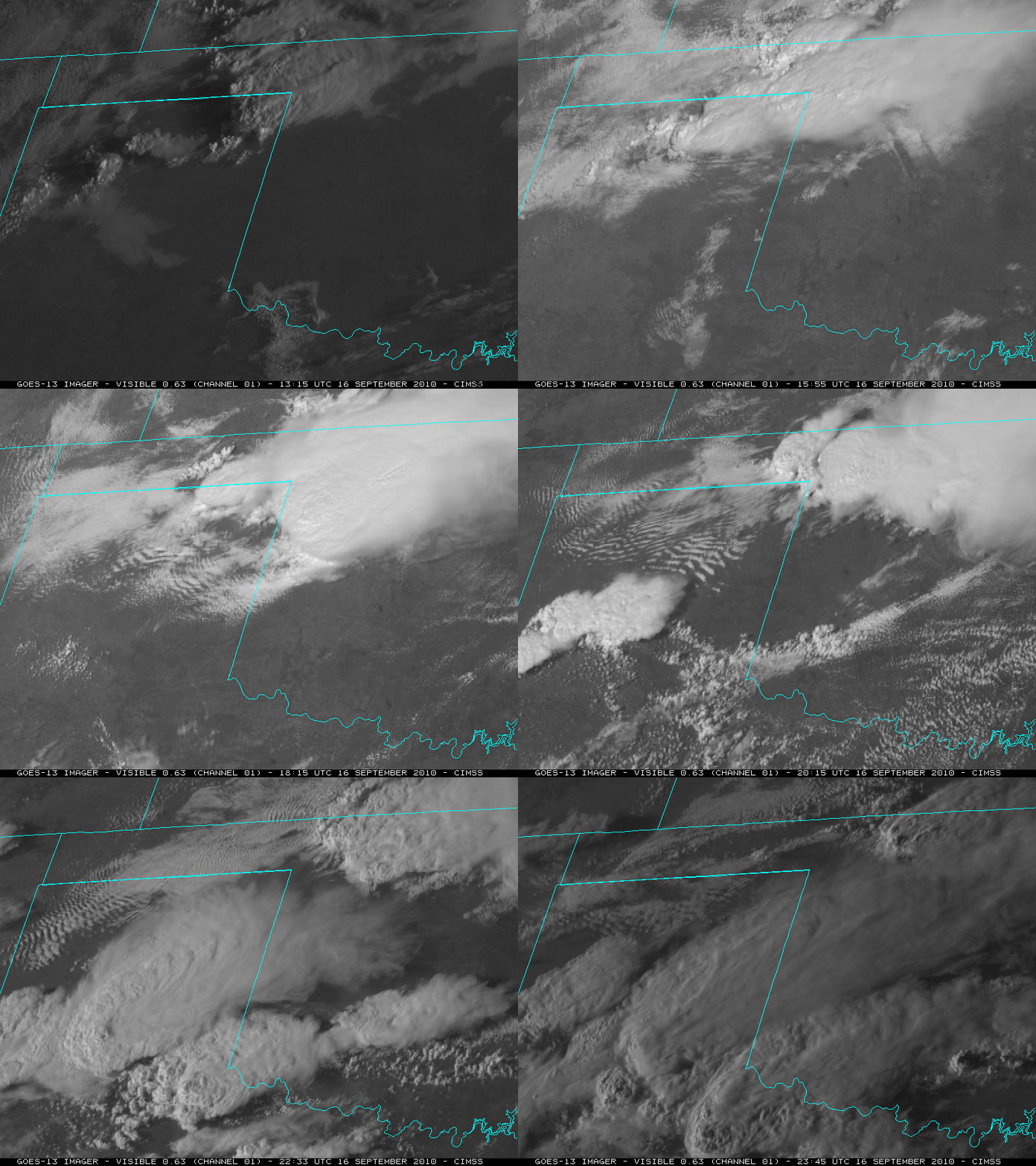
Convective initiation along a pre-existing convective outflow boundary
McIDAS images of GOES-13 0.63 µm visible channel data on 16 September 2010 (above) showed a nice example of the role that a pre-existing convective outflow boundary can play in helping to act as a forcing mechanism for new convection — and also to help intensify existing strong convection that encounters the outflow boundary. Morning thunderstorms along the Texas/Oklahoma border region produced an outflow boundary that later moved southward and westward during the early afternoon hours. New convection was then seen to develop in Oklahoma and Texas along the old outflow boundary after about 20 UTC.
In addition, new thunderstorms that had developed in the Texas Panhandle around 19 UTC appeared to intensify once they moved eastward and encountered the aforementioned outflow boundary that was left behind from the earlier storms. According to the SPC Storm Reports, the large thunderstorms in the Texas Panhandle produced hail up to 4.00 inches in diameter, with surface wind gusts up to 75 mph.


