Forecasting Isolated Convection
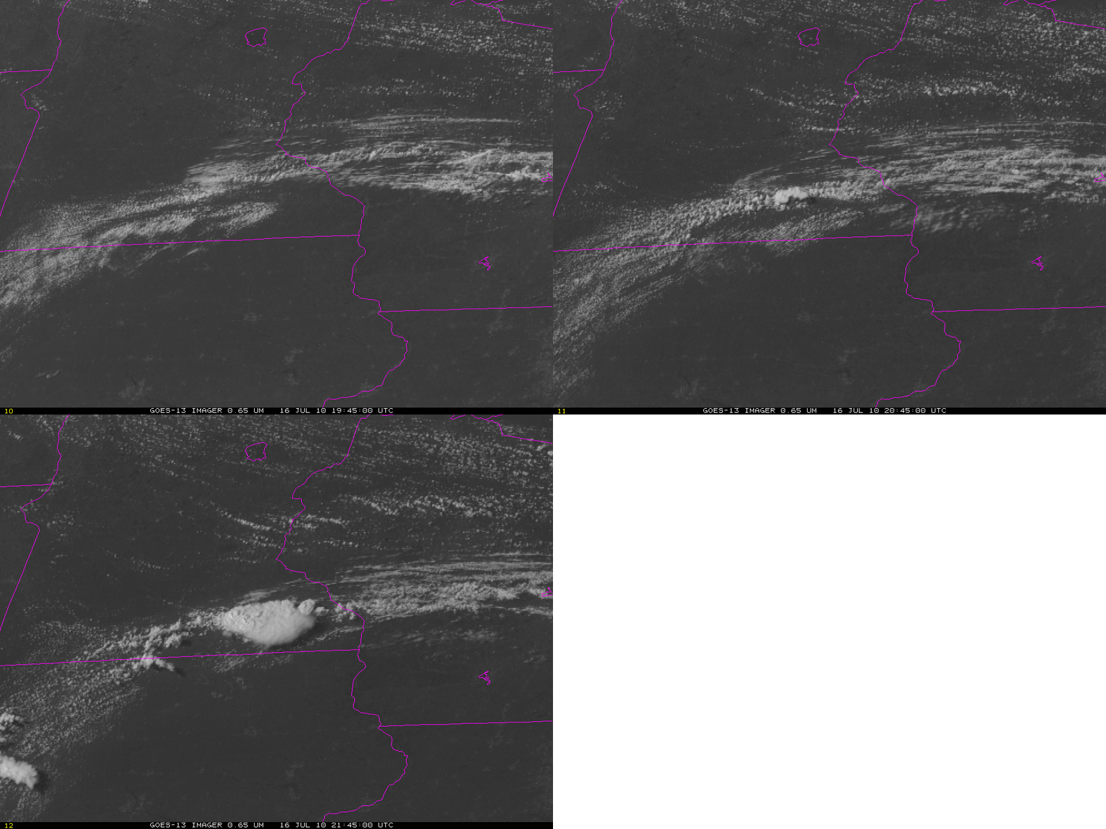
How can satellite data be used to focus one’s attention to the relevant portion of an airmass when isolated convection is developing? That was a salient question late in the day on 16 July when a few convective cells developed over the upper midwest. Visible imagery (above) shows the development of a strong cell — that produced 1.75-inch hail southwest of Rochester in Waltham, MN.
Several satellite products from earlier in the day suggested convection could be sustained in this region. For example, the CIMSS Nearcasting product, which product uses a Lagrangian transport model of upper and lower level moisture observations from the GOES Sounder to make short-term predictions of convective instability (that is, the change in equivalent potential temperature with height), shows a ribbon of lower stability air arcing from Nebraska to southern Minnesota to central Wisconsin. Consider the forecast for 2000 UTC on 16 July made from observations at 1400 UTC, 1500 UTC, 1600 UTC and 1700 UTC. (A loop of the four forecasts valid at 2000 UTC is here). The forecast for lower level (around 800 mb) equivalent potential temperature to be 7-12 K warmer than the upper level (around 500 mb) equivalent potential temperature is very consistent from run to run.
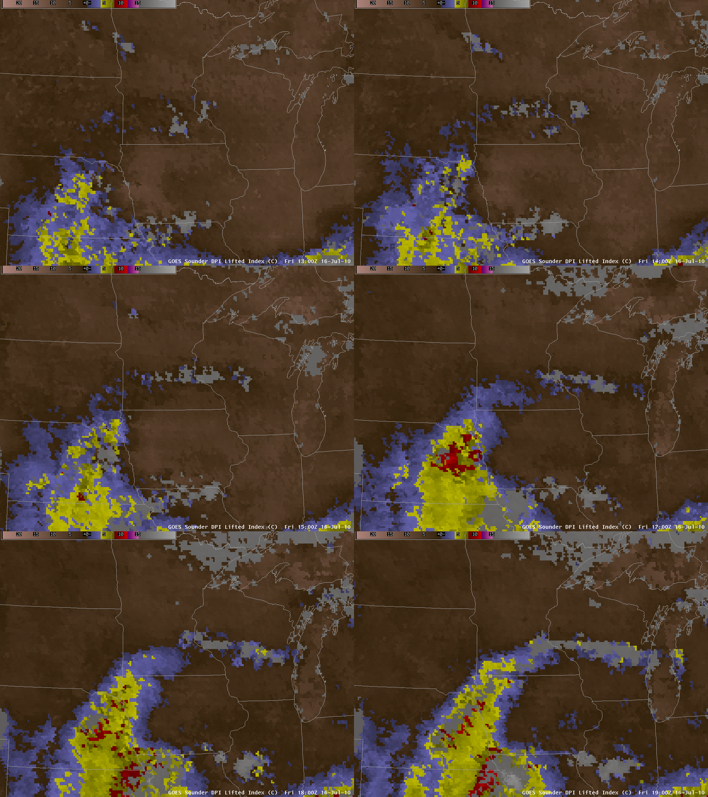
Sounder Derived Product Imagery also shows destabilization ongoing in the region highlighted by the Nearcasting technique. The Lifted Index (above) derived from the Sounder Retrievals shows a ribbon of progressively more unstable air over the course of the day.
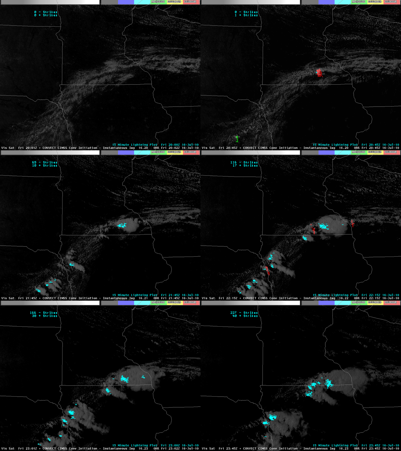
Once the region of interest is identified, UW Convective Initiation can be used to identify the specific cumulus cell that will grow. For example, consider the visible image at 2000 UTC, 2015 UTC, 2032 UTC and 2045 UTC . A convective cell develops over southern Minnesota out of a line of towering cumulus. By 2045 UTC, lightning is being produced. The UW Convective Initiation product, which uses both cloud-top cooling and cloud phase changes (both derived from GOES-13 imagery) to infer strong convective growth that leads to clouds with supercooled water and then ice, shows convective initiation likely over south-central Minnesota at 2032 UTC, and ongoing at 2045 UTC. A more complete visible loop that includes lightning plots is here. The complete visible loop with convective initiation values overlain is below. Strong convective cells from Nebraska to Wisconsin are recognized by the UWCI algorithm. Note that convective initiation only detects the start of convection; once the convective tower has glaciated, initiation is deemed to have ended and it is no longer detected. For this reason, UWCI may not show optimal results in regions of ice clouds. However, as the loop below shows, it commonly detects growing convective clouds before the convection produces lightning, and long before severe weather occurs.


