Turbulence associated with an orographic banner cloud over Montana
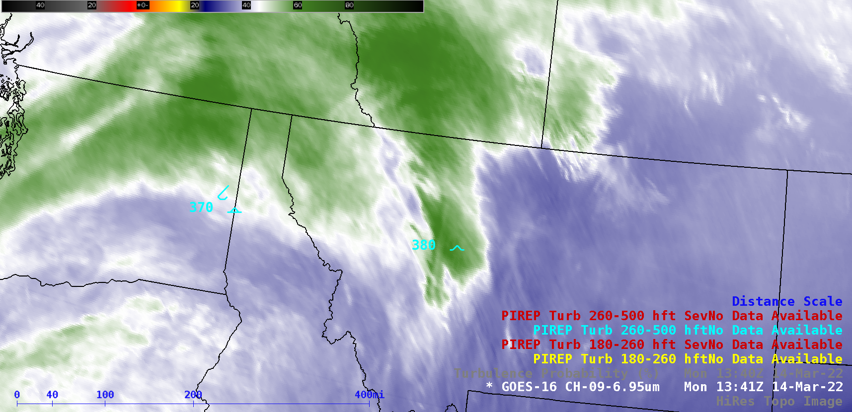
GOES-16 (GOES-East) Mid-level Water Vapor (6.9 µm) images along with a Turbulence Probability product (above) showed the formation of a banner cloud in northwestern Montana on 14 March 2022 — this orographic cloud feature appeared to be anchored to the Lewis Range and Sawtooth Range, which rise to elevations of 8,000-9,000 feet. The Probability of... Read More