Turbulence Probability and moisture with a strong jet

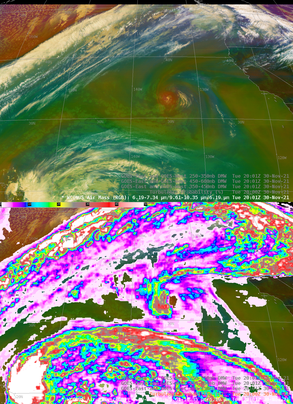
The GOES-17 Air Mass RGB, above, shows a distinct jet in the northwestern quadrant of the image. Derived Motion winds are as strong as 170 knots between 250-350 mb (they’re almost as strong from 350-450 mb!) In contrast, winds from 450-600 mb are closer to 70 knots just to the northwest of that upper-level jet. As you might expect, Turbulence Probability fields have a maximum along that very strong jet, as shown below. High Probabilities of turbulence also exist northeast of Hawaii (in the lower left corner of the image), and near the upper-level low at 33 N, 134 W. Turbulence Probablities are derived from GOES-17 infrared data and from GFS estimates of upper level stability. (Training on this product is available here under ‘Machine-Learning for Turbulence Detection by Satellite’).

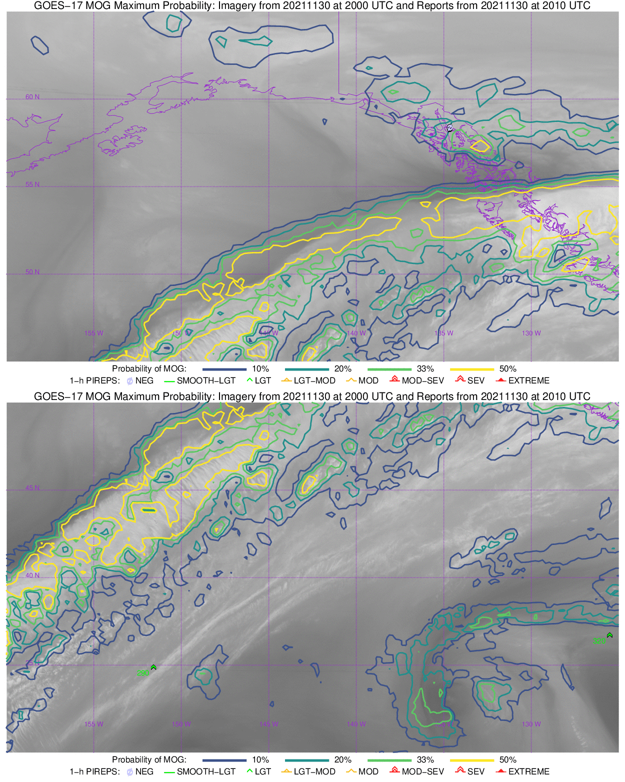
In addition to their availability in AWIPS, as shown above (via an LDM feed from CIMSS), Turbulence Probabilities are also available on line at https://cimss.ssec.wisc.edu/turbulence. Values from 2000 UTC are shown below in the GOES-17 ‘Gulf of Alaska’ and ‘Vancouver’ domains.

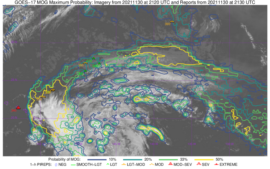
Turbulence probability fields from 2120 UTC, below, show that most of the Pilot Reports of turbulence align with the axis of higher probabilities. But not all of them: Severe turbulence (denoted in red) is noted near Oahu in a region of small (but not zero!) probability.

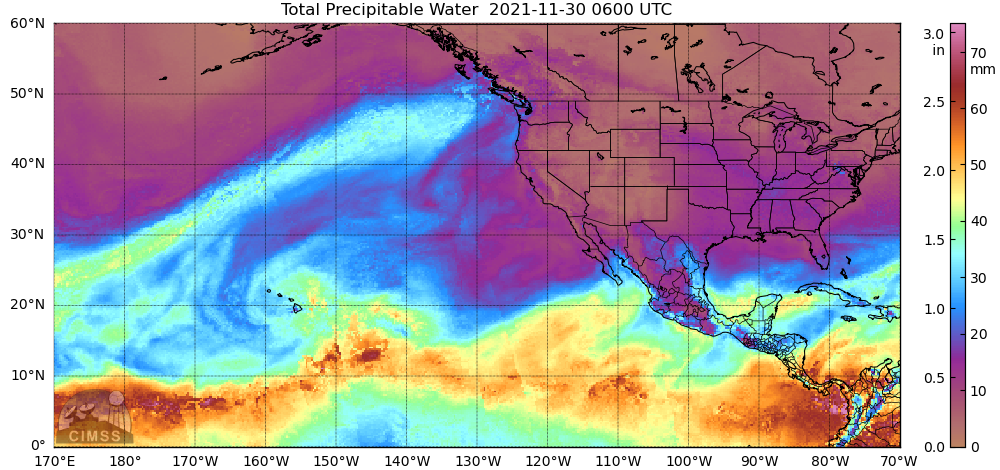
The strong jet obvious in the Air Mass RGB is associated with strong transport of moisture towards the Pacific Northwest. MIMIC Total Precipitable Water (TPW) fields, below, show abundant moisture traveling across most of the Pacific. OSPO’s TPW Percent of Normal fields show values exceeding 200% in this moist airstream (image from 1500 UTC on 30 November).


