Chemical plant fire near Houston, Texas
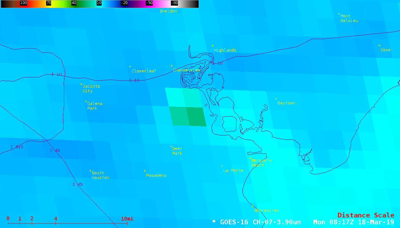
GOES-16 (GOES-East) Shortwave Infrared (3.9 µm) images (above) revealed the thermal anomaly or “hot spot” of a fire burning at the Intercontinental Terminals Company petrochemical plant in Deer Park, Texas on 18 March 2019. Although the thermal signature was often partially masked by the passage of high clouds overhead, it was... Read More