MIRS Rain Rate from Direct Broadcast
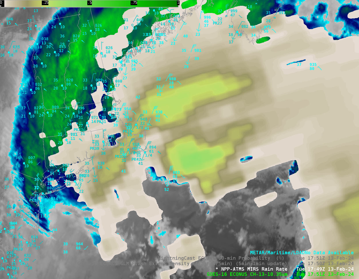
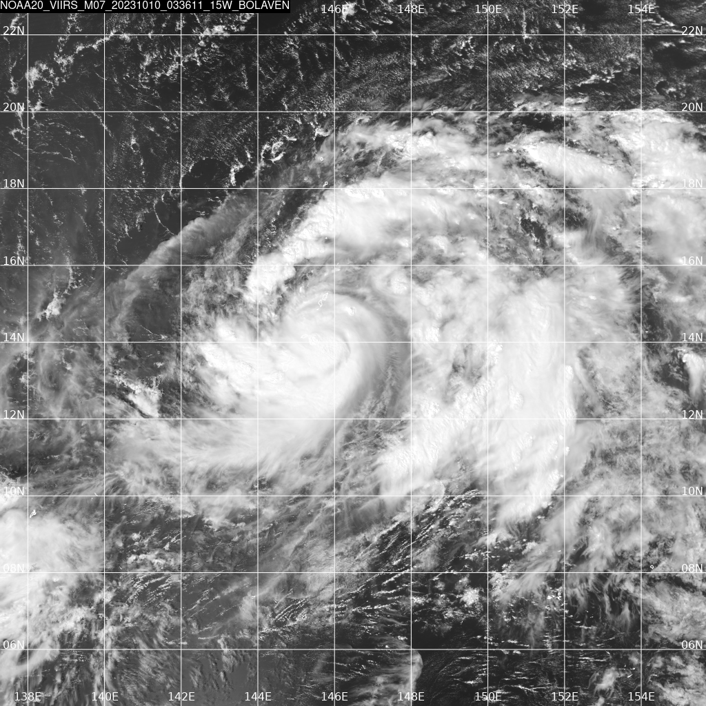
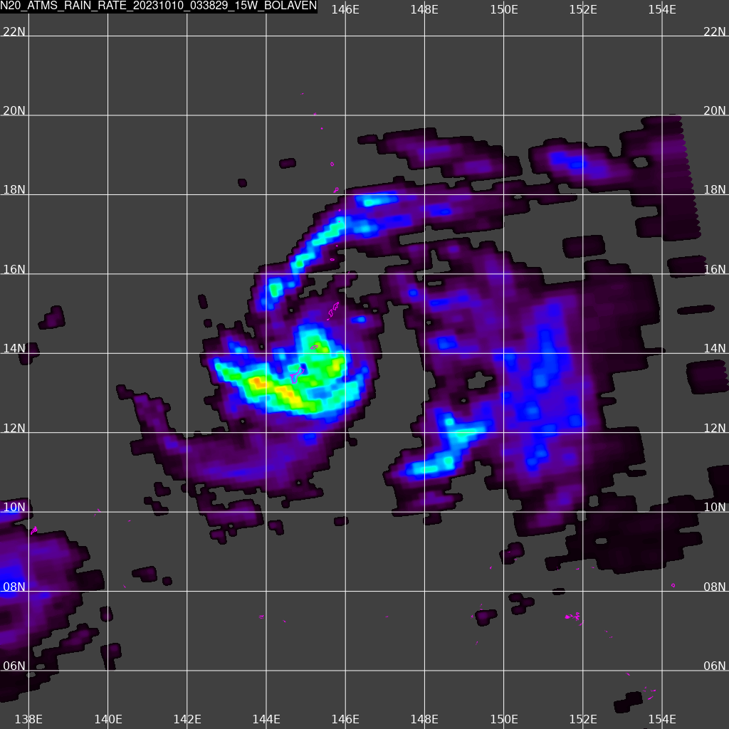
CSPP software processes signals at Direct Broadcast antenna sites to create products and imagery with very low latency from Low-Earth Orbit (LEO) satellites. The software includes Microwave Integrated Retrieval System (MIRS) algorithms, including rain rate (available here). How well does that product do in capturing observed precipitation? The toggle above shows... Read More
