This website works best with a newer web browser such as Chrome, Firefox, Safari or Microsoft Edge. Internet Explorer is not supported by this website.

Stories by Scott Bachmeier

Tropical Invest 90L in the Gulf of Mexico

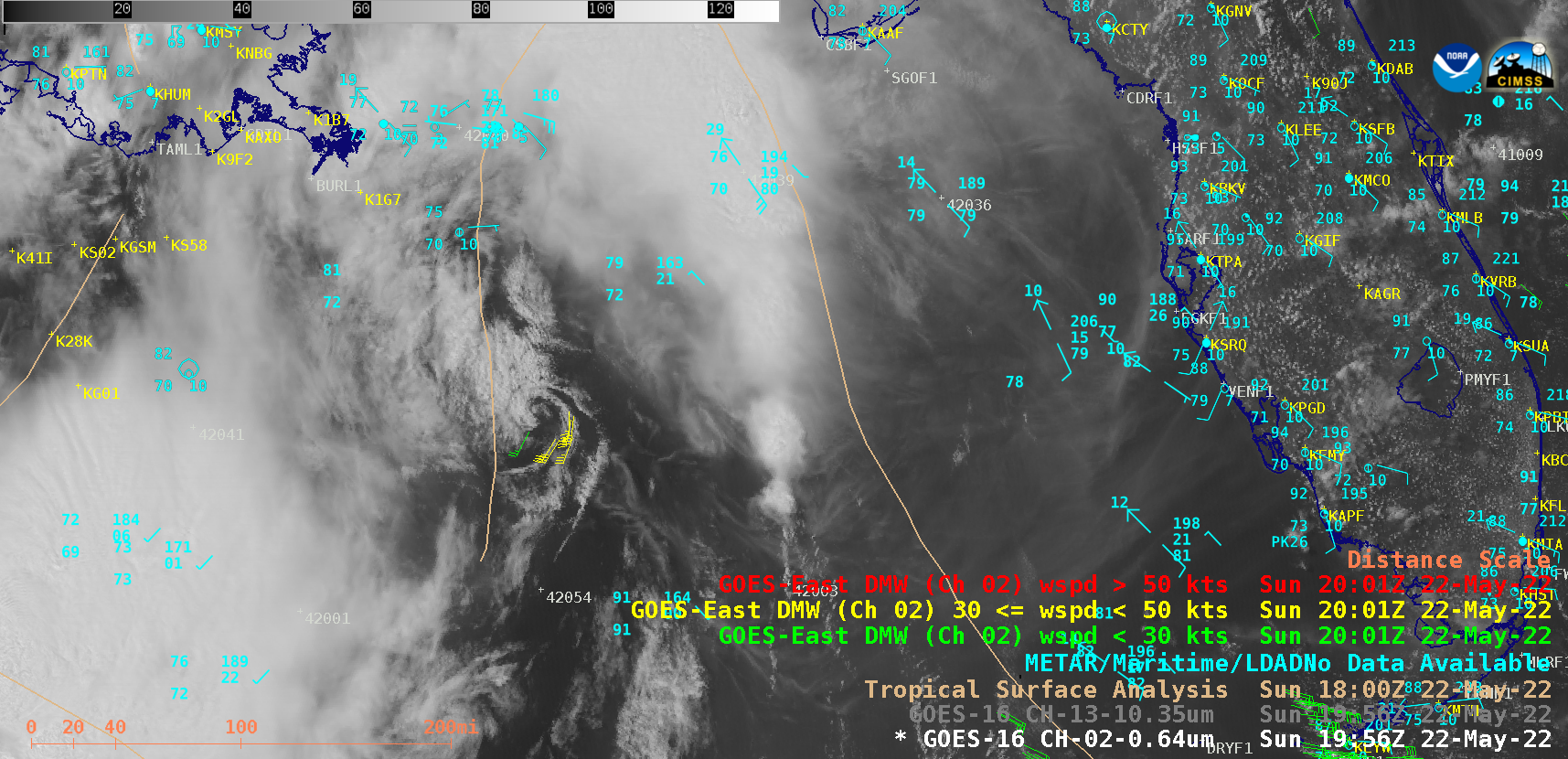
GOES-16 (GOES-East) “Red” Visible (0.64 µm) and “Clean” Infrared Window (10.35 µm) images (above) showed that a decaying Mesoscale Convective System (MCS) produced a low-level Mesoscale Convective Vortex (MCV) over the Gulf of Mexico on 22 May 2022. The coldest MCS overshooting tops exhibited  infrared brightness temperature of -77C around 1401 UTC. GOES-16 Visible (ABI... Read More

Another pyrocumulonimbus cloud spawned by the Calf Canyon Fire in New Mexico

Preliminary / non-operational GOES-18 “Red” Visible (0.64 µm), Shortwave Infrared (3.9 µm) and “Clean” Infrared Window (10.35 µm) images (above) showed that the Calf Canyon Fire/Hermits Peak Fire in northern New Mexico produced another another pyrocumulonimbus (pyroCb) cloud on 14 May 2022 — following 2 previous pyroCb events on 10 May and 01 May. This particular pyroCb first exhibited cloud-top infrared brightness... Read More

Severe thunderstorms across the Upper Midwest

1-minute Mesoscale Domain Sector GOES-16 (GOES-East) “Red” Visible (0.64 µm) images (above) include time-matched SPC Storm Reports — and showed some of the widespread severe weather that occurred across the Upper Midwest during the afternoon and early evening hours on 11 May 2022. Numerous pulsing overshooting tops were apparent in the vicinity of most storm reportsThe corresponding 1-minute GOES-16 “Clean”... Read More