Calf Canyon Fire produces a pyrocumulonimbus cloud
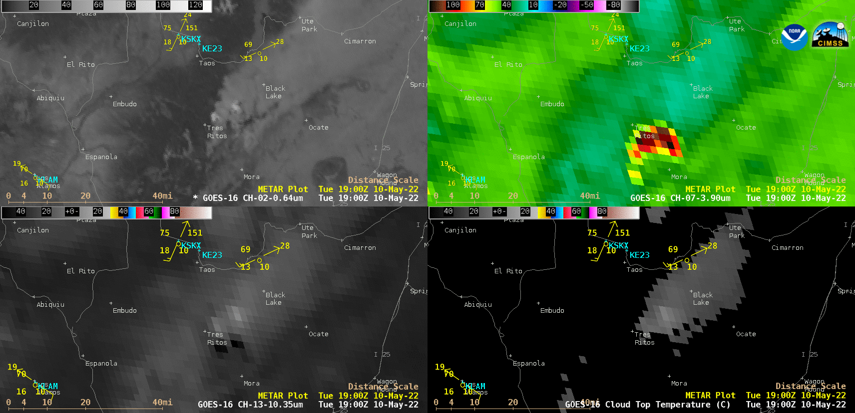
GOES-16 “Red” Visible (0.64 µm, top left), Shortwave Infrared (3.9 µm, top right), Infrared Window (10.35 µm, bottom left) and Cloud Top Temperature derived product (bottom right) [click to play animated GIF | MP4]
In a comparison of NOAA-20 VIIRS True Color RGB, False Color RGB and Infrared Window (11.45 µm) images valid at 2057 UTC (below), the coldest cloud-top infrared brightness temperature was -59ºC. These images were acquired and processed using the Direct Broadcast ground station at SSEC/CIMSS.
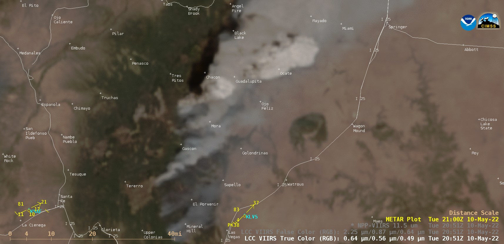
NOAA-20 VIIRS True Color RGB, False Color RGB and Infrared Window (11.45 µm) images [click to enlarge]
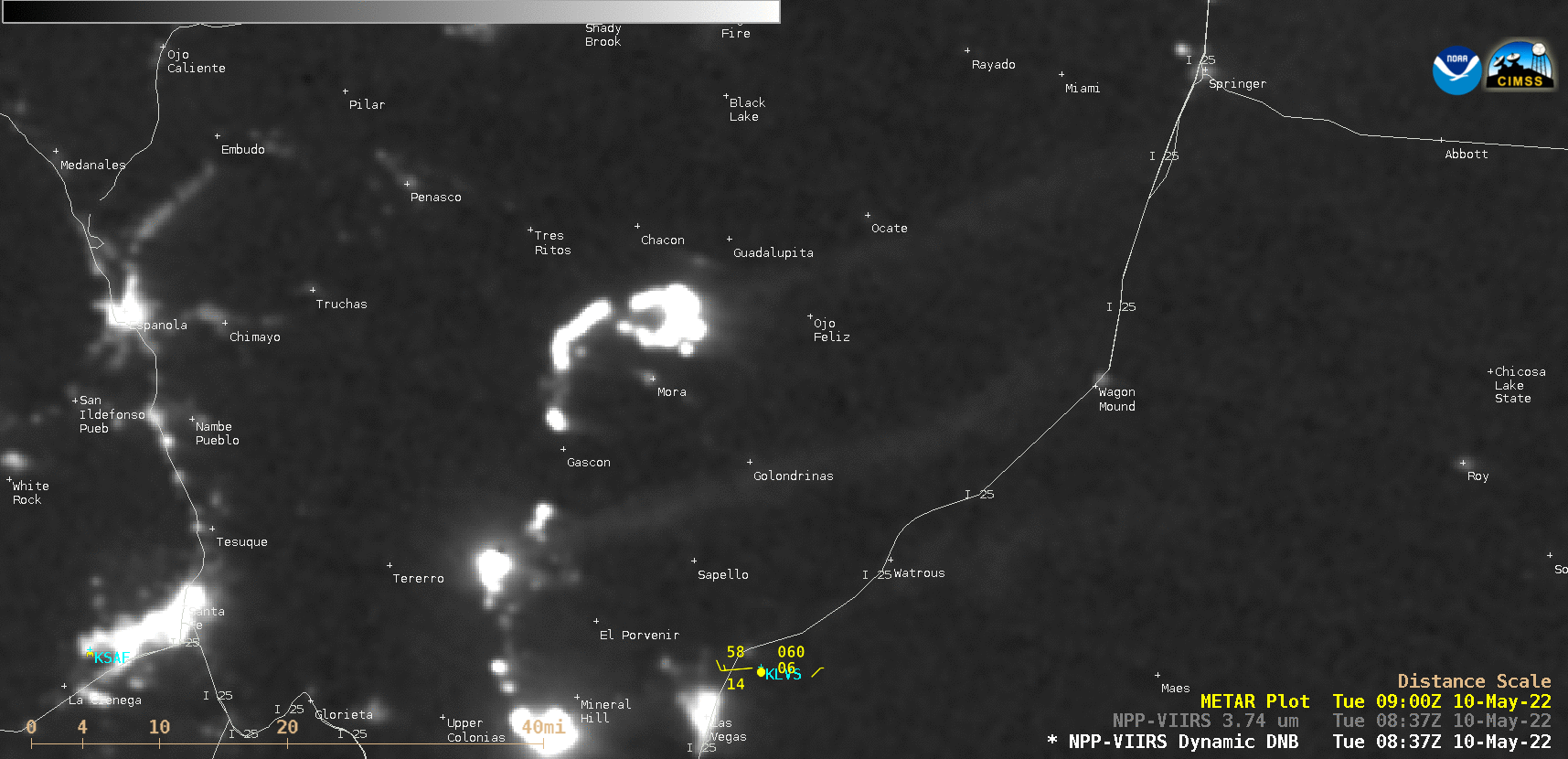
Suomi-NPP VIIRS Day/Night Band (0.7 µm) and Infrared Window (11.45 µm) images [click to enlarge]