Undular bore along the leading edge of a “pneumonia front” over Lake Michigan
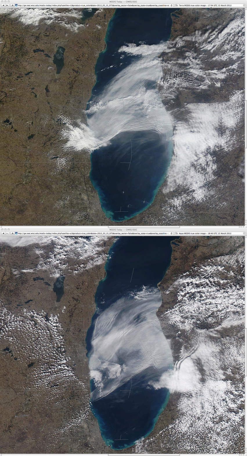
250-meter resolution Terra and Aqua MODIS true-color Red/Green/Blue (RGB) images from the SSEC MODIS Today site (above) revealed the presence of an undular bore along the leading edge of a southward-moving cold front (also known regionally as a “pneumonia front“) on 15 March 2012.
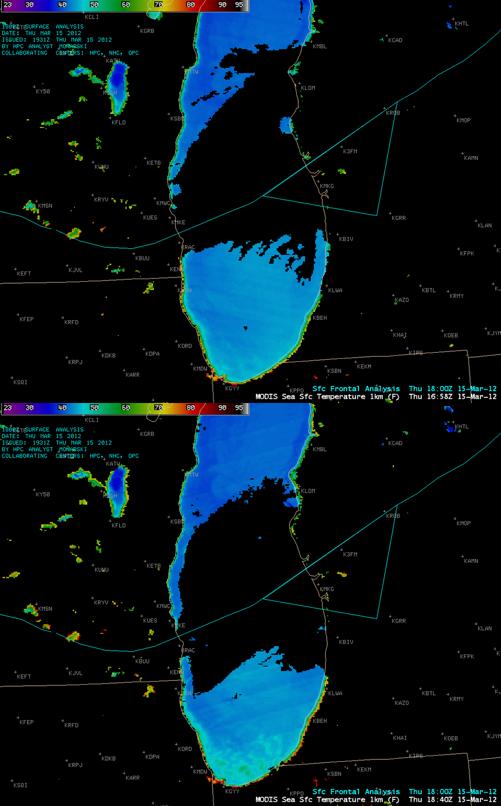
AWIPS images of the MODIS Sea Surface Temperature (SST) product (below) indicated that SST values in the central portion of Lake Michigan (behind the cold frontal boundary) were generally in the upper 30s to low 40s F (darker blue color enhancement). At Racine in southeastern Wisconsin (station identifier KRAC), the surface air temperature dropped from 69 F to 47 F in 2 hours after the front passed. Just to the north, the high temperature of 72 F at Milwaukee (station identifier KMKE) set a record high for the date — then the temperature there dropped into the upper 40s F a few hours later.
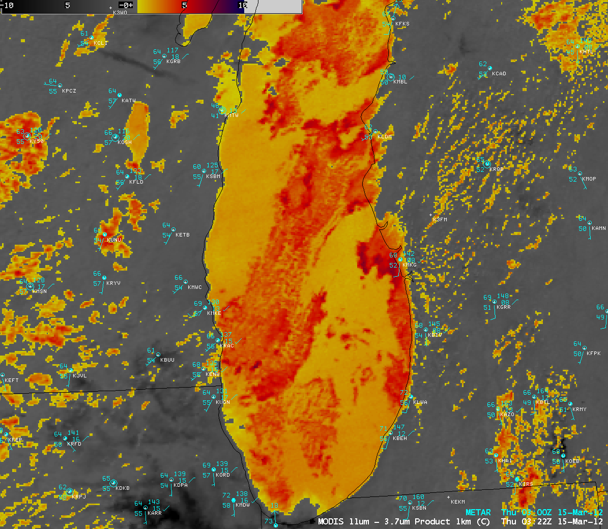
During the previous night-time hours, the southerly to southwesterly flow of unseasonably warm air (with dew points in the 50s F) over the cold waters led to widespread lake fog across almost all of Lake Michigan, as was seen in a 03:22 UTC MODIS fog/stratus product (below).
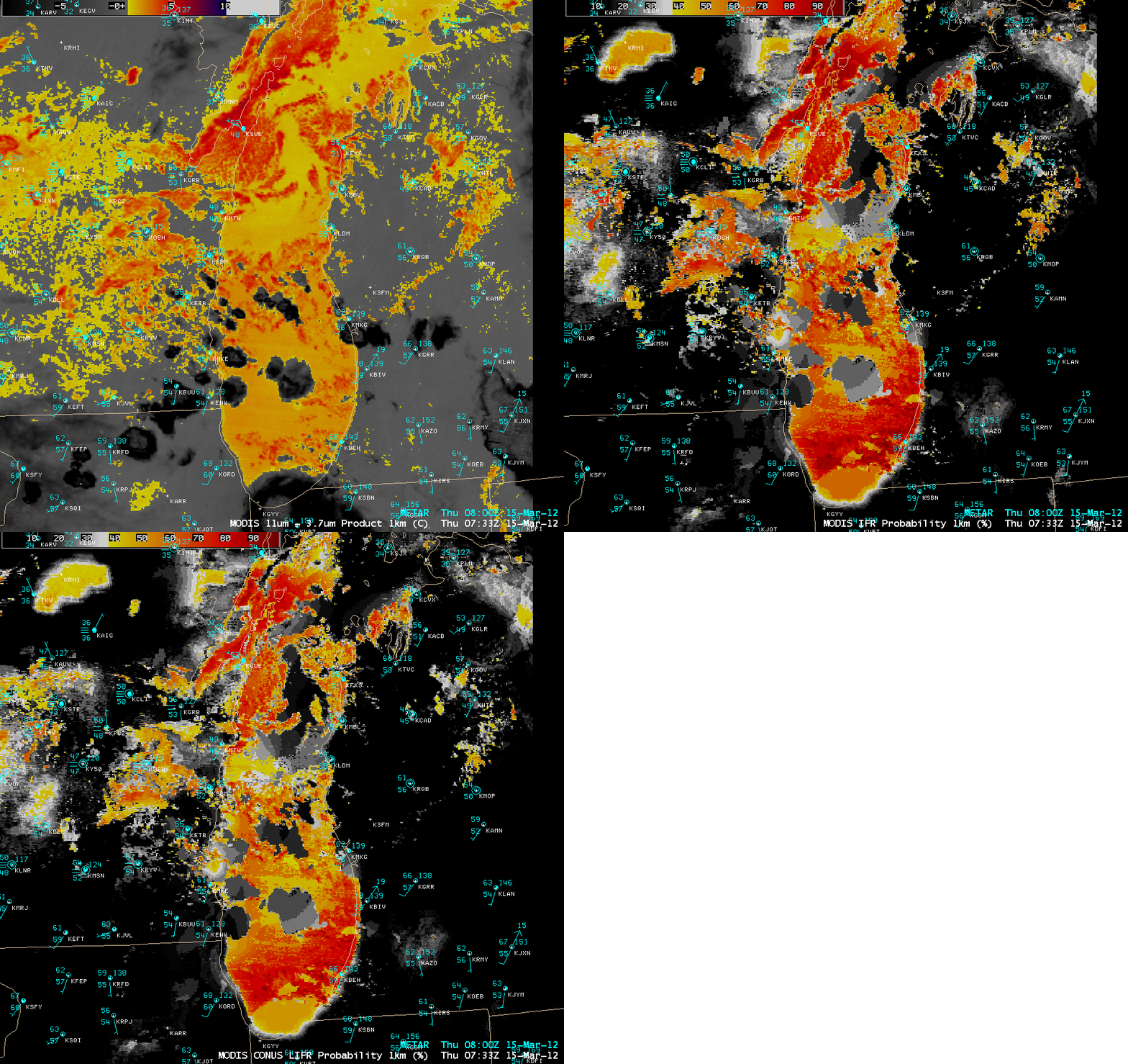
A few hours later (at 07:33 UTC), isolated convective rain showers were moving across the southern half of Lake Michigan — these showed up at the darker gray to black enhanced features on the MODIS fog/stratus product image (below). The corresponding MODIS Instrument Flight Rules (IFR) and Low Instrument Flight Rules (LIFR) Probability products indicated a number of areas with IFR and/or LIFR probabilities in excess of 80-90% (darker red color enhancement).


