Hole punch clouds and aircraft distrails over Georgia and South Carolina
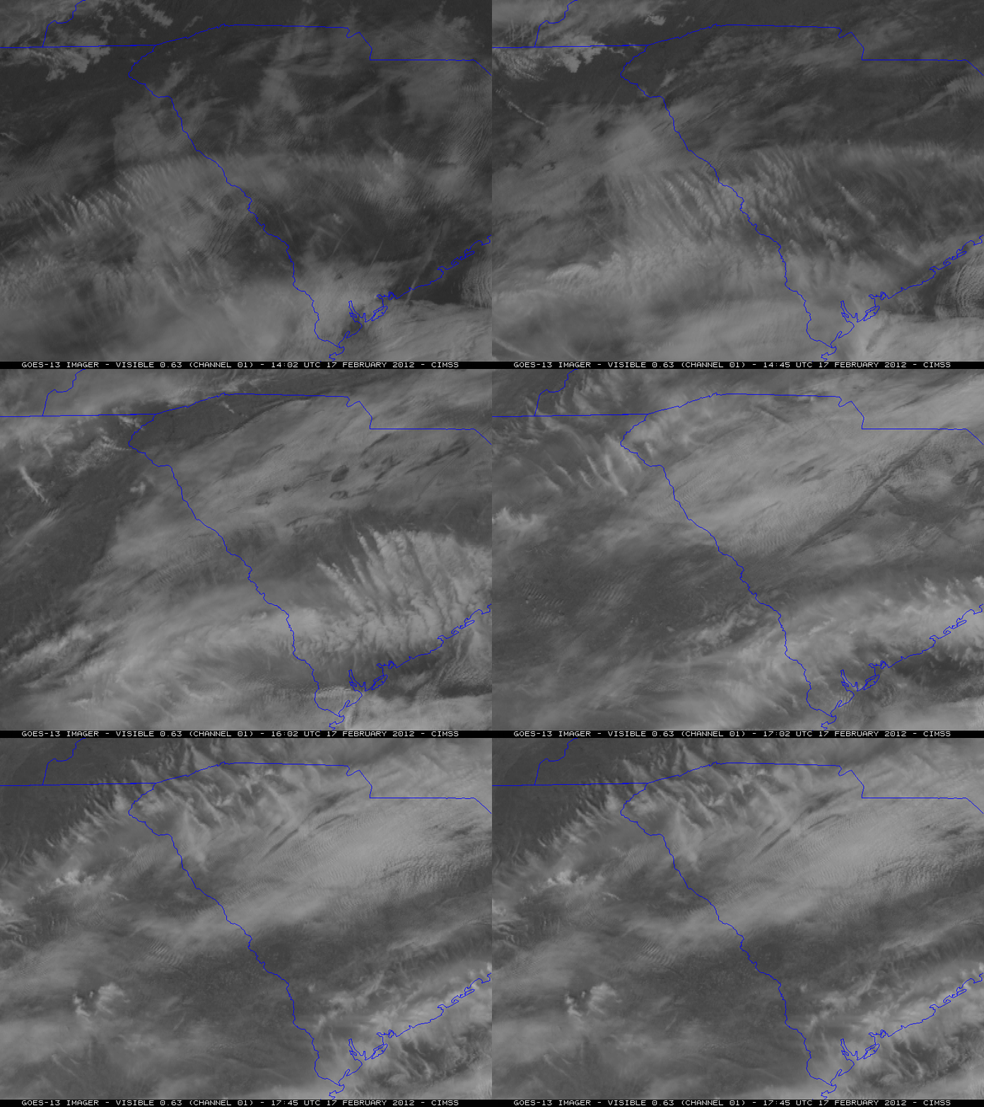
McIDAS images of 1-km resolution GOES-13 0.63 µm visible channel data (above) showed that there were a number of “hole punch clouds” and long “aircraft dissipation trails” (or “distrails”) drifting east-northeastward over eastern Georgia and the northern half of South Carolina on 17 February 2012. These features occur when aircraft ascend or descend through a cloud layer composed of supercooled water droplets — particles from the jet engine exhaust act as ice nuclei that initiate glaciation. The resulting relatively large ice crystals then begin to fall out of the supercooled water droplet cloud layer, causing the hole punch or aircraft dissipation trail to appear.
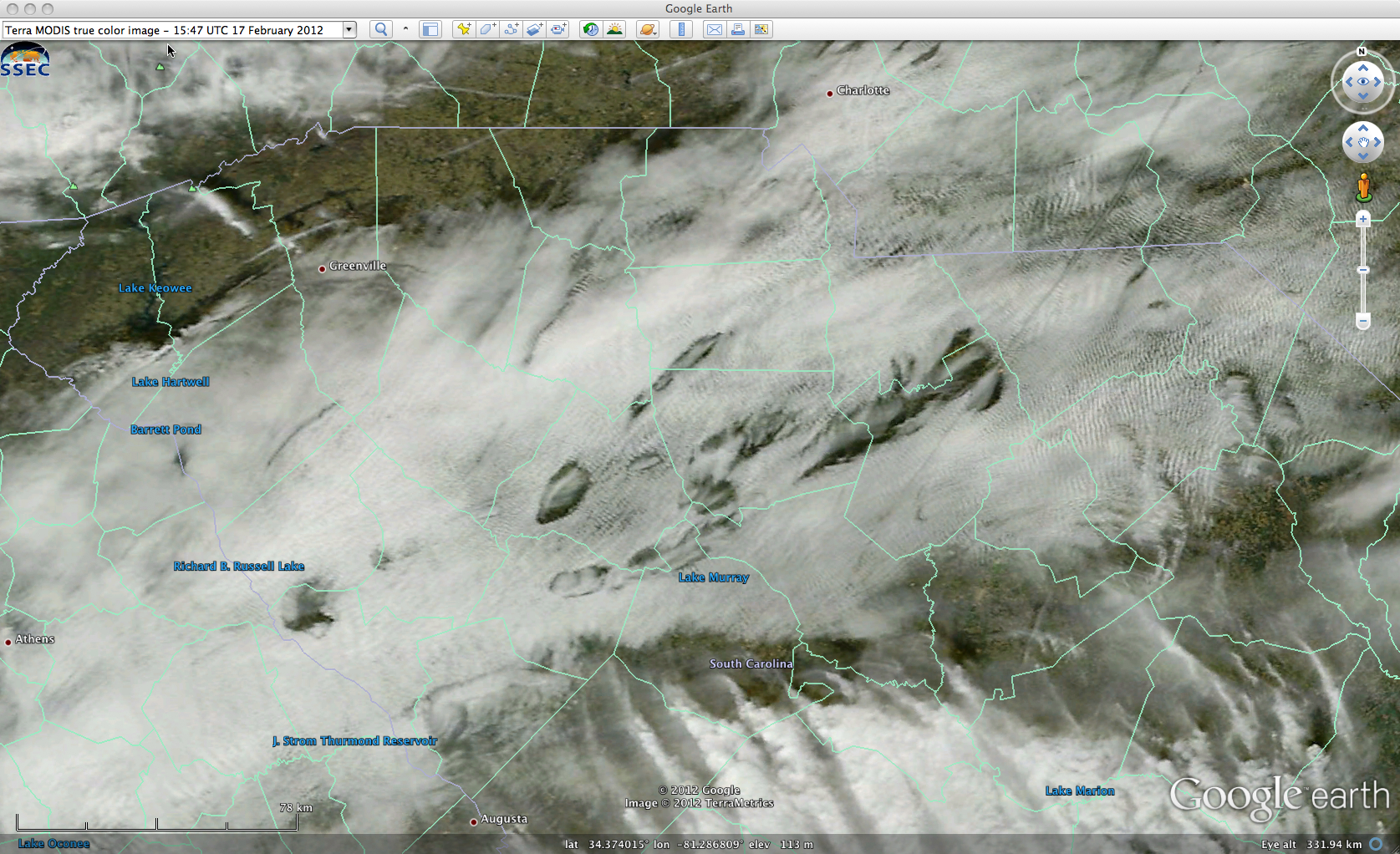
A closer view using a 250-meter resolution Terra MODIS true-color Red/Green/Blue (RGB) image from the SSEC MODIS Today site (below; viewed using Google Earth) shows more structural details of some of the hole punch and distrail features at 15:47 UTC (10:47 am local time). The aircraft likely penetrated the supercooled water droplet cloud over Georgia, after which the hole punch and distrail signatures grew as the cloud drifted east-northeastwrad over South Carolina.
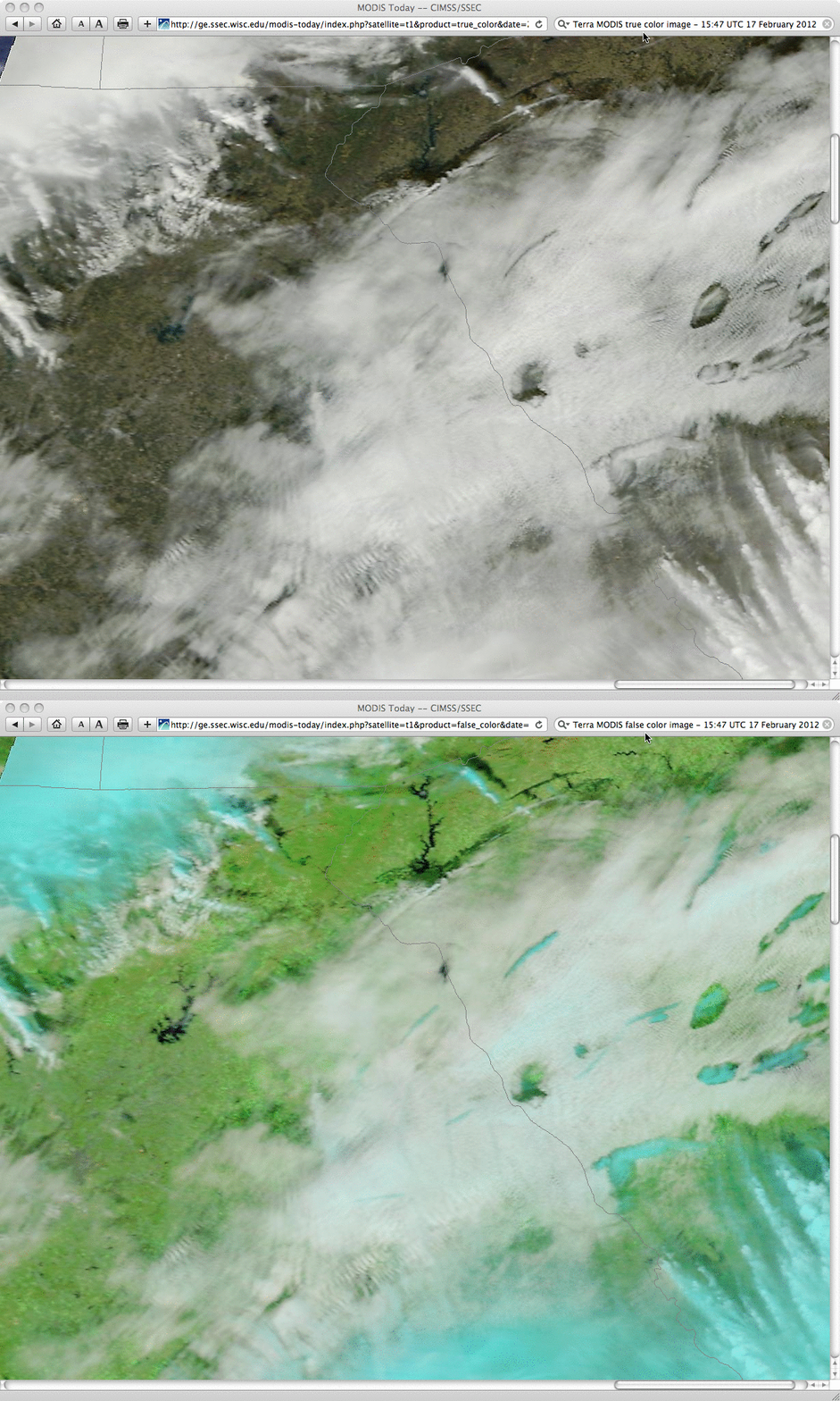
A comparison of 250-meter resolution Terra MODIS true-color and false-color Red/Green/Blue (RGB) images (below) helps to verify that the hole punch and distrail features were indeed composed of ice crystals (which appear as cyan on the false-color image, in contrast to the brighter white supercooled water droplet cloud features).


