Tropical Cyclone Giovanna (12S)
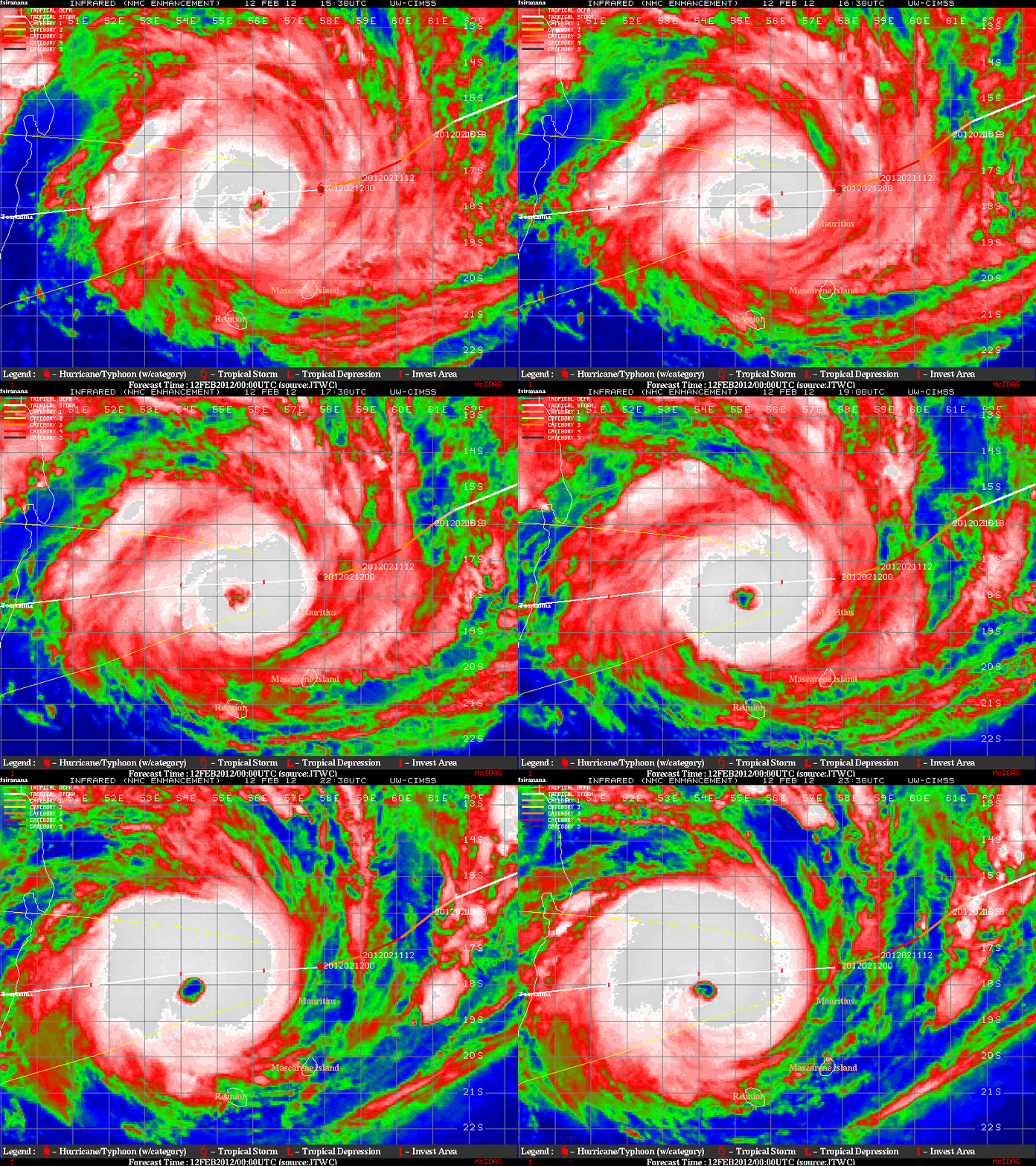
EUMETSAT Meteosat-7 10.8 µm IR images from the CIMSS Tropical Cyclones site (above) showed the formation of a well-defined eye as Tropical Cyclone Giovanna (12S) intensified from a Category 3 to a Category 4 storm over the Indian Ocean late in the day on 12 February 2012.
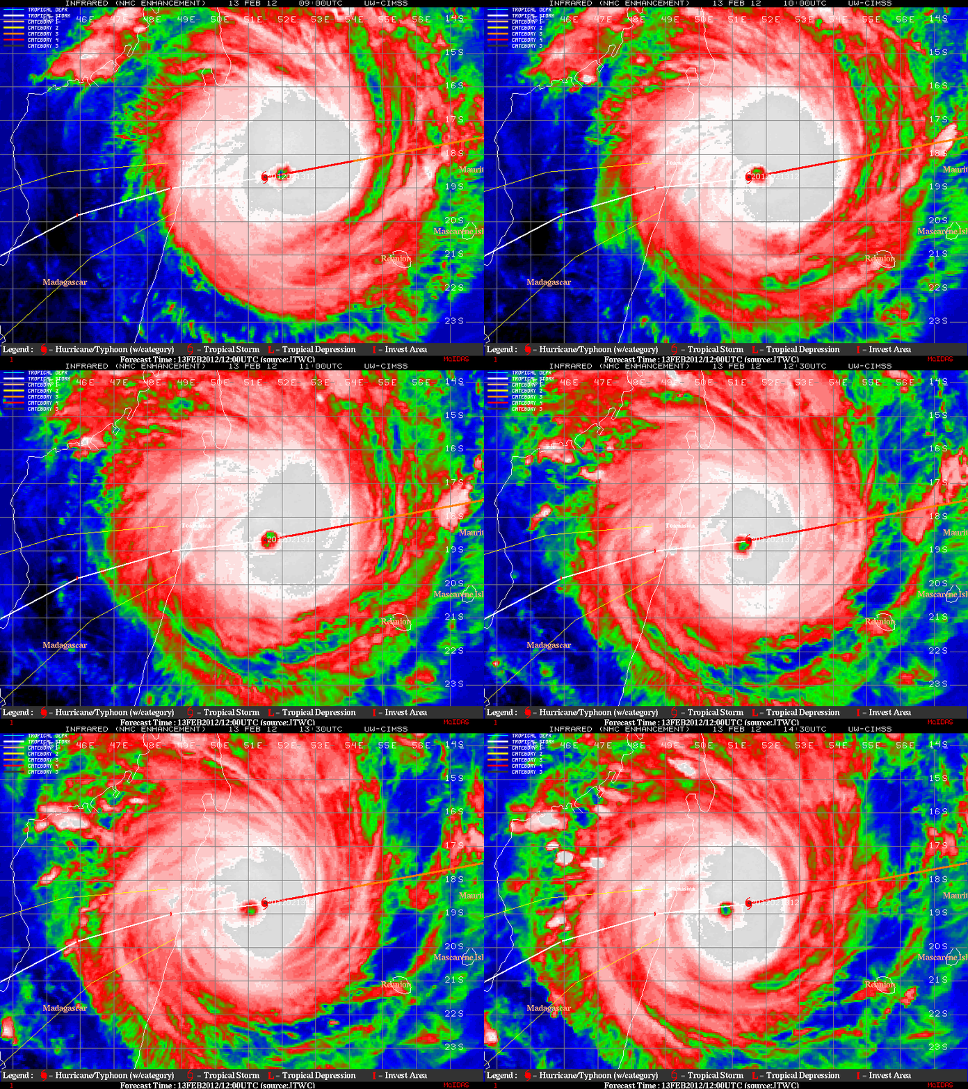
Tropical Cyclone Giovanna maintained a Category 4 intensity as it approached the island nation of Madagascar on 13 February, with the diameter of the eye contracting somewhat on IR imagery as Giovanna was undergoing an eyewall replacement cycle (below).
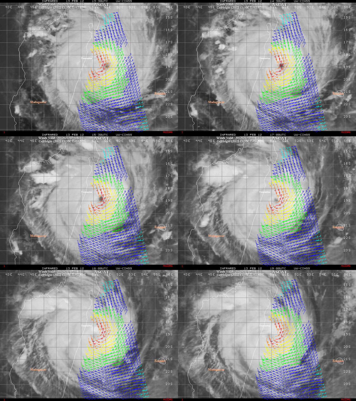
A few hours prior to landfall, a timely overpass of the EUMETSAT Metop-A satellite allowed a nice view of the surface wind structure using ASCAT scatterometer winds (below).
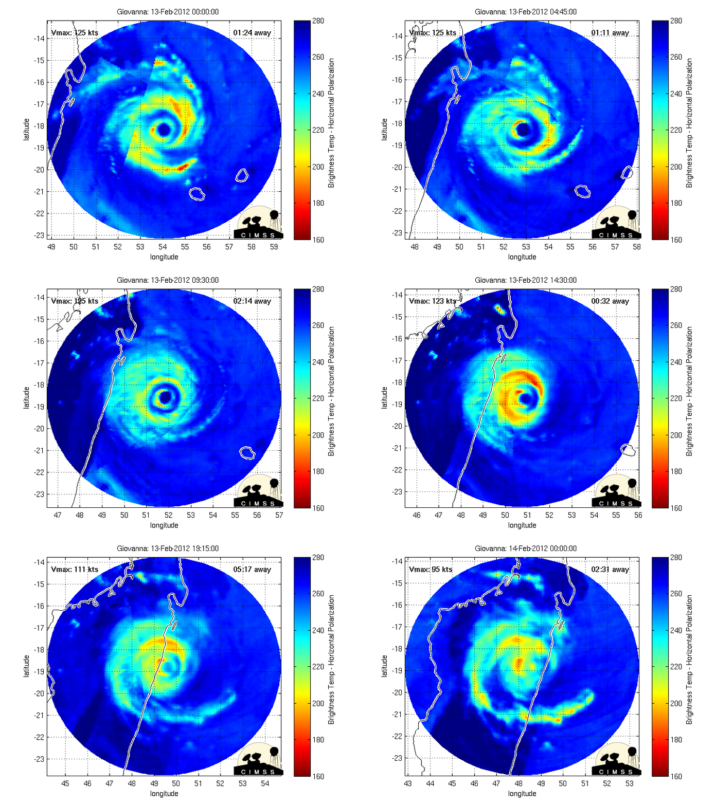
As the tropical cyclone approached the eastern coast of Madagascar, the erosion of the eastern semicircle of the inner eyewall of Giovanna could be seen in the MIMIC-TC product (below).


