Strong cold front and a lee-side frontal gravity wave
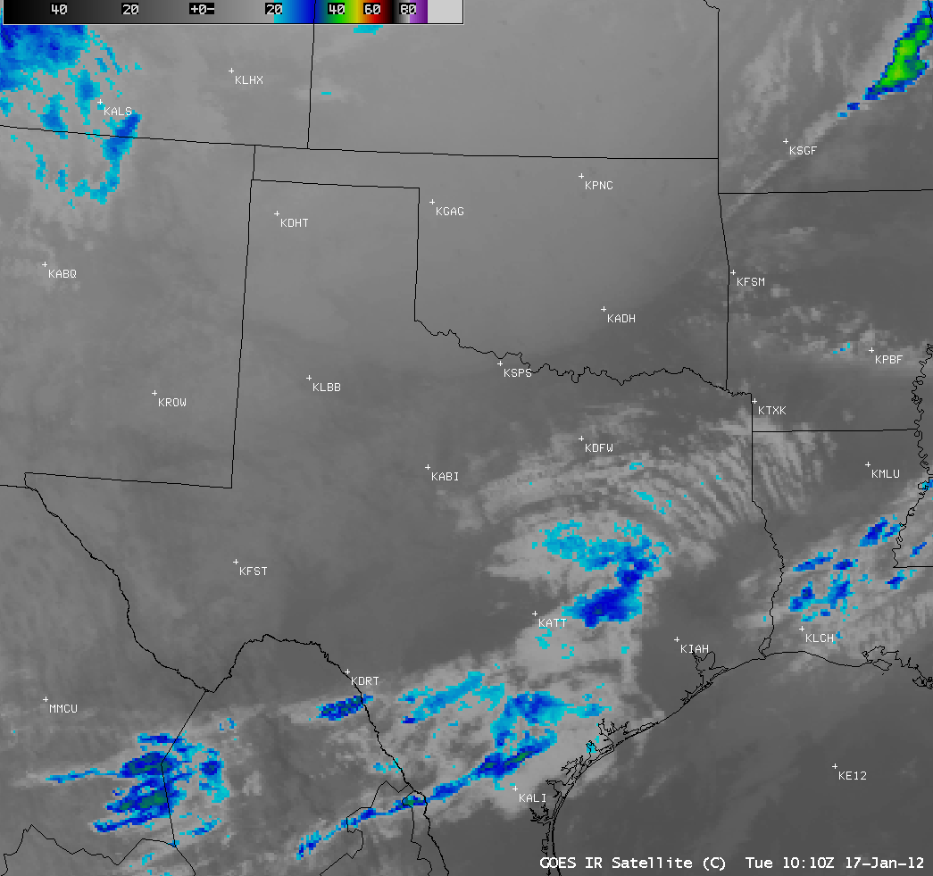
A strong cold front moved southward across the south-central US on 17 January 2012, dropping temperatures as much as 20 degrees F in 1-2 hours with wind gusts of 30-40 knots. The cold air behind the front (lighter gray enhancement) was clearly evident on AWIPS images of 4-km resolution GOES-13 10.7 µm IR channel data (above; click image to play animation).
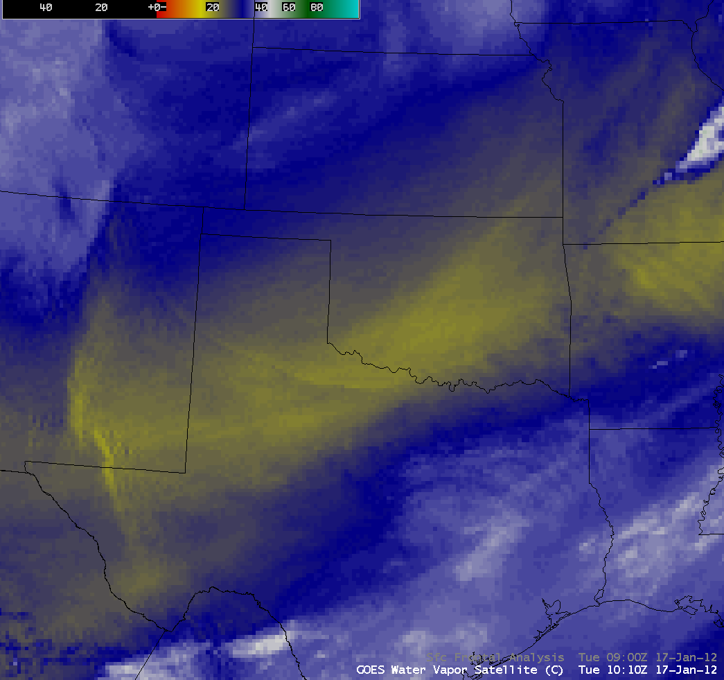
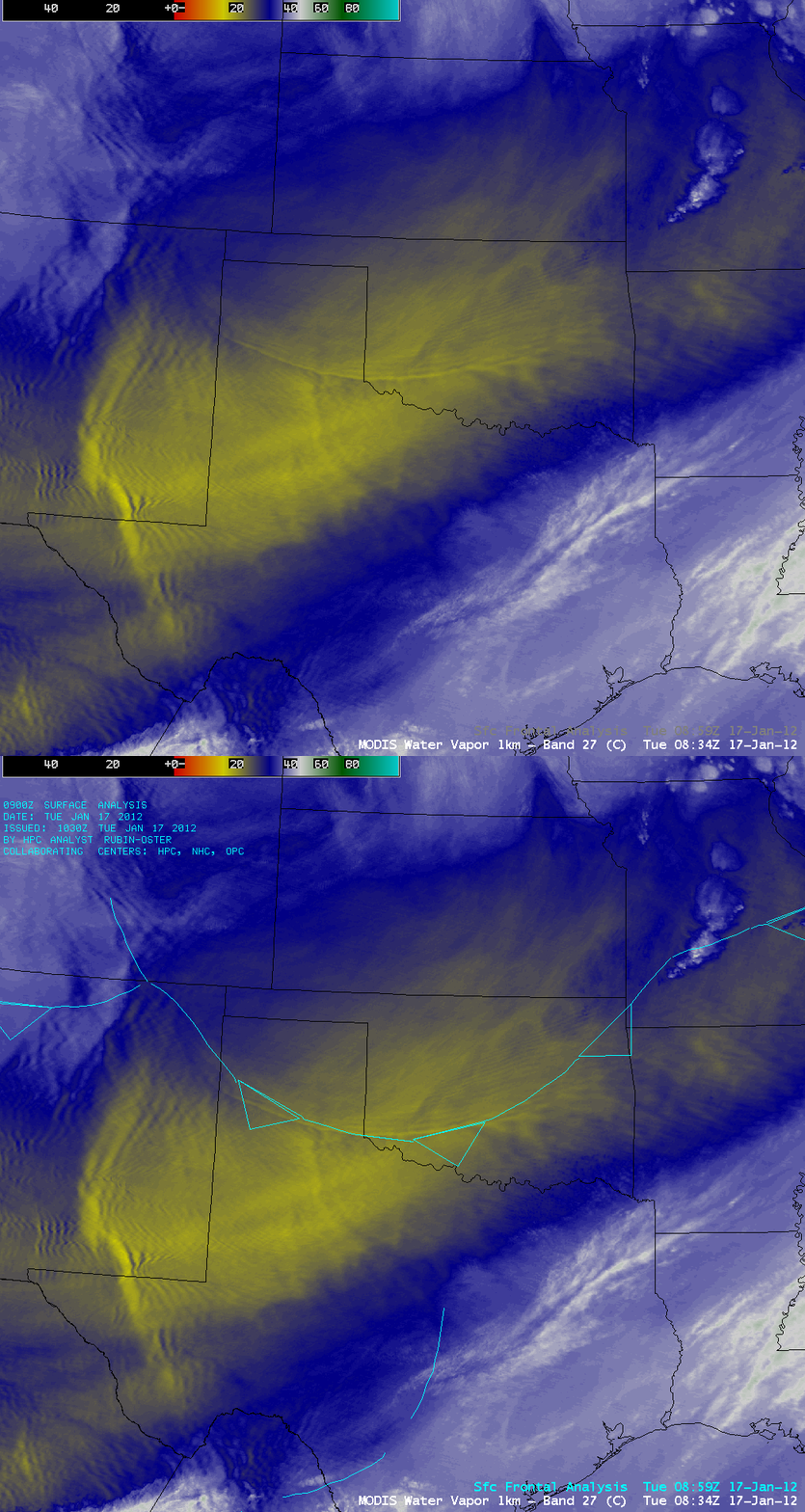
As the cold front moved southward, a lee-side cold frontal gravity wave was seen along its leading edge on 4-km resolution GOES-13 6.5 µm water vapor channel images (above; click image to play animation). Note the very complex wave structure that was displayed on a 1-km resolution MODIS 6.7 µm water vapor channel image at 08:34 UTC (below). In addition, the MODIS water vapor image showed great detail in the mountain waves across parts of New Mexico and far southwestern Texas, as strong westerly flow was interacting with the terrain in that region.
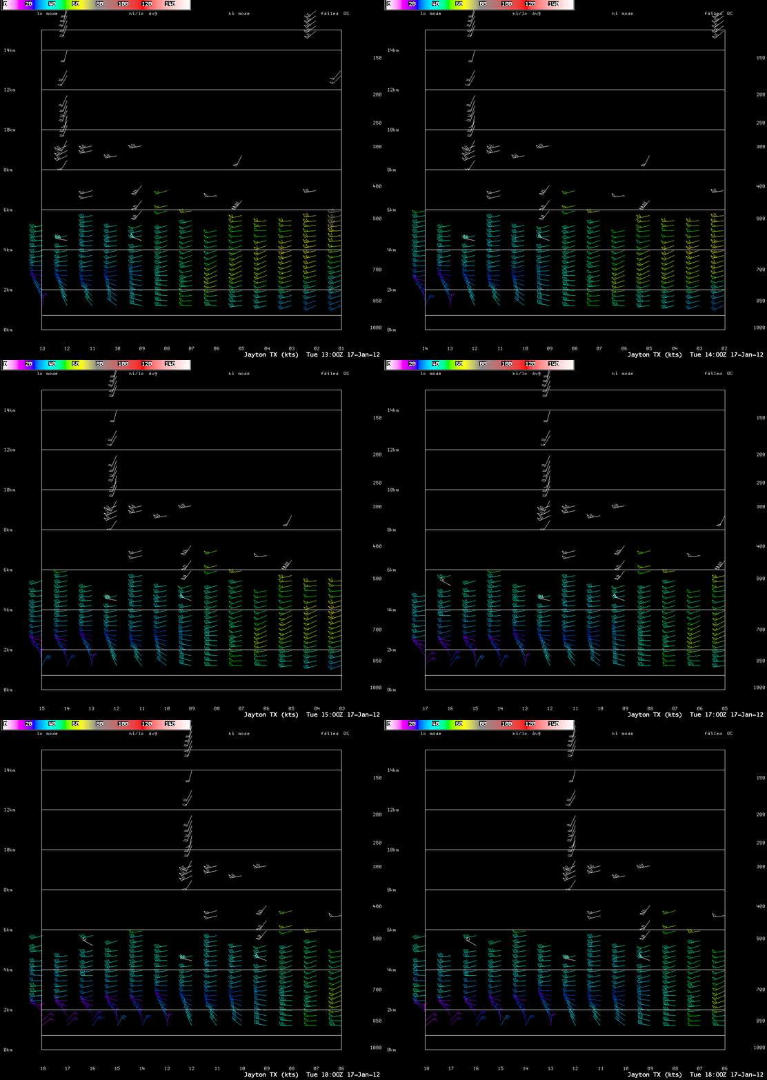
As the cold front passed the Jayton, Texas NOAA wind profiler site (station identifier JTNT2) after about 12 UTC, the transition to a northeasterly flow of cold air was evident (above). Even though the depth of the cold air was not more than about 1.5 km, the lee-side cold frontal gravity wave was able to be seen on the water vapor imagery due to the fact that the cold, dry air mass shifted the peak of the GOES-13 water vapor weighting function down to within the 700-500 hPa pressure level — much lower than the height of the water vapor weighting function of the US Standard Atmosphere air mass (below).
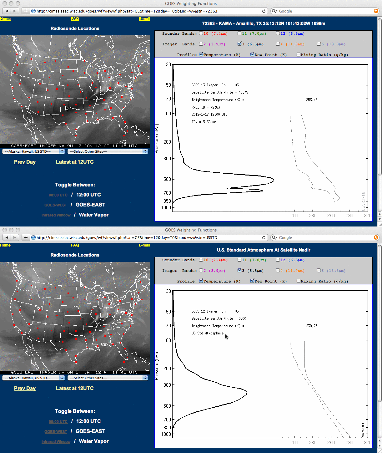
Amarillo, Texas water vapor weighting function vs US Standard Atmosphere water vapor weighting function


