Cold air and snowfall invade the Pacific Northwest
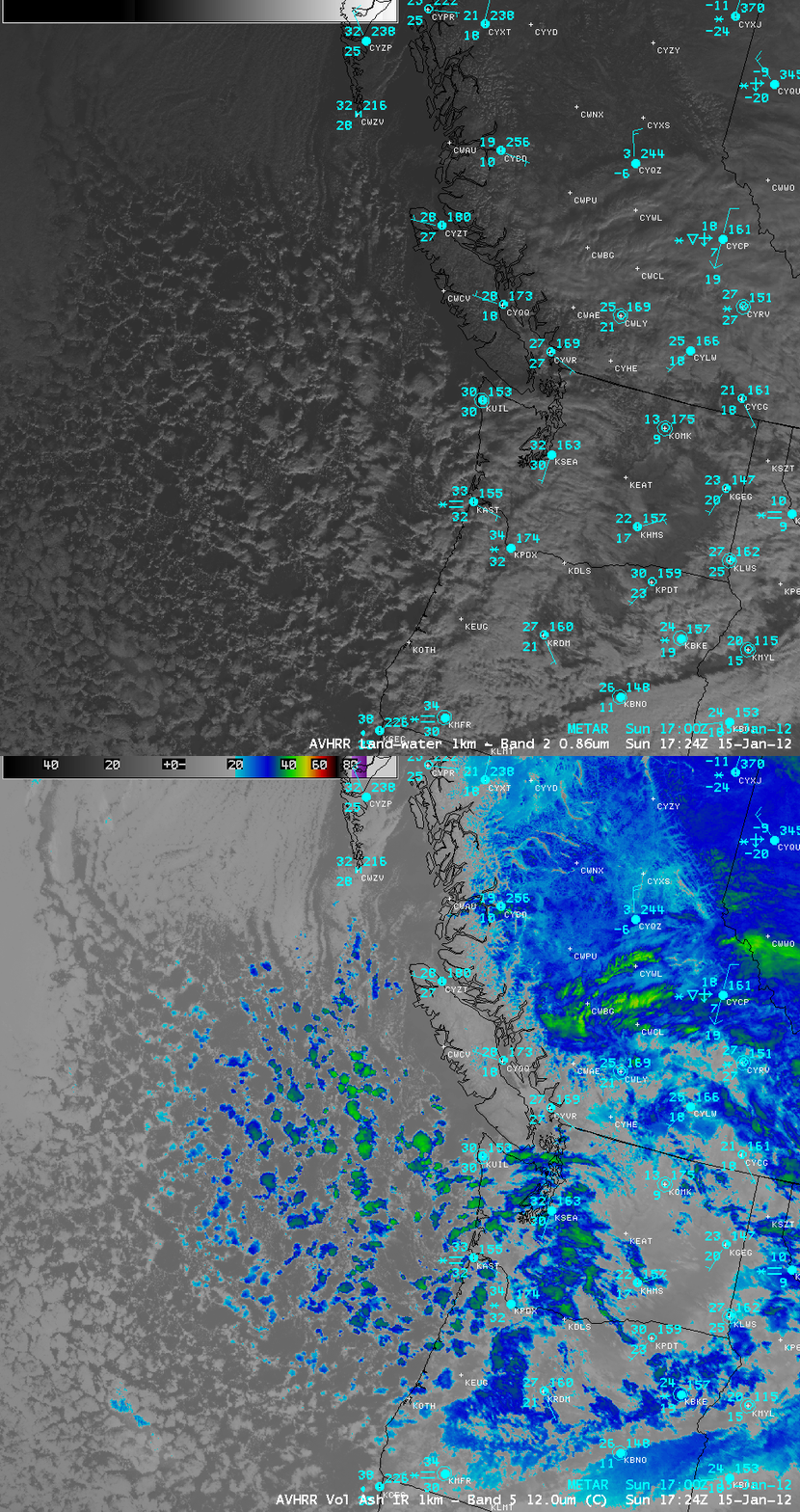
A surge of cold air brought the first measurable snowfall to parts of the Pacific Northwest states on 14 January – 15 January 2012. The Seatle-Tacoma aiport received 2.4 inches of snow on 15 January. A comparison of 1-km resolution POES AVHRR 0.86 µm visible channel and 12.0 µm IR channel data (above) displayed a classic example of “open cell convection” — this type of open-cell mesoscale convective cloud pattern is a signature of strong instability (via boundary layer cold air advection over relatively warmer waters) in an environment of cyclonic flow.
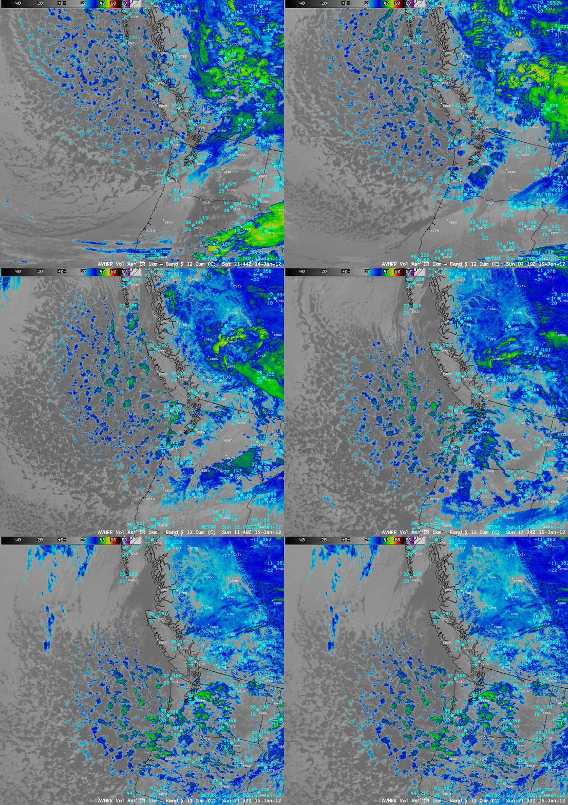
A sequence of 1-km resolution POES AVHRR 12.0 µm IR channel images (below) showed the inland progression of the open cell convection, eventually producing snowfall at Seattle, Washington (station identifier KSEA) and Portland, Oregon (station identifier KPDX).


