Tropical Storm Hanna
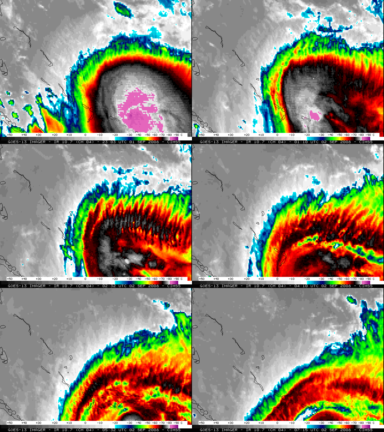
Tropical Storm Hanna exhibited some interesting satellite imagery features on 02 September 2008. GOES-13 IR images (above) displayed a period of transverse banding during the 01-05 UTC period — this transverse banding is a satellite signature of potential turbulence (although no aircraft reports of turbulence were received from that region, since pilots generally try to avoid flying over tropical storms). Very cold cloud top brightness temperatures were observed prior to the period of banding, with values in the -80º to -89º C range (light purple to dark purple colors).
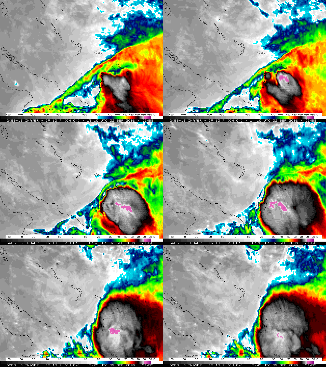
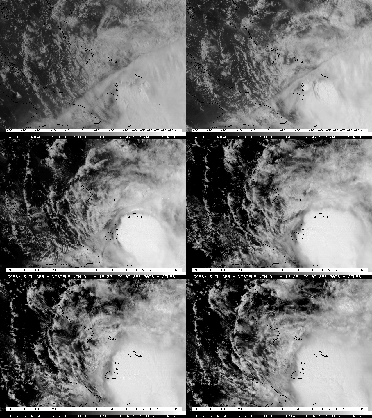
Later in the morning, an interesting “shear axis” or “deformation zone” signature was noted in the vicinity of Hanna, which was marked by a thin band of clouds oriented SW-NE. GOES-13 IR imagery (above) and visible imagery (below) showed that this shear axis was subsequently deformed and eroded by a burst of convective development near the center of Hanna.
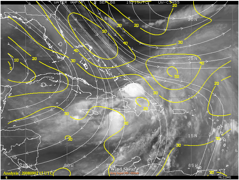
A deep-layer wind shear analysis from the CIMSS Tropical Cyclones site (below) showed that strong northwesterly outflow from the remnants of Hurricane Gustav were impinging upon Tropical Storm Hanna, helping to reinforce the shear axis / deformation zone.
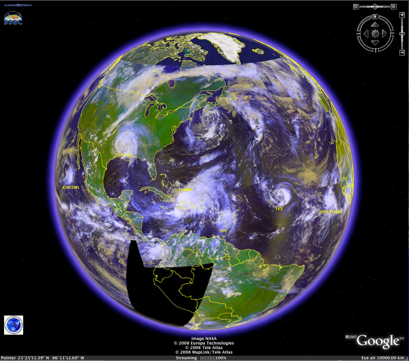
An AVHRR false-color composite image (below; viewed using Google Earth) showed that the tropics were becoming fairly active, with Tropical Depression Karina in the East Pacific and Tropical Depression Gustav over the continental US, and Tropical Storm Hanna, Invest Area 90L, Tropical Storm Ike, and Tropical Storm Josephine in the Atlantic basin on 02 September 2008.


