Historic October Northeastern US Snowstorm
A historic early season October winter storm produced snowfall amounts of 12 inches or more across 9 Northeastern US states during the 29 October – 30 October 2011 period, with a storm total snowfall as high as 32.0 inches reported at Peru, Massachusetts (HPC storm summary). McIDAS images of 4-km resolution GOES-13 6.5 µm water vapor channel data (above; click image to play animation) showed the evolution of the storm system during the period, which included rapid intensification following the approach of a jet streak and associated dry slot.
1-km resolution GOES-13 0.63 µm visible channel images (below; click image to play animation) showed a good portion of the resulting swath of snow cover on the morning of 30 October — areas of inland fog and stratus could be seen burning off across the southwestern portion of the satellite scene, and the center of the storm circulation was very evident over the adjacent offshore waters of the Atlantic Ocean.
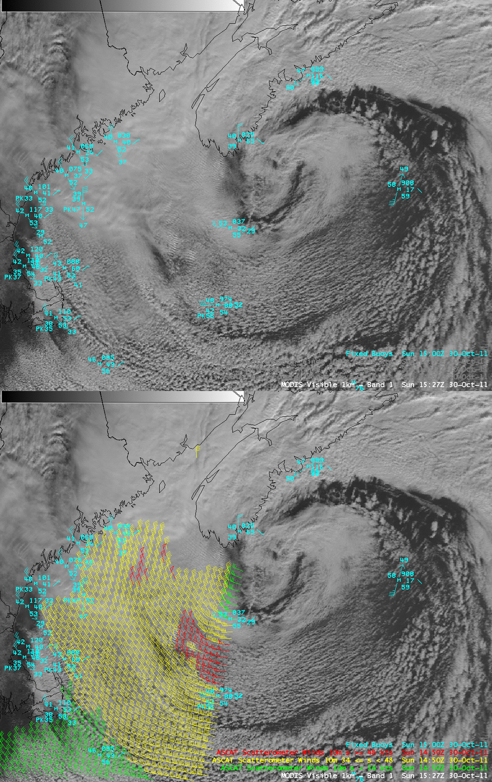
An AWIPS image of 1-km resolution MODIS 0.65 µm visible channel data with overlays of ocean buoy data and ASCAT scatterometer surface winds (below) showed that buoy winds were still gusting as high as 56 knots at that time, with a number of 50-knot ASCAT winds to the west and southwest of the center of the circulation.
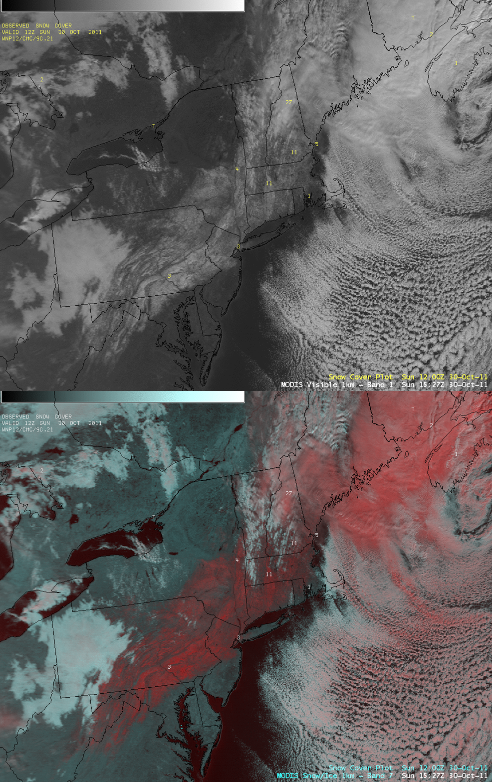
A comparison of the 0.65 µm MODIS visible channel image with the corresponding false color Red/Green/Blue (RGB) image creted using the MODIS visible channel and the MODIS 2.1 µm “snow/ice” channel (below) was helpful for discriminating between liquid and supercooled water droplet cloud features (which appeared as lighter shades of white) and the swath of snow cover on the ground (or clouds composed of ice crystals, which appeared as shades of red).
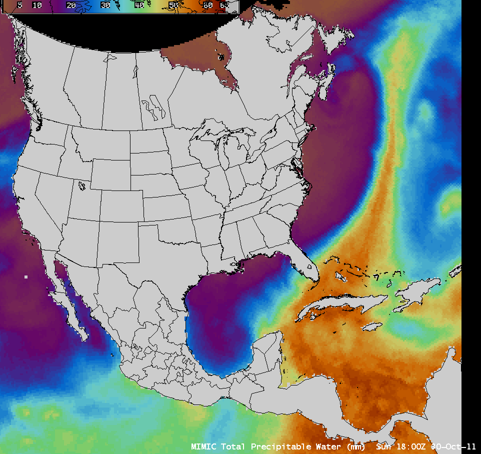
The MIMIC Total Precipitable Water product (below; click image to play animation) indicated that the storm was able to tap into a long plume of tropical moisture (originating in the Caribbean Sea) that was feeding northeastward across the western Atlantic Ocean.


