Tropical moisture being drawn into a “Rex block” cut-off low
McIDAS images of 4-km resolution GOES-15 6.5 µm water vapor channel data (above; click image to play 3-day animation) showed a plume of tropical moisture being drawn into the circulation of a large cut-off low that was part of a “Rex block” that had formed over the far East Pacific Ocean during the 11 October – 13 October 2011 period.
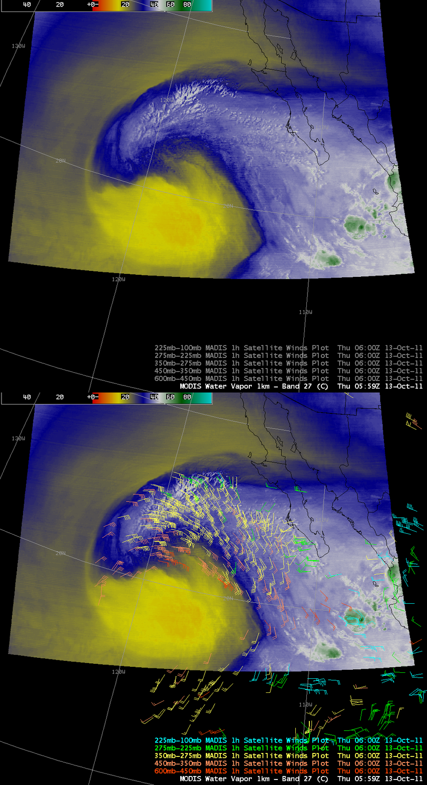
An AWIPS image of 1-km resolution MODIS 6.7 µm water vapor channel data with an overlay of 1-hour MADIS atmospheric motion vectors or “satellite winds” (below) showed better detail of the moisture plume structure, and indicated that this moisture was being drawn into the circulation of the cut-off low at speeds as great as 50-60 knots.
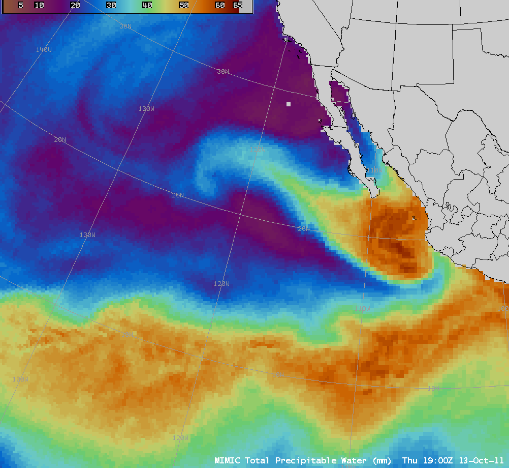
AWIPS images of the MIMIC Total Precipitable Water product (below; click image to play animation) revealed that the plume of tropical moisture was likely composed of contributions from the remnants of Hurricane Jova (which had moved inland across western Mexico on 12 October) and Tropical Storm Irwin (which had been meandering across the Eastern Pacific Ocean for 8 days, reaching Category 1 hurricane intensity on 07 October).


