New AVHRR and MODIS cloud and fog products
Accurately diagnosing cloud properties can be a challenge, especially over regions such as the panhandle of southeastern Alaska where upstream upper air report information is sparse. New satellite products such as those derived using POES AVHRR and MODIS spectral bands (channels) can be helpful in such situations. On 22 July 2011, the Area Forecast Discussion issued by the National Weather Service forecast office at Juneau, Alaska included the following:
SOUTHEAST ALASKA FORECAST DISCUSSION
NATIONAL WEATHER SERVICE JUNEAU AK
529 AM AKDT FRI JUL 22 2011.SHORT TERM…A LOW OVER THE SW GULF WILL MOVE TO THE S-CNTRL GULF BY LATE AFTERNOON…THEN BEGIN TO TURN SE TONIGHT. ASSOCIATED OCCLUDED FRONT WILL MOVE INTO THE SERN GULF BY LATE THIS AFTERNOON…THEN SLOWLY WEAKEN AS IT NEARS THE SRN OUTER COAST TONIGHT. USED A BLEND OF THE 00Z GFS AND ECMWF FOR THE SHORT TERM PERIOD.
OTHERWISE CLOUDS WILL BE A TRICKY CALL AS THERE WILL LIKELY BE SEVERAL AREAS OF THIN MID-LEVEL CLOUDS ALONG WITH SOME LOWER CLOUDS ALONG THE COAST AND WRN PARTS OF INNER CHANNELS. THINK A LOT OF THE LOWER CLOUDS WILL BREAK UP TODAY AS FLOW TURNS MORE ELY AHEAD OF APPROACHING FRONT. THE MID-LEVEL BANDS WILL BE A TRICKIER ISSUE…AND THINK A BAND WILL HANG ALONG THE COAST MTNS FROM THE PAJN AREA SEWD…BUT BE THIN AND BROKEN ENOUGH TO ALLOW SUNSHINE TO PEEK THROUGH MUCH OF THE TIME.
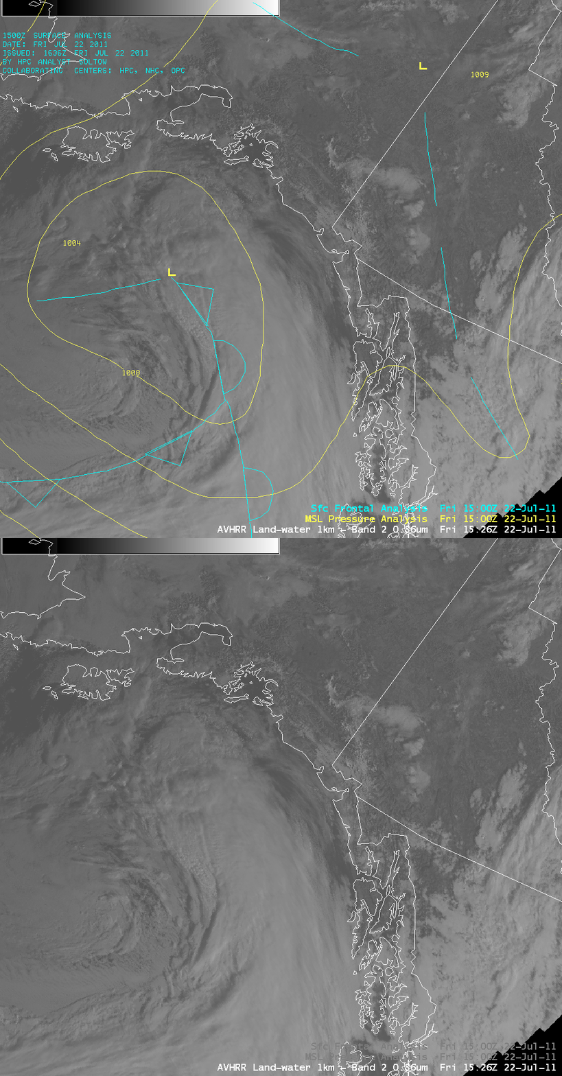
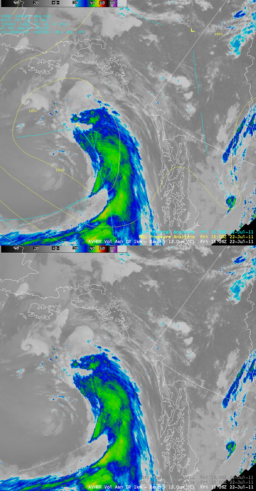
AWIPS images of the 1-km resolution POES AVHRR visible channel (above) and corresponding 1-km resoltion POES AVHRR IR channel (below) showed the cloud band associated with the occluded front as it approached the Alaska Panhandle.
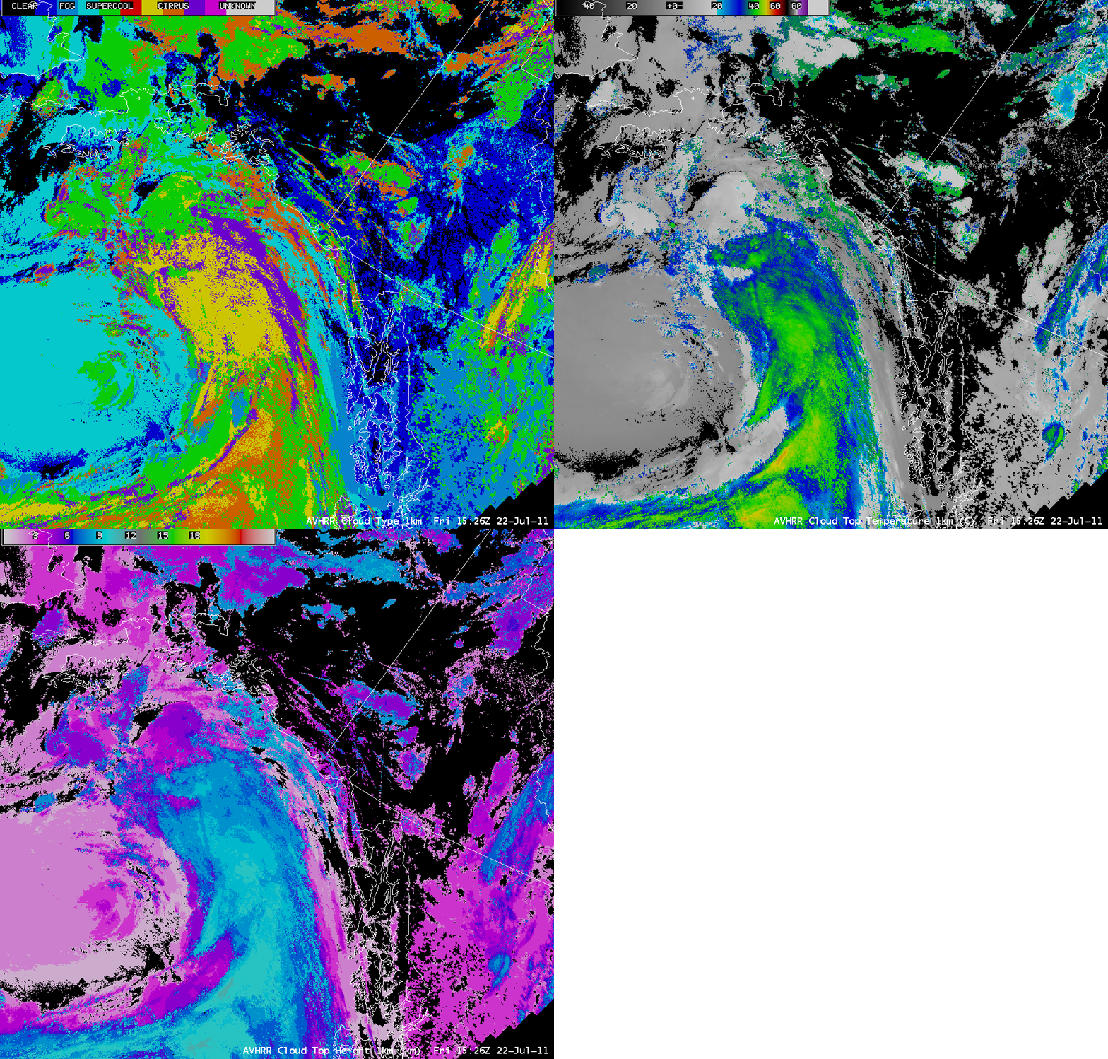
A comparison of the 1-km resolution POES AVHRR Cloud Type, Cloud Top Temperature, and Cloud Height products (below) offered a bit more information about the composition and properties of various parts of this cloud band. The coldest cloud top temperature value within the cloud band was -54ºC, and the highest cloud top heights were 11 km.
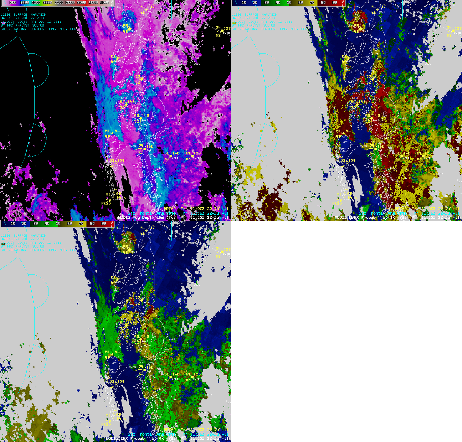
Taking a closer look at the far southern Alaska Panhandle region using a comparison of the 1-km resolution MODIS Fog Depth, MODIS MVFR Probability, and MODIS IFR Probability products (below) indicated a number of localized ares where the fog depth was higher, and higher probabilities of Marginal Visual Flight Rules (MVFR) and Instrument Flight Rules (IFR) conditions existed.
CIMSS participation in GOES-R Proving Ground activities includes the development and testing of these types of products, along with their dissemination to select NWS offices for evaluation and feedback.


