Severe weather in New England
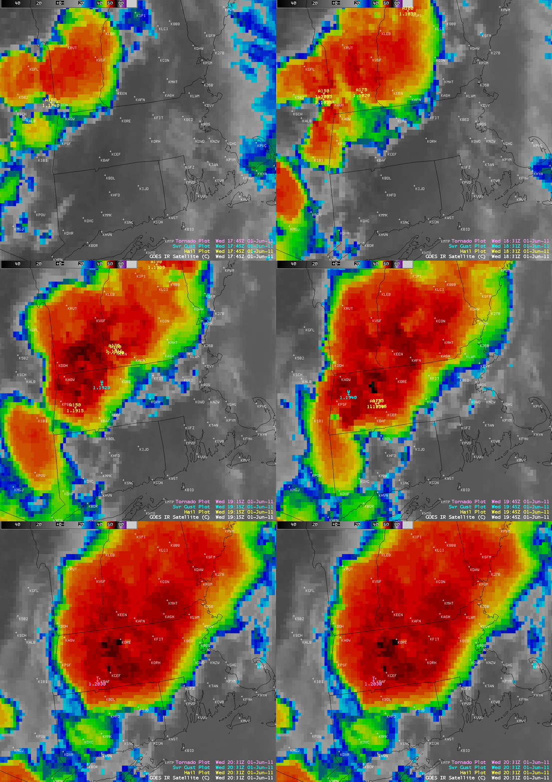
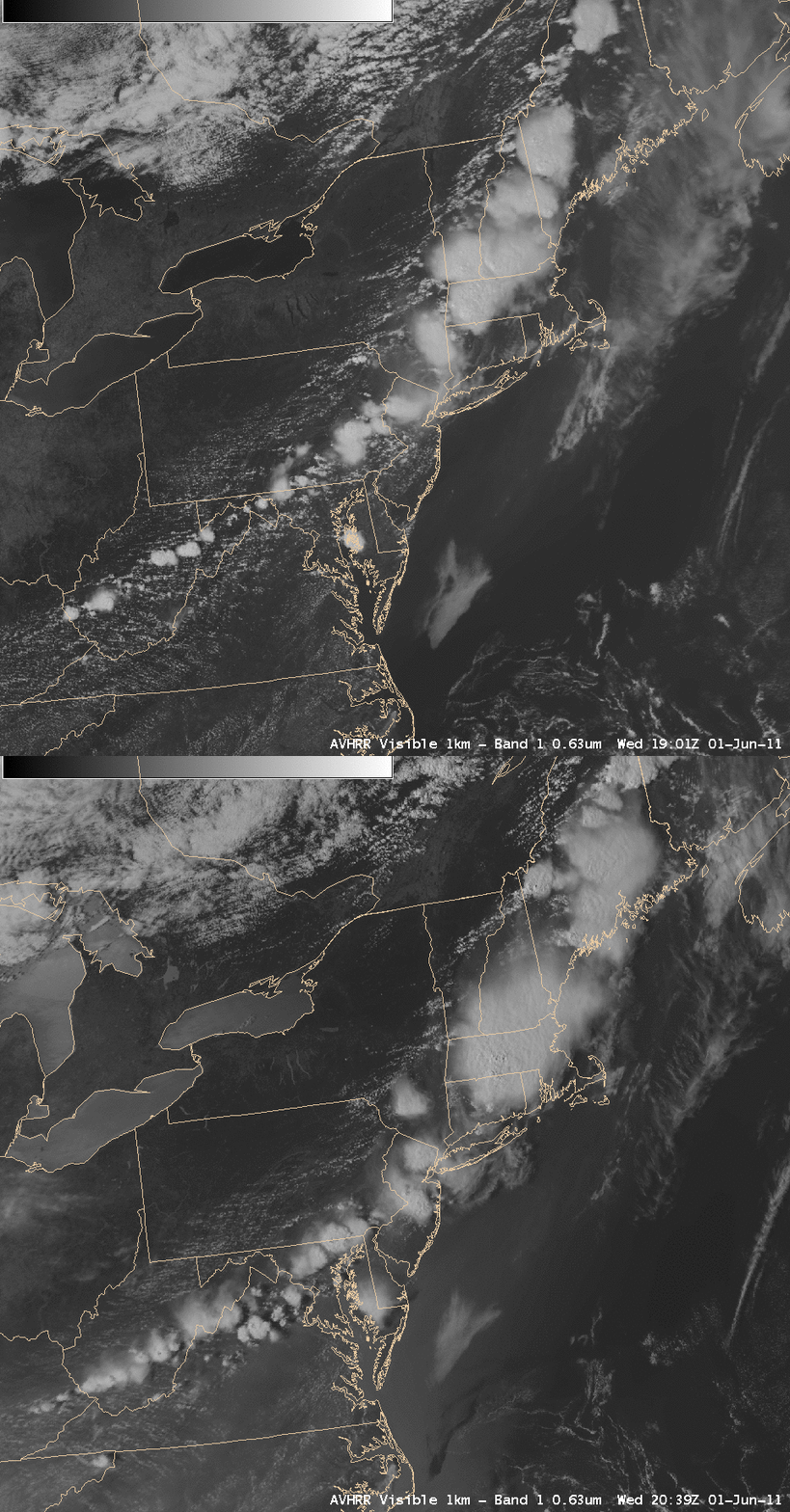
AWIPS images of 4-km resolution GOES-13 10.7 µm IR images with overlays of SPC storm reports (above) showed the large Mesoscale Convective System that moved across the New England region of the US on 01 June 2011. This was part of a long line of thunderstorms that stretched from Maine to West Virginia, as seen on POES AVHRR 0.63 µm visible images (below).
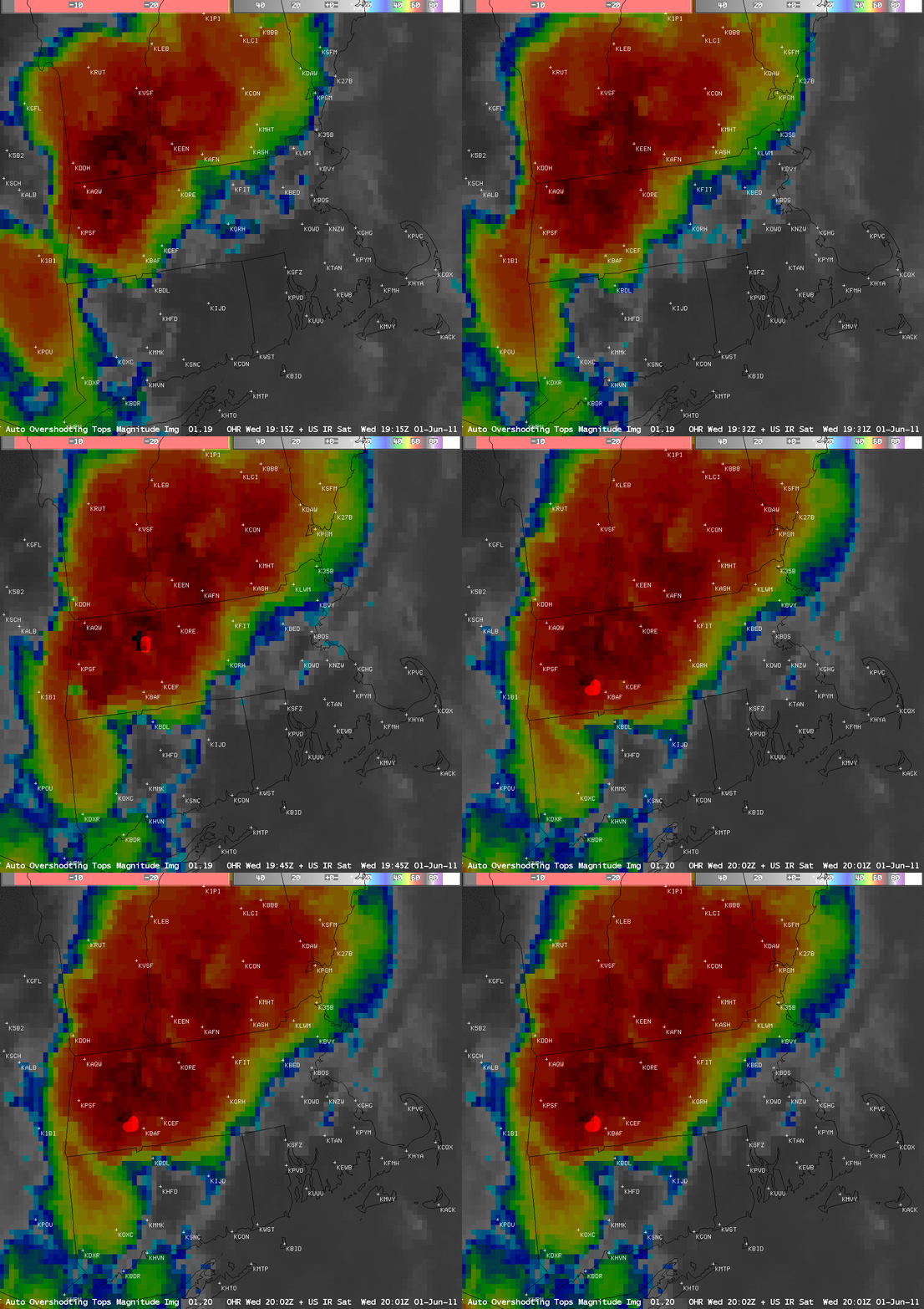
One of the more notable events was a tornado that produced EF-3 damage in the Westfield and Springfield areas in southwestern Massachusetts. Images of GOES-13 10.7 µm IR images with an overlay of the Automated Overshooting Top Detection product (below) revealed a overshooting top (OT) just to the northwest of Westfield (station identifier KBAF) at 20:02 UTC — about 28 minutes later the tornado was reported in Westfield at 20:30 UTC (also see the NOAA Hazardous Weather Testbed blog). It is important to mention that the OT markers as plotted in AWIPS are parallax-corrected, which moves them slightly to the southeast of the coldest cloud tops on the non-parallax-corrected GOES IR imagery in AWIPS.
Note that another OT was detected farther to the north at 19:45 UTC, with the cell that later produced damaging winds at Northampton at 19:58 UTC. and Hadley at 20:15 UTC.
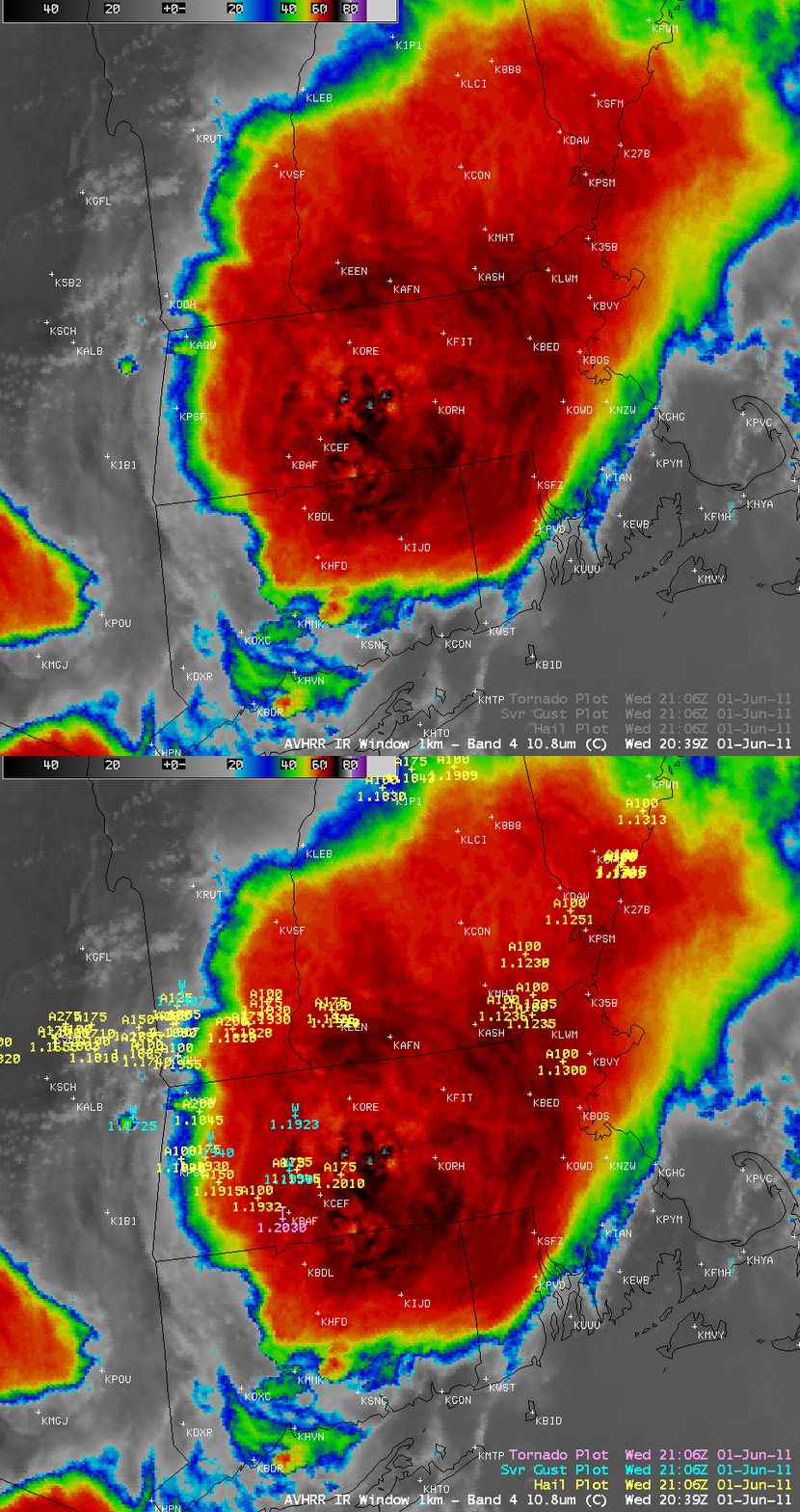
A 1-km resolution POES AVHRR 10.8 µm IR image at 20:39 UTC with an overlay of the cumulative SPC storm reports up to that time (below) offered a more detailed view of the cold storm top IR brightness temperatures (which were as cold as -79º C).
CIMSS participation in GOES-R Proving Ground activities includes making POES AVHRR images and products available for National Weather Service offices to add to their local AWIPS workstations, as well as the testing and evaluation of products such as Automated Overshooting Tops Detection during the NOAA Hazardous Weather Testbed. The VISIT training lessons “POES and AVHRR Satellite Products in AWIPS†and “Objective Satellite-Based Overshooting Top and Enhanced-V Anvil Thermal Couplet Signature Detection” are available to help users understand these products and their applications to weather analysis and forecasting.


