Smoke from Alberta fires streaming southward along the Pacific Northwest coast
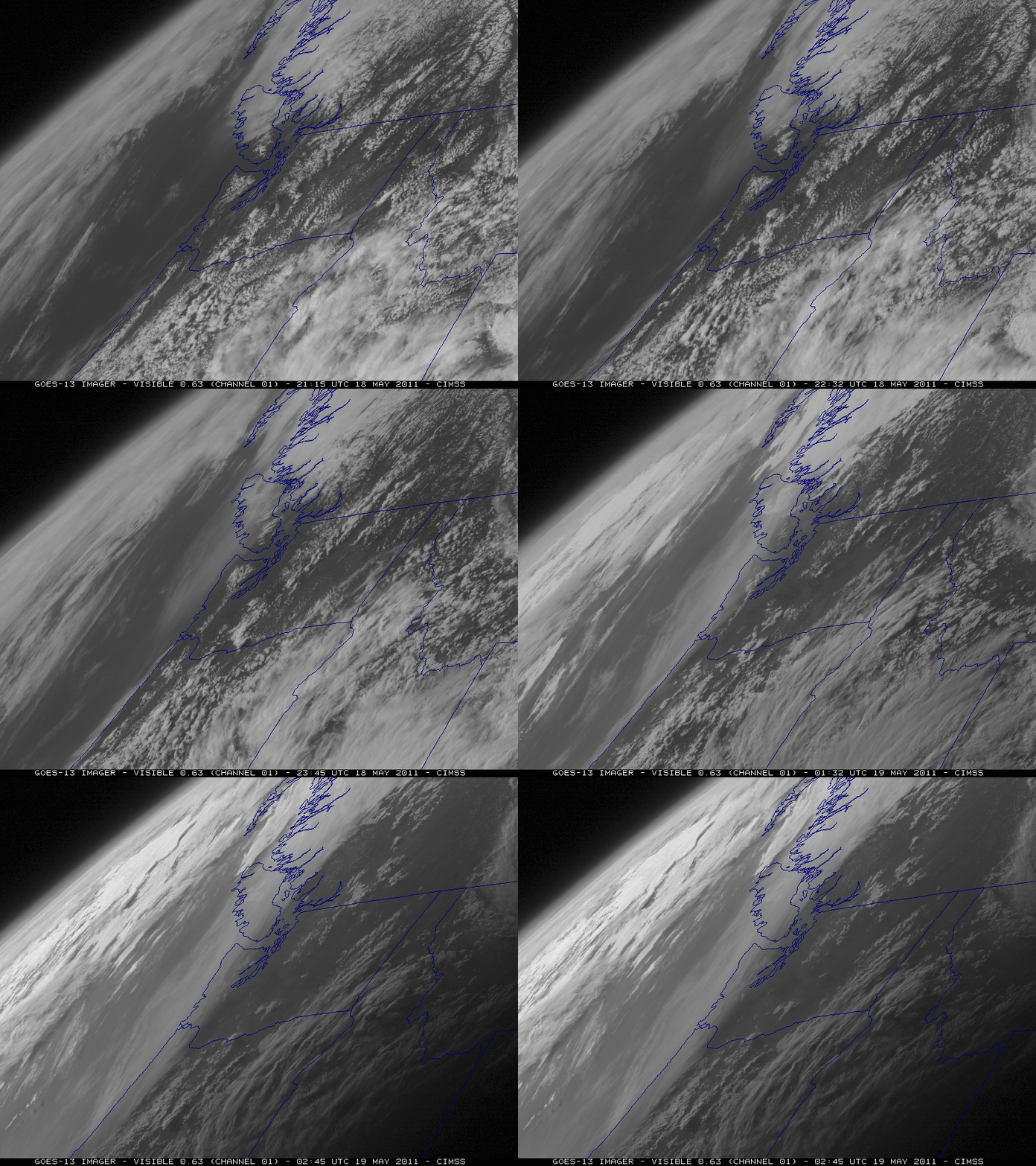
McIDAS images of GOES-13 0.63 µm visible channel data (above) revealed a hazy plume moving southward along the Pacific Northwest coast of the US late in the day on 18 May 2011. The airborne smoke showed up very well due to the favorable “forward scattering angle” during the later hours of the early evening, as viewed from the GOES-13 (GOES East) satellite located at 75º West longitude.
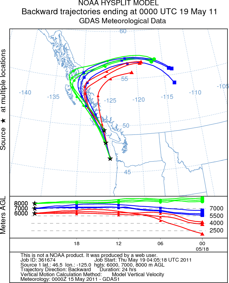
It is very likely that this hazy plume was due to long range transport of smoke from recent fire activity in northern Alberta, Canada — large smoke plumes were seen over that region on GOES-11 and GOES-13 visible channel images as early as 15 May. NOAA ARL HYSPLIT model backward trajectories initialized at altitudes of 6 km, 7 km, and 8km (below) did indeed indicate transport from the region of the fires. Lidar data from the University of British Columbia showed that the portion of the aerosol layer over Vancouver was located at altitudes of 7-8 km.
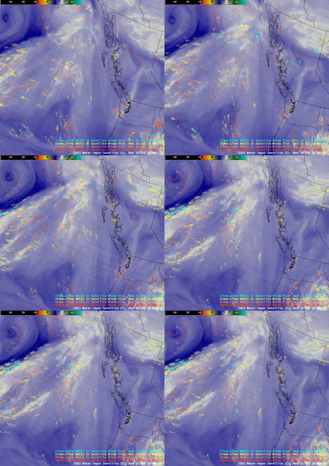
AWIPS images of GOES-11 6.7 µm “water vapor channel” imagery with overlays of MADIS hourly atmospheric motion vectors or “satellite winds” (below) showed that there was a cyclonic circulation aloft around a small vortex located over British Columbia, Canada.
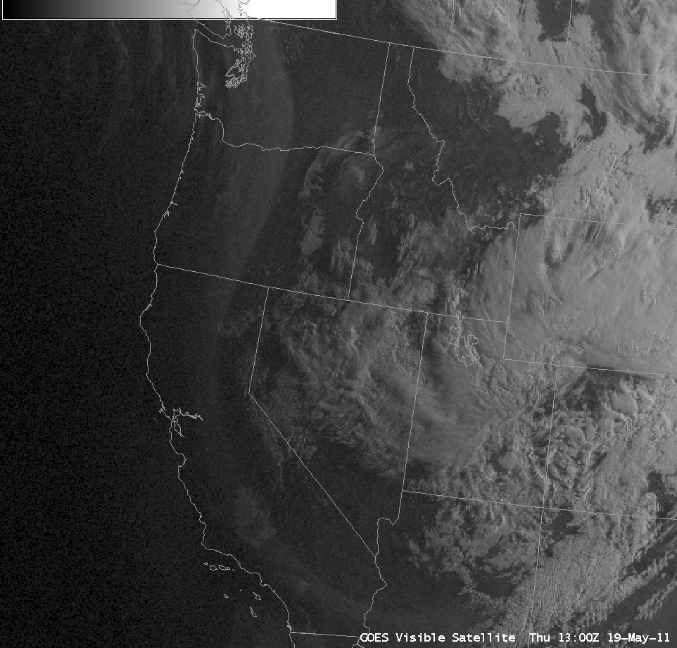
On the following morning of 19 May, a favorable forward scattering angle early in the day allowed the long smoke plume to be seen on AWIPS images of GOES-11 0.65 µm visible channel data (below; click image to play animation) — the leading edge of the smoke plume appeared to have reached southern California by that time. The AWIPS images are a composite of GOES-11 (GOES-West) and GOES-13 (GOES-East) visible channel data; the vertical “seam” between the 2 satellite sources should be fairly easy to see.


