Lake effect snow band over Lake Ontario
A long lake effect snow band became well-organized and stretched nearly the entire length of Lake Ontario on 20 January 2011. The cloud band was very evident on McIDAS images of GOES-13 0.63 µm visible channel data (above; click image to play animation). As the lake band moved onshore, it produced light to occasionally moderate snow at a few inland locations across central New York. In addition, if you look closely in the far northeastern portion of the lake you can also see ice floes that were drifting slowly eastward.
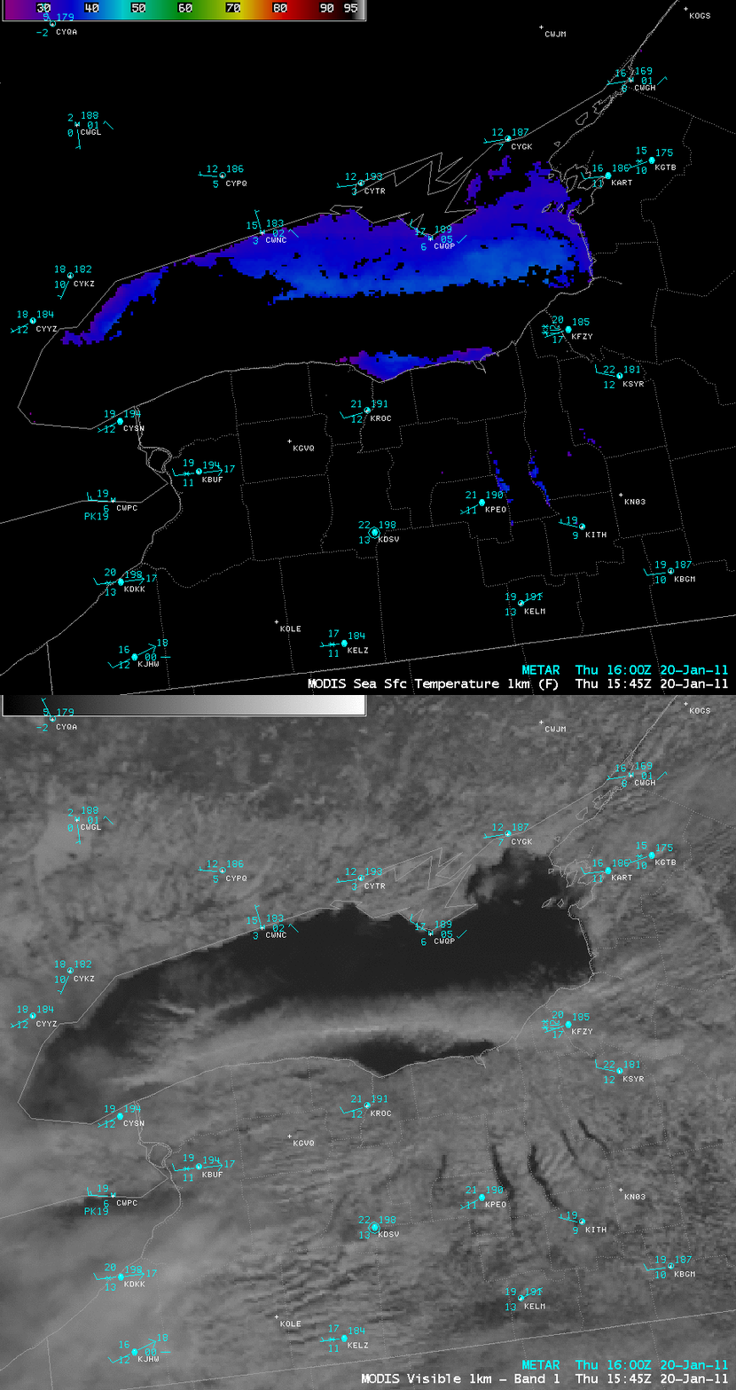
An AWIPS image of 1-km resolution MODIS 0.65 µm visible channel data (below) showed a more detailed view of the lake effect snow band feature. On the corresponding 1-km resolution MODIS Sea Surface Temperature (SST) product, relatively warm SST values as high as 40º F (lighter blue color enhancement) could be seen on either side of the cloud band.
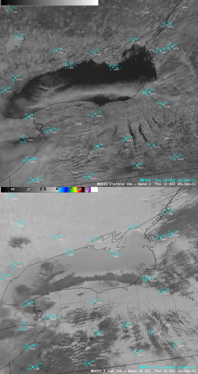
A comparison of the MODIS 0.65 µm visible image with the corresponding 3.7 µm shortwave IR image (below) indicated that there was a significant amount of solar reflection off the center portion of the cloud band, suggesting a cloud composed of supercooled water droplets (darker gray enhancement) — perhaps with a very thin veil of cirrus cloud spreading out over the top of the supercooled water droplet clouds. At the time of the MODIS images, Fulton, New York (station identifier KFZY) was reporting moderate snow with a reduction in surface visibility to 0.5 mile.
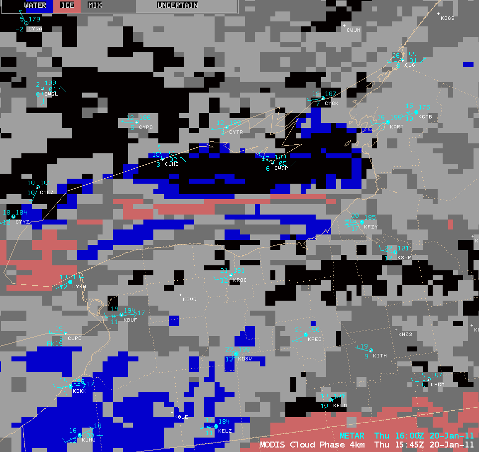
However, the 4-km resolution MODIS Cloud Phase product (below) indicated that a good portion of the center of the cloud band had glaciated (salmon color enhancement), although this thin area of ice cloud was surrounded by a great deal of mixed phase (darker gray) or uncertain (lighter gray) and also water phase (blue color enhancement) cloud.


