Mukluk Fire near Tok, Alaska forces evacuations
10-minute Full Disk scan GOES-18 (GOES-West) GeoColor RGB images with an overlay of Next Generation Fire System (NGFS) Fire Detection polygons (above) showed the thermal signature associated with the Mukluk Fire near Tok, Alaska — which began around 1940 UTC on 17 August 2026. With winds at Tok gusting to 20-30 mph, the fire spread quickly and forced some evacuations in the Tok area (18 August update).

10-minute GOES-18 Visible images with an overlay of the Fire Mask derived product (below) provided another view of the fire’s thermal signature.
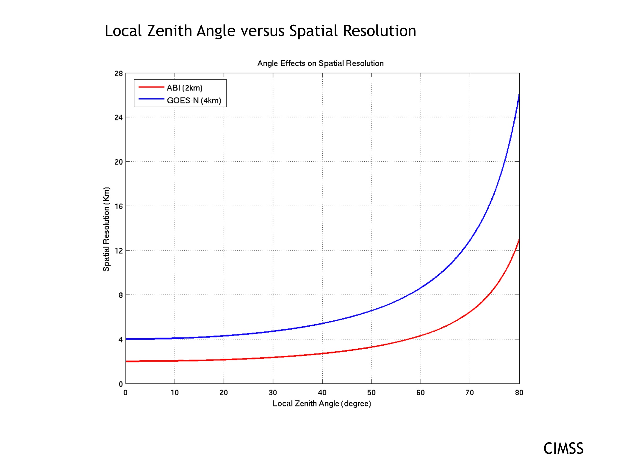
The areal coverage of NGFS Fire Detection polygons was somewhat distorted in GOES-18 imagery, due to the large effective pixel size of the spectral bands used to create the NGFS product (as shown in a plot of pixel size vs. satellite viewing angle; the GOES-18 viewing angle or zenith angle for Tok is around 72 degrees). Polar-orbiting satellites such as NOAA-20 and NOAA-21 flew directly over Alaska as the Mukluk Fire was burning, and offered a more accurate mapping of the fire’s thermal signature (below).