

Eruption of Sheveluch on Russia’s Kamchatka Peninsula
According to the Tokyo VAAC, Sheveluch (located on Russia’s Kamchatka Peninsula) erupted around 0508 UTC (text | image) on 31 July 2026. A signature of the resulting volcanic cloud became apparent in 10-minute Full Disk scan GOES-18 (GOES-West) Ash RGB images (above) and Dust RGB images (below), created using Geo2Grid. Brighter shades of yellow in both RGB image types were indicative of a mixture of ash and SO2 within the volcanic cloud. The volcanic cloud signature eventually became lost within a band of meteorological clouds associated with a cold front south of the Aleutian Islands.

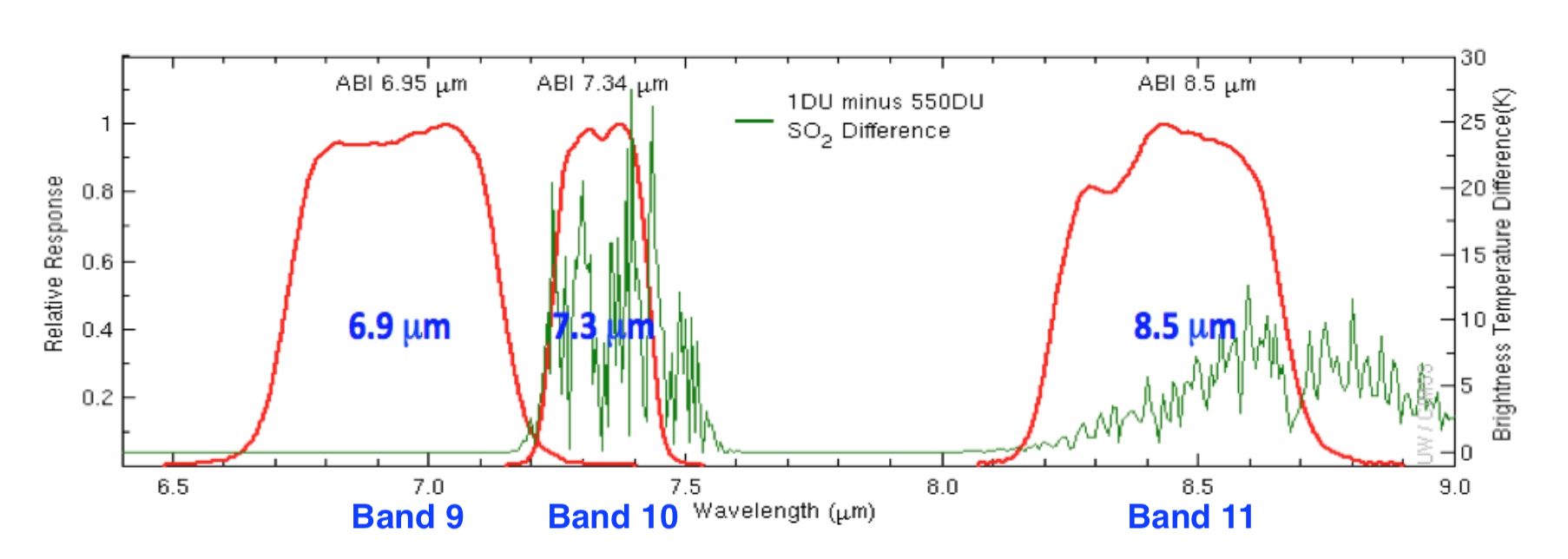
GOES-18 Split Cloud Top Phase images (below) included plots of Pilot Reports (PIREPs) and Volcanic Ash Advisory/Forecast polygons issued by the Anchorage VAAC. The 8.4 µm spectral band is sensitive to SO2 absorption which led to positive values (brighter green to yellow to red) in the imagery.
As the volcanic cloud advanced farther eastward across the Bering Sea, advisory responsibility was transferred from the Tokyo VAAC to the Anchorage VAAC, beginning at 1500 UTC on 31 July (below). The leading, faster-moving portion of the volcanic cloud had a maximum altitude of FL340 (34000 feet) — while the trailing, slower-moving portion had a maximum altitude of FL250 (25000 feet).

Wile many aircraft were flying above the FL340 (34000 feet) maximum altitude of the leading portion of the volcanic cloud, there were some pilot reports of Volcanic Ash (VA) clouds either in the distance or below the altitude of the aircraft (below).


The final Anchorage VAAC advisory for this event was issued at 1209 UTC on 01 August (below), as the volcanic cloud was approaching the Washington VAAC area of responsibility.
