Lake Mendota fog features
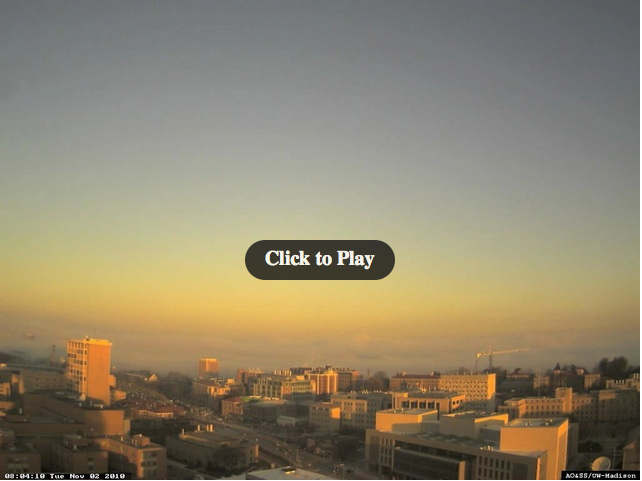
Nocturnal radiation fog formed over Lake Mendota (the largest of the 4 lakes in the immediate vicinity of Madison, Wisconsin) on 02 November 2010 — the evolution and motion of this fog was captured by a northwest-facing camera (above; smaller 640×480 version) mounted on the top of the Atmospheric, Oceanic, and Space Sciences building on the University of Wisconsin – Madison campus (Google map). The camera video begins at 09:54 UTC (4:54 am local time) and ends at 15:39 UTC (10:39 am local time). During the daylight hours, there even appeared to be evidence of a local-scale cyclonic circulation within the fog feature along the southern shore of Lake Mendota. Thanks to Pete Pokrandt, AOS, for supplying the QuickTime animation.
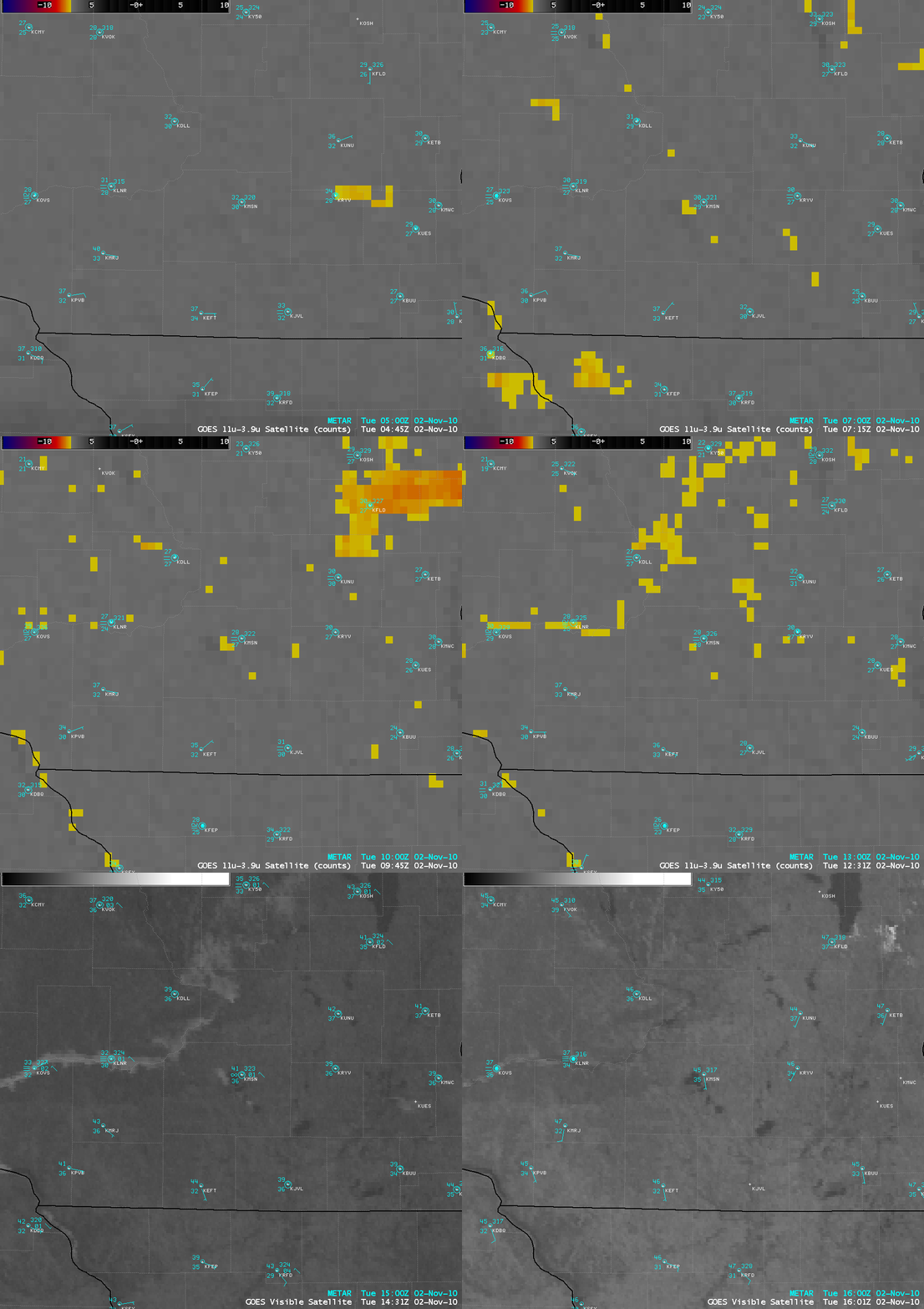
AWIPS images of the 4-km resolution GOES-13 fog/stratus product at night (followed by 1-km resolution GOES-13 0.63 µm visible channel images after sunrise) are shown below. In spite of the high amount of noise and “false fog/stratus pixels” (yellow enhancement), the GOES-13 fog/stratus product did show a relatively persistent fog signal over Lake Mendota through much of the night-time hours — and then the fog features could then be seen dissipating on the GOES-13 visible images after sunrise. On both the rooftop camera video and the GOES-13 visible images, the fog features appeared to be drifting to the southwest — in fact, the surface visibility at the Middleton Municipal Airport (KC29, located just to the west of Lake Mendota) dropped to 0.15 mile, while the surface visibility at Madison’s Dane County Regional Airport airport (KMSN, located just to the east of Lake Mendota) only fell to 3.0 miles.
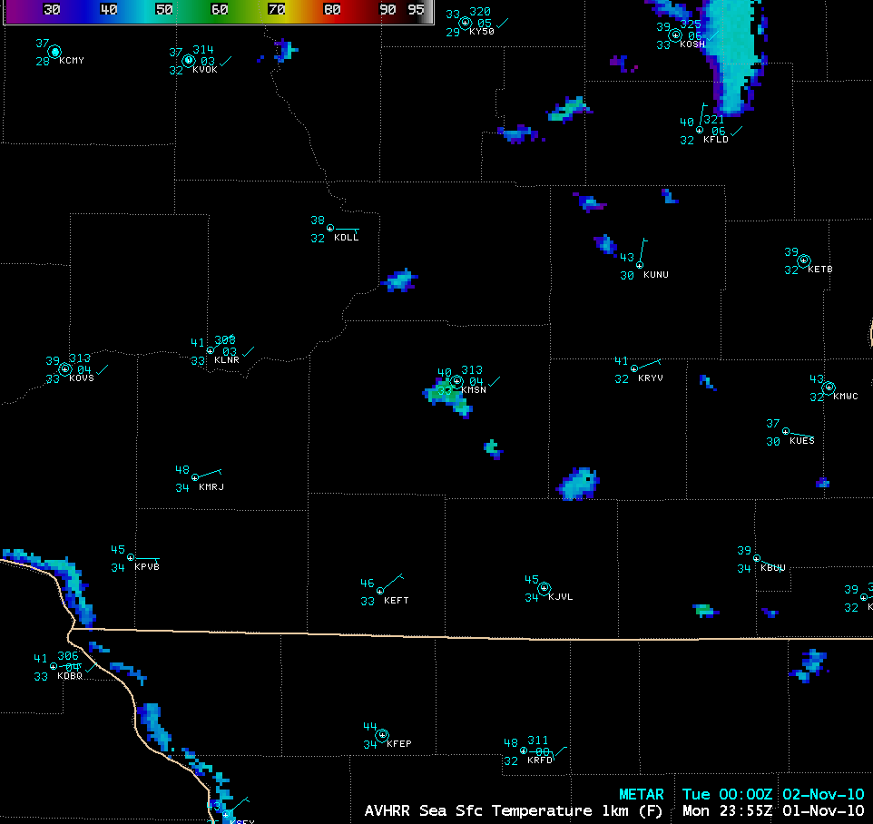
An AWIPS image of the POES AVHRR 1-km resolution Sea Surface Temperature product (below) indicated that SST values over the central portion of Lake Mendota were as warm as 54.5º F at 23:55 UTC (6:55 PM local time) before sunset. With light winds and strong radiational cooling during the night, the surface air temperate at nearby Madison Dane County Regional Airport (KMSN) cooled to 27º F — and with such a large difference in water vs air temperature, thick fog eventually began to form over Lake Mendota.
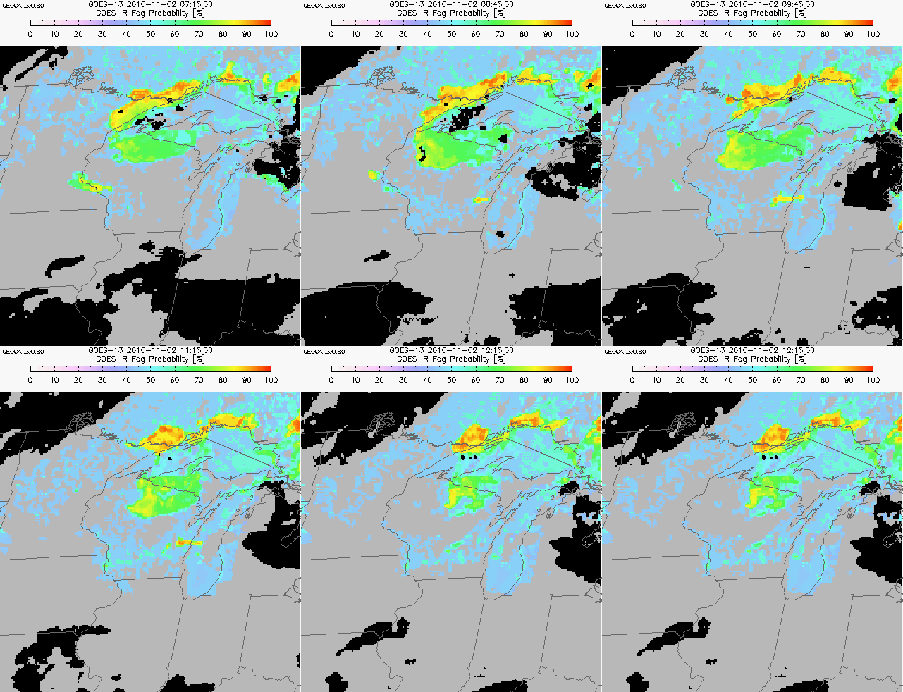
Looking ahead to the future GOES-R era, Geostationary Cloud Algorithm Test-bed (GEOCAT) images of a GOES-R Fog Probability product (below) did indeed suggest that fog probabilities were increasing across south-central Wisconsin during the night-time hours as radiational cooling continued.


