Hurricane Dolly
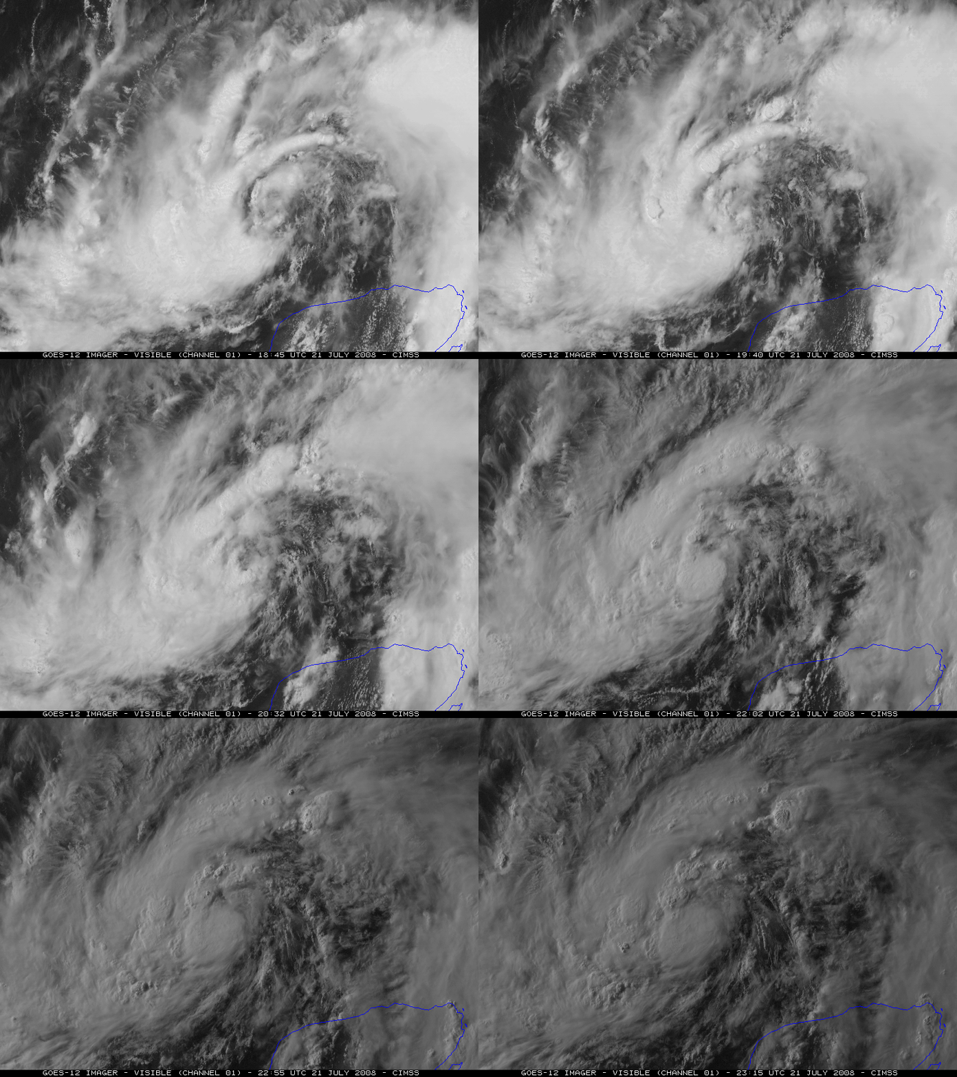
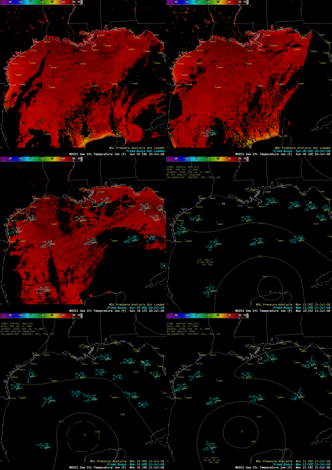
The GOES-12 satellite was placed into Rapid Scan Operations (RSO) mode to monitor Tropical Storm Dolly on 21 July 2008 — the RSO visible images at 5-10 minute intervals (above) showed that deep convection was increasing around the core of the tropical cyclone. Dolly was moving northwestward across the Gulf of Mexico – AWIPS images of the MODIS Sea Surface Temperature (SST) product (below) showed rather warm SST values (mid 80s to near 90 F, red colors) across much of the western Gulf of Mexico on the previous day, which argued in favor of a trend of intensification to hurricane strength. For additional satellite imagery and the latest information on Dolly, see the CIMSS Tropical Cyclones site.
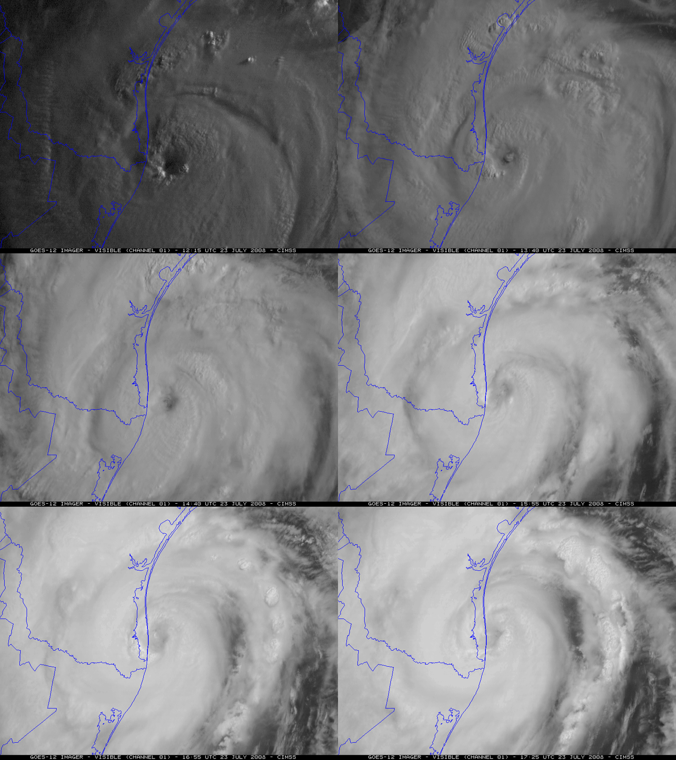
** 23 July UPDATE: Dolly reached hurricane intensity late in the day on 22 July (CIMSS Advanced Dvorak Technique intensity plot). GOES-12 RSO visible images (below) show the ragged eye of Hurricane Dolly approaching South Padre Island along the southern coast of Texas. A peak wind gust of 76 mph was reported at Port Mansfield and Rincon in Texas, with a ship captain off South Padre Island estimating a wind gust of 100 mph — wave heights over 24 feet were recorded by an offshore buoy. In addition to the strong winds, there were also several tornadoes and waterspouts, along with rainfall in excess of 12 inches.
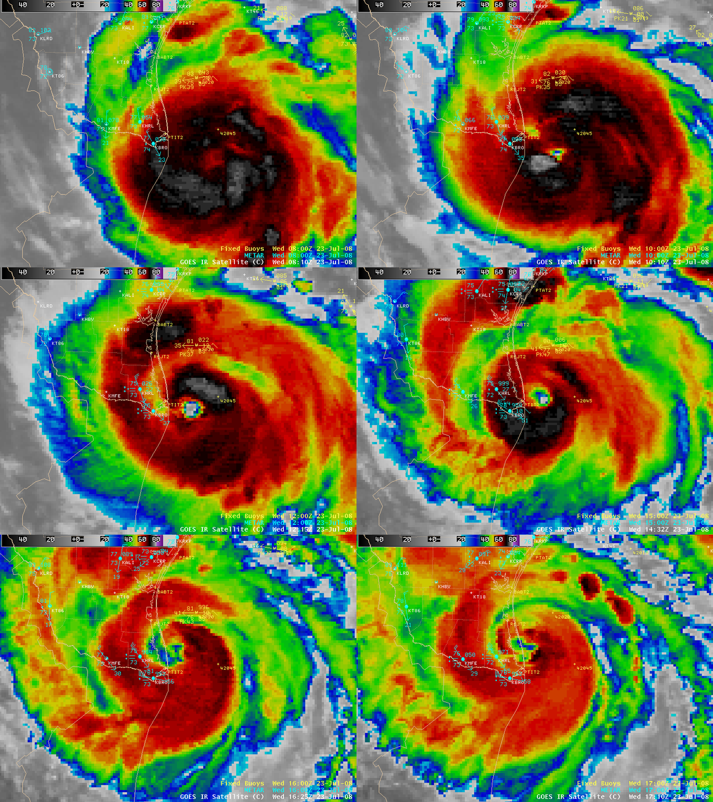
AWIPS images of the 4-km resolution GOES-12 10.7 µm IR channel (below) revealed that cloud top brightness temperature values around the eye and in the outer band regions were in the -70º to -80º C range (black to white colors).
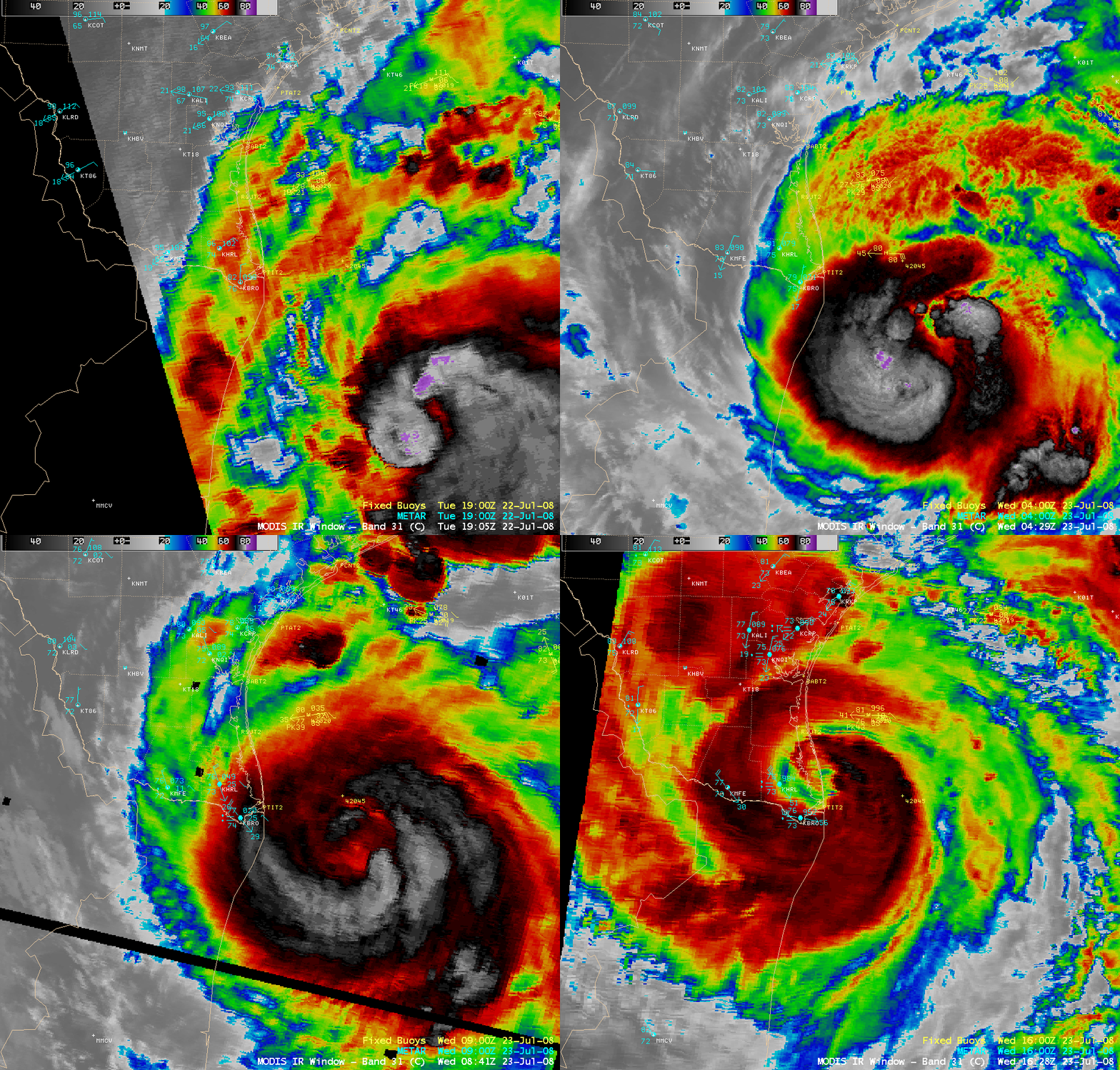
AWIPS images of the 1-km resolution MODIS 11.0 µm IR channel (below) indicated that cloud top brightness temperatures were as cold as -84º C (purple colors) on 22 July as the storm reached hurricane intensity.


