SPC issues Extreme Fire Weather Outlooks for parts of the central/southern Plains — with significant wildfire outbreaks along the Oklahoma/Kansas border

1-minute GOES-19 Visible images with overlays of Fire Mask pixels, SPC Fire Weather Outlooks (yellow contours), and Surface Fronts (cyan) from 1701 UTC on 17 February to 0000 UTC on 18 February [click to play MP4 animation]
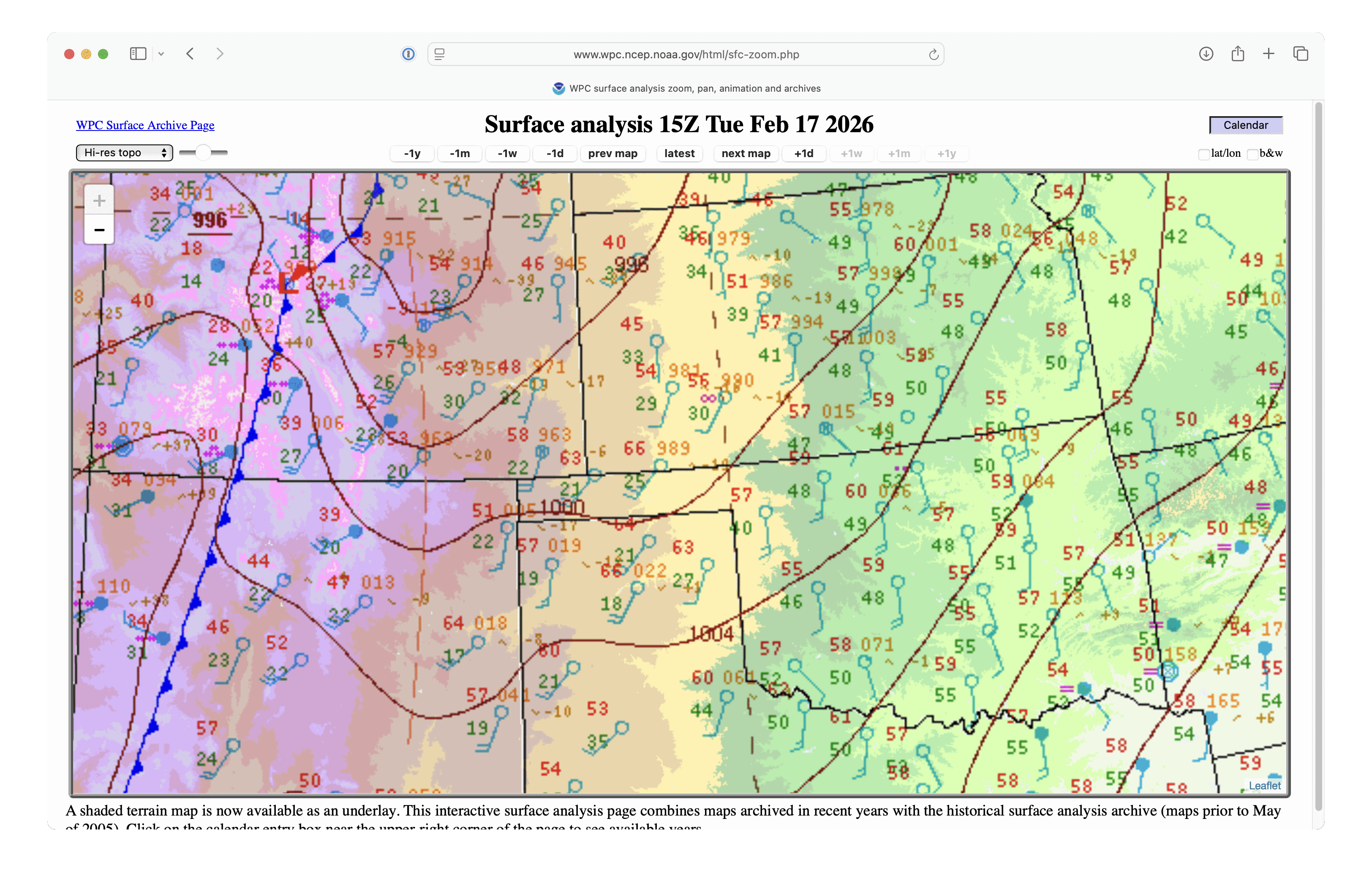
The Storm Prediction Center issued Extreme Fire Weather Outlooks (1200 UTC | 1700 UTC) that covered much of the central and southern Plains on 17 February 2026. A large-scale view of 1-minute Mesoscale Domain Sector GOES-19 (GOES-East) Visible images (above) included plots of Fire Mask pixels — which depicted the development of numerous wildfires, most notably along the Oklahoma/Kansas border.
A closer view using 1-minute GOES-19 Shortwave Infrared images (below) showed the Ranger Road Fire that began to burn in Beaver County, Oklahoma around 1716 UTC — and strong SW winds (with peak gusts in the 50-56 kt range) ahead of an approaching cold front (surface analyses) helped this fire make a rapid 65-mile run to the northeast, crossing the border into Meade/Clark/Comanche Counties in far southern Kansas. The Ranger Road Fire burned at least 145000 acres, and prompted the issuance of Fire Warnings and evacuation orders along/ahead of its path.

1-minute GOES-19 Shortwave Infrared images, with plots of Surface Wind barbs and Peak Wind Gusts (yellow/red) and Surface Fronts, from 1701 UTC on 17 February to 0100 UTC on 18 February [click to play MP4 animation]
Near the leading edge of the Ranger Road Fire (in Clark County in far southern Kansas), it first exhibited a maximum 3.9 µm brightness temperature of 137.77ºC — which is the saturation temperature of GOES-19 Band 7 detectors — at 2354 UTC (below).

GOES-19 Shortwave Infrared image at 2354 UTC on 17 February, with a cursor sample showing a 3.9 µm infrared brightness temperature of 137.77ºC [click to enlarge]
1-minute GOES-19 GeoColor RGB images with an overlay of Next Generation Fire System (NGFS) Fire Detection polygons (below) displayed the thermal signatures, smoke plume and pyrocumulus clouds associated with the Ranger Road Fire. Surface observations in the vicinity of the fire depicted wind gusts as high as 65 mph at 2140 UTC.

1-minute GOES-19 GeoColor RGB images with an overlay of NGFS Fire Detection polygons (with/without plots of surface observations), from 1700 UTC on 17 February to 0000 UTC on 18 February [click to play MP4 animation]
===== 21 February Update =====

Landsat-9 Natural Color RGB image at 1720 UTC on 21 February, with map labels or county outlines [click to enlarge]
A 30-meter resolution Landsat-9 Natural Color RGB image (above) showed the burn scar of the Ranger Road Fire 4 days later, at 1720 UTC on 21 February.