Melissa becomes a Hurricane southeast of Jamaica, then rapidly intensifies to a Category 5 storm

1-minute GOES-19 Infrared images with plots of GLM Flash Points, from 1201 UTC on 25 October to 0300 UTC on 26 October [click to play MP4 animation]
Melissa then reached Category 4 intensity south of Jamaica at 1200 UTC on 26 October — and by that time the eye was well defined in both Infrared and Visible imagery (below). Low-altitude mesovortices were apparent within the eye in the Visible images.

1-minute GOES-19 Infrared images with plots of GLM Flash Points, from 1200 -2100 UTC on 26 October [click to play MP4 animation]

1-minute GOES-19 Visible images with plots of GLM Flash Points, from 1200-2100 UTC on 26 October [click to play MP4 animation]
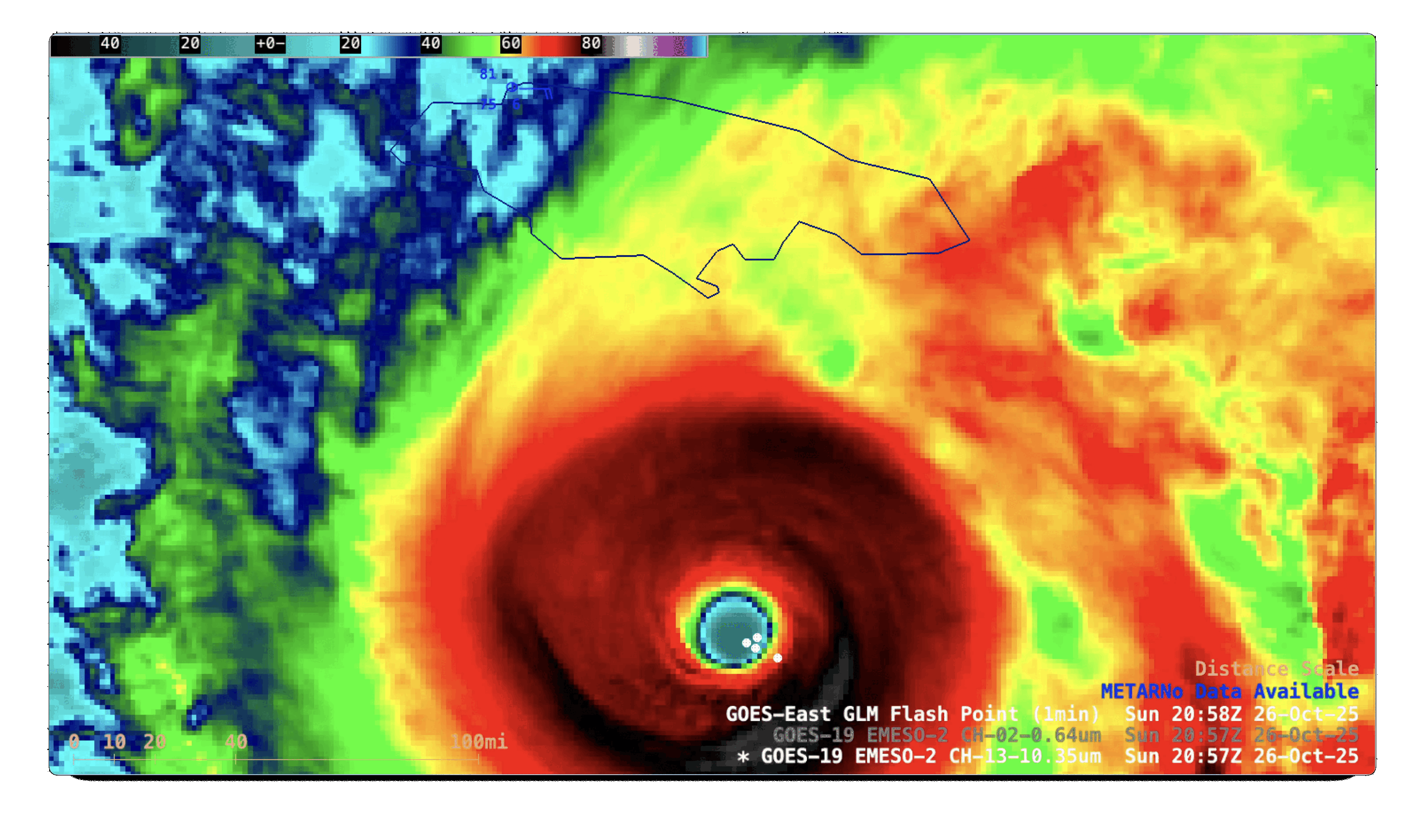
GOES-19 Visible and Infrared images at 2057 UTC on 26 October, with plots of GLM Flash Points [click to enlarge]
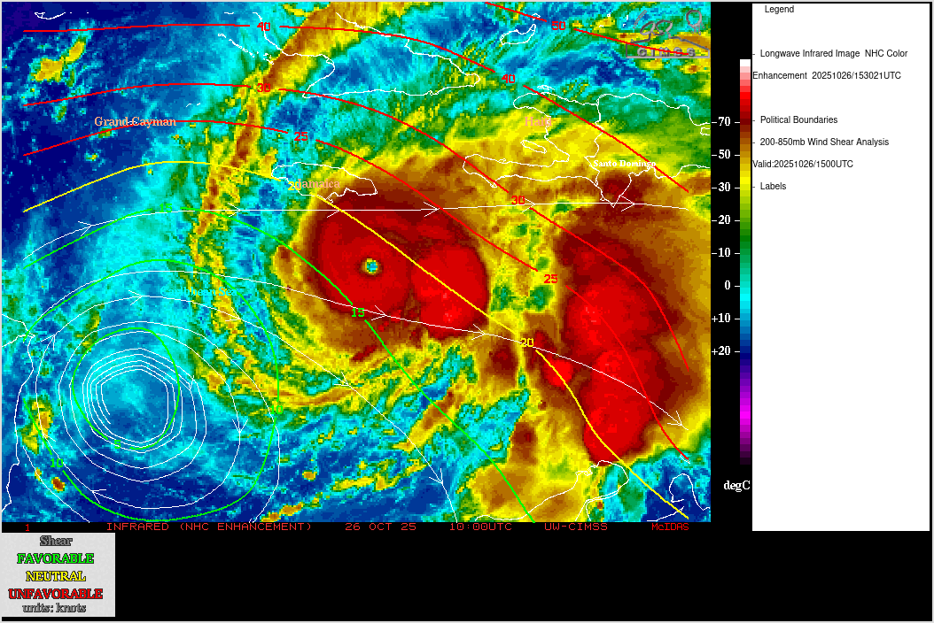
GOES-19 Infrared images, with an overlay of contours and streamlines of deep-layer wind shear at 1500 UTC on 26 October
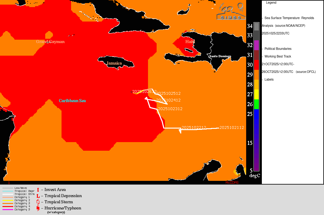
Sea Surface Temperature and Ocean Heat Content, with the track of Melissa ending at 1200 UTC on 26 October
===== 27 October Update =====

1-minute GOES-19 Visible and Infrared images with plots of 1-minute GOES-19 GLM Flash Points, from 1131-2200 UTC on 27 October [click to play MP4 animation]
The maximum sustained wind speed of Melissa was increased to 150 kts at 2100 UTC (SATCON | ADT).