Advection fog over the western Great Lakes
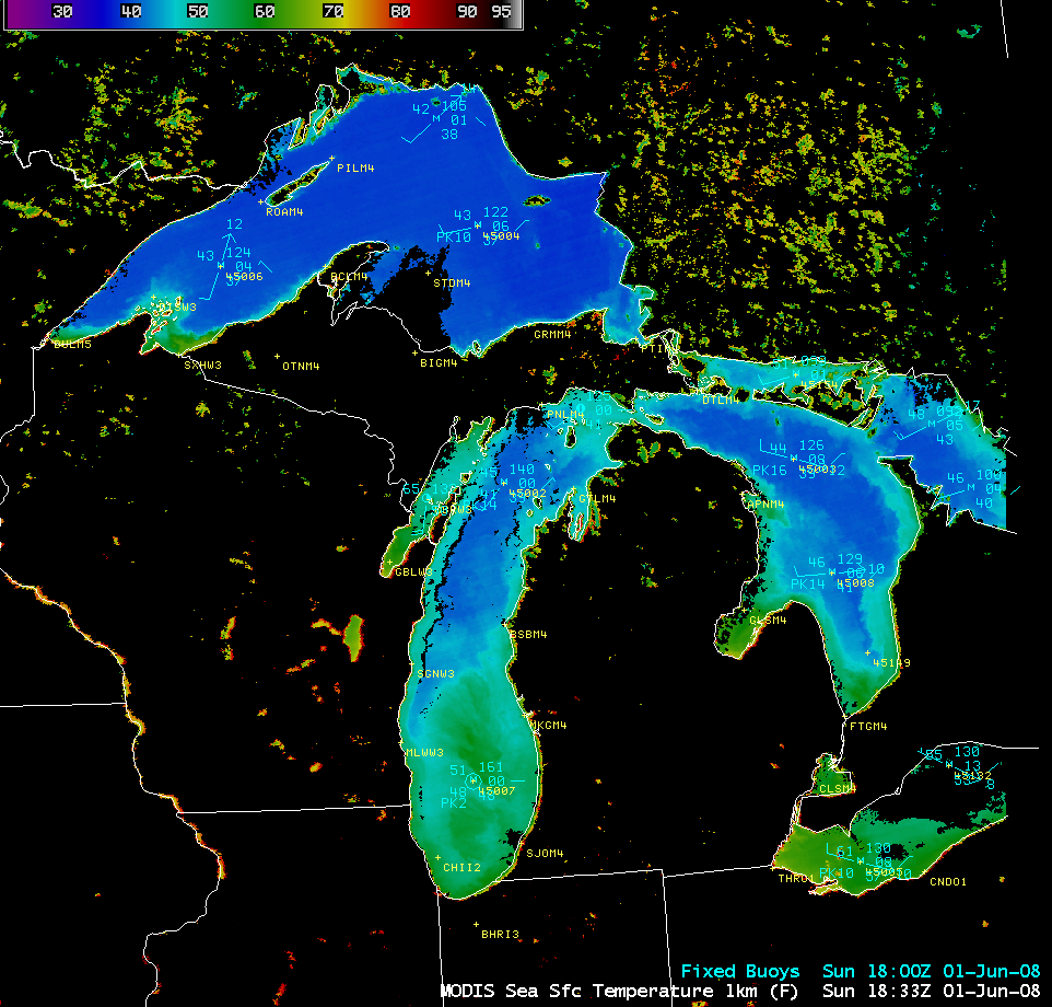
An AWIPS image of the MODIS Sea Surface Temperature (SST) product (above) revealed that the water temperatures were still quite cool across much of the western Great Lakes on 01 June 2008. Several days later, a northward surge of warm and humid air brought daytime temperatures into the 80s F with dew points into the mid-upper 60s F over a good deal of the region on 06 June 2008. As this warm and humid air flowed over the still-cool waters of Lakes Superior, Michigan, and Huron, dense advection fog formed which lasted into the early morning hours on 07 June 2008.
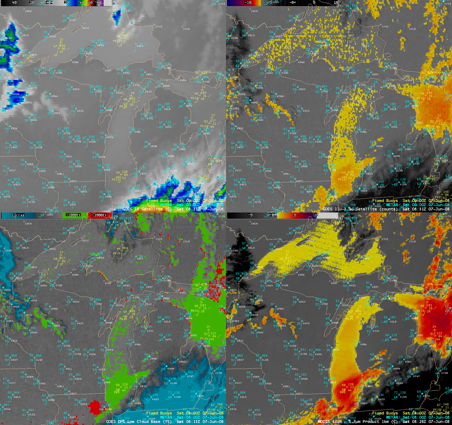
A comparison of the 4-km resolution GOES-12 IR window, fog/stratus product, and Low Cloud Base product images with the 1-km resolution MODIS fog/stratus product image (below) showed the extensive coverage of fog over the lakes just after 08 UTC (3am local time).
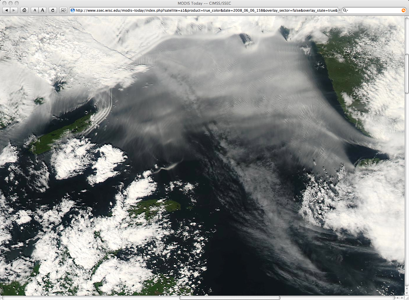
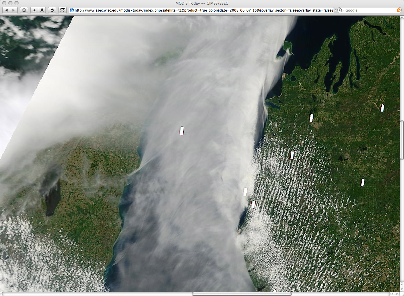
250-meter resolution MODIS true color images from the SSEC MODIS Today site (below) show interesting small-scale structure in the fog over Lake Superior on 06 June and over Lake Michigan on 07 June, including “bow shock waves” where the southerly flow of wind and lake fog was interacting with various islands and coastal features.


