Severe thunderstorms cause ground stops at Chicago’s Midway and O’Hare airports

1-minute GOES-19 Red Visible (0.64 µm) images with an overlay of 1-minute GOES-19 GLM Flash Points and 30-minute Peak Wind Gusts, from 1800-2200 UTC on 24 July [click to play MP4 animation]
The corresponding GOES-19 Infrared imagery (below) displayed cloud-top infrared brightness temperatures as cold as -75ºC with some of the more robust thunderstorm overshooting tops.
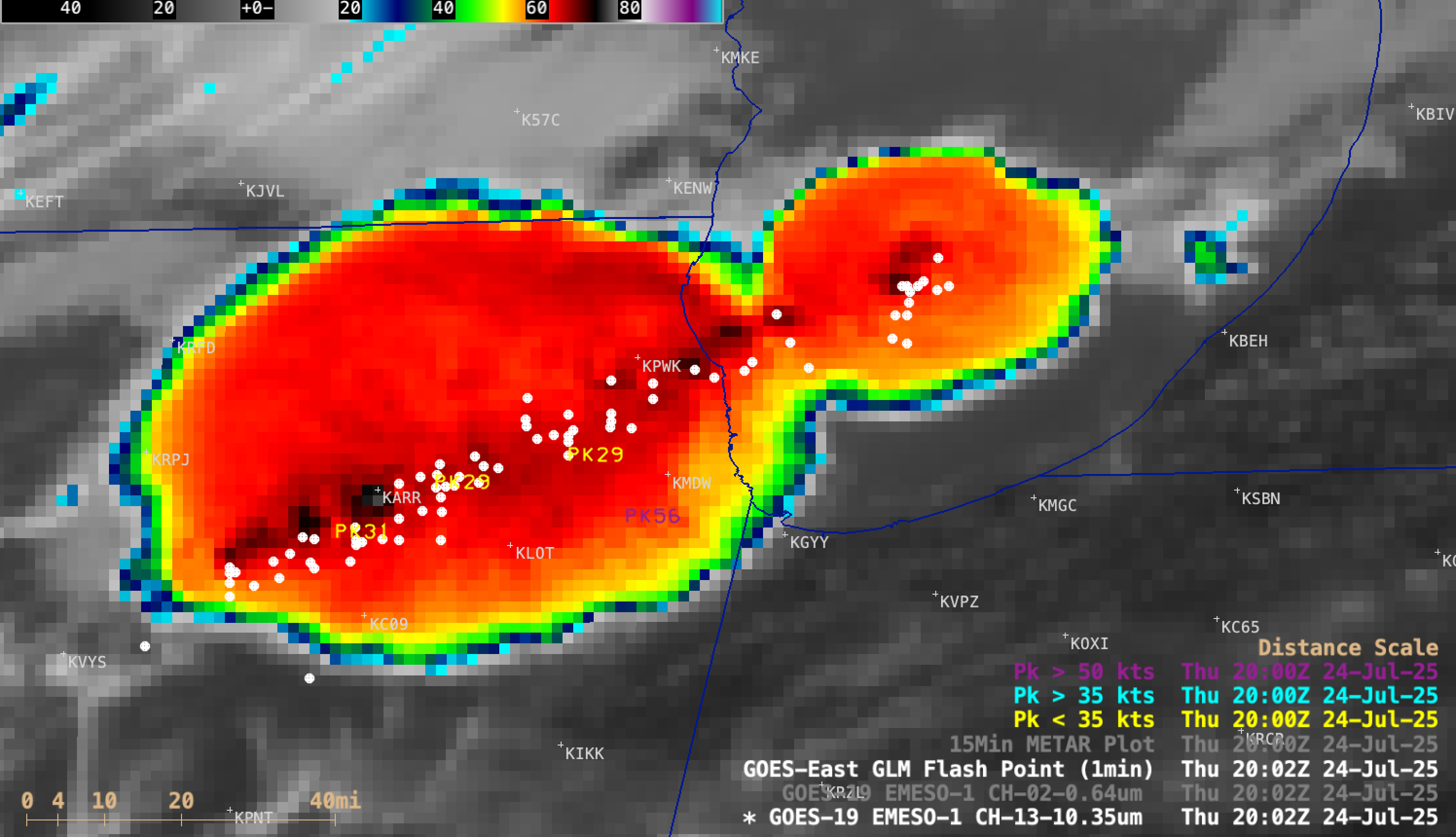
1-minute GOES-19 Clean Infrared Window (10.3 µm) images with an overlay of 1-minute GOES-19 GLM Flash Points and 30-minute Peak Wind Gusts, from 1800-2200 UTC on 24 July [click to play MP4 animation]

Plot of rawinsonde data from Lincoln, Illinois at 0000 UTC on 25 July [click to enlarge]

1-minute GOES-19 Visible (0.64 µm, left) and Infrared (10.3 µm, right) images, with time-matched (+/- 3 minutes) SPC Storm Reports (W=wind damage; W80=wind gust to 80 mph) plotted in red/cyan [click to play animated GIF | MP4]