Cram Fire in Oregon
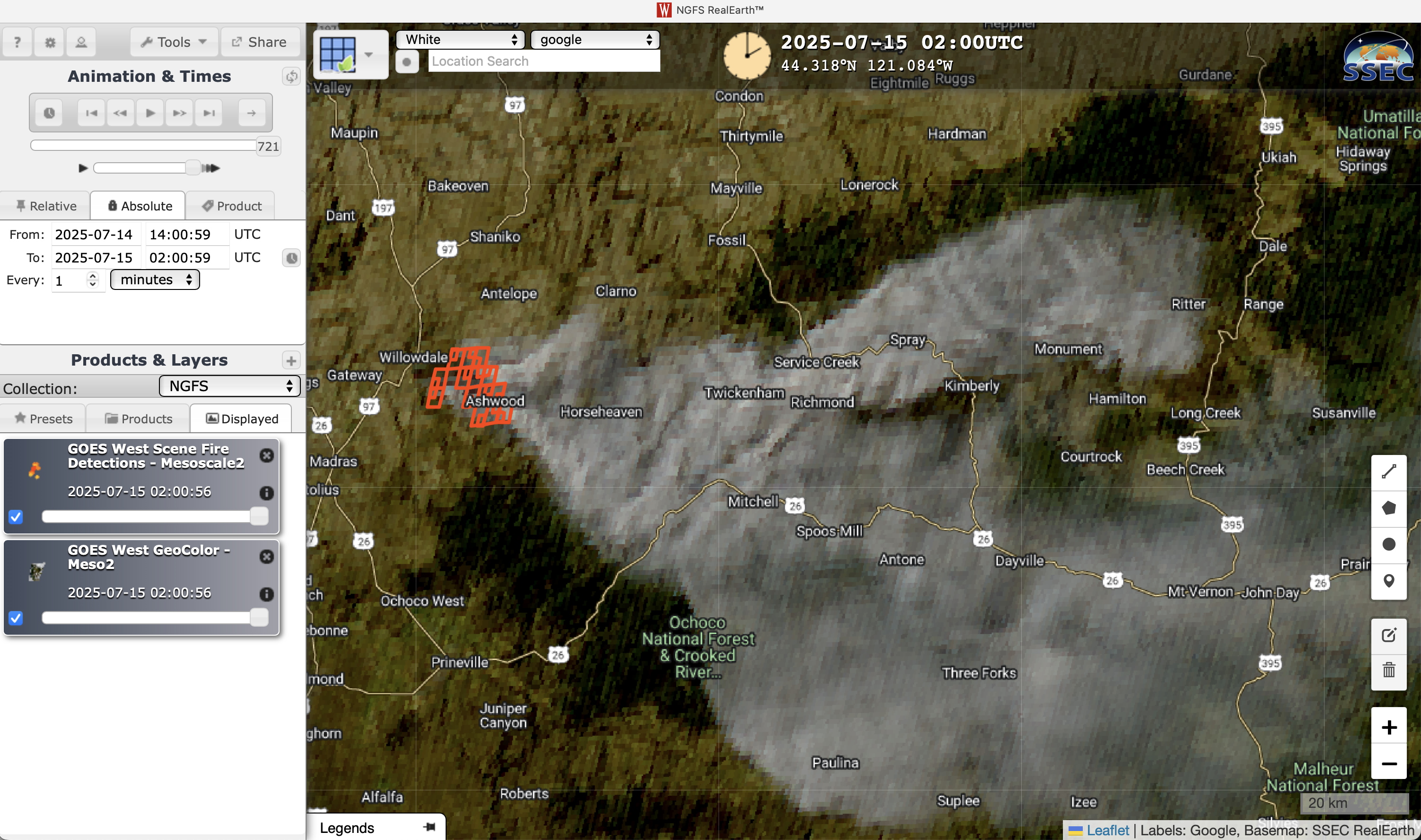
1-minute GOES-18 GeoColor RGB images with an overlay of NGFS Fire Detection polygons, from 1400 UTC on 14 July to 0200 UTC on 15 July [click to play MP4 animation]
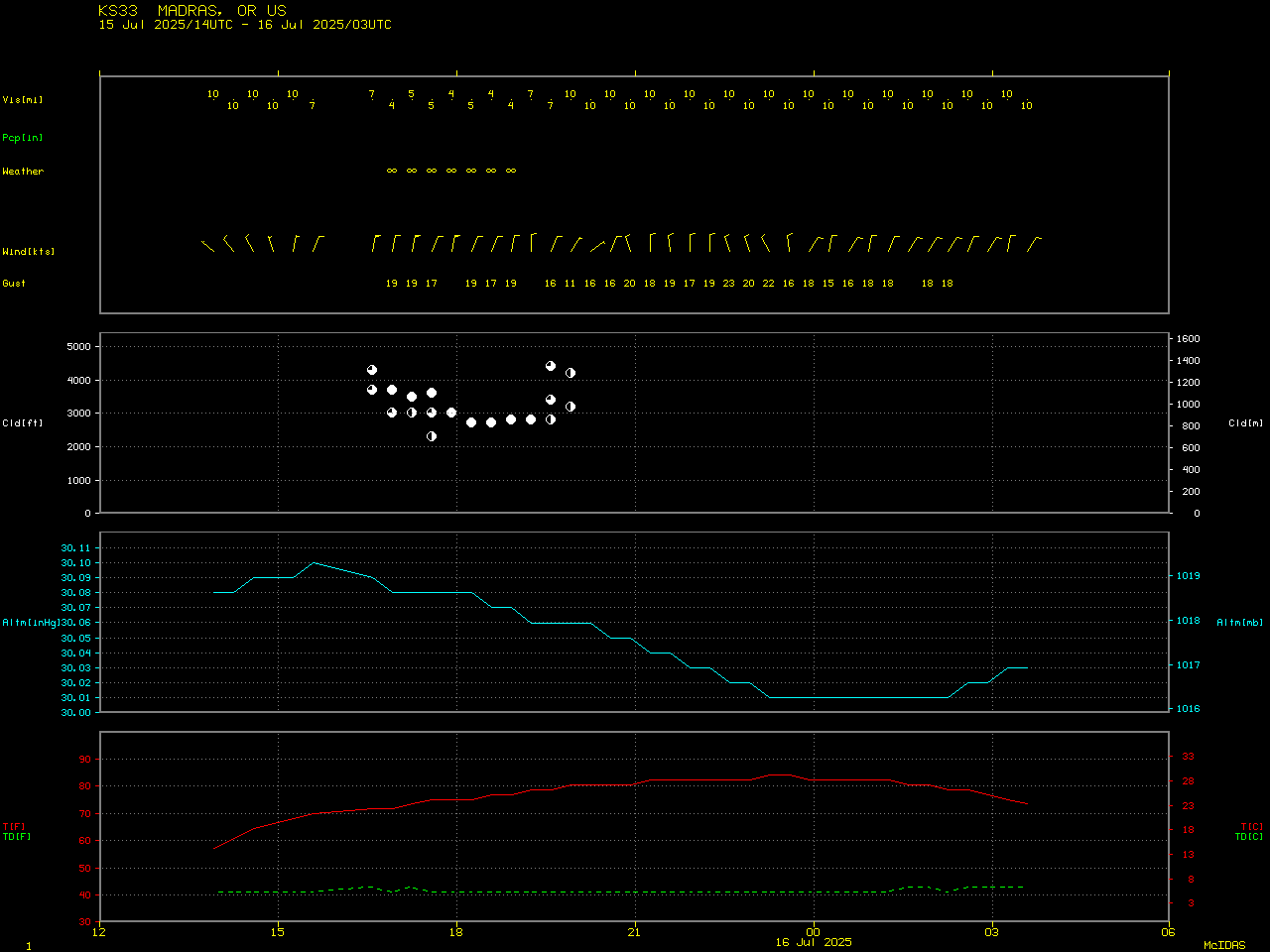
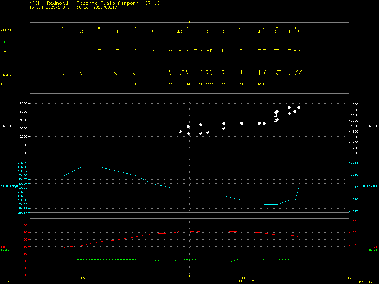
1-minute GOES-18 Visible images with an overlay of the FDCA Fire Mask derived product (below) also displayed the large thermal signature of the Cram Fire as it burned in the vicinity of the Wasco/Jefferson County line. Data from RAWS sites showed that winds just northeast of the fire were gusting as high as 40 mph at 2300 UTC.
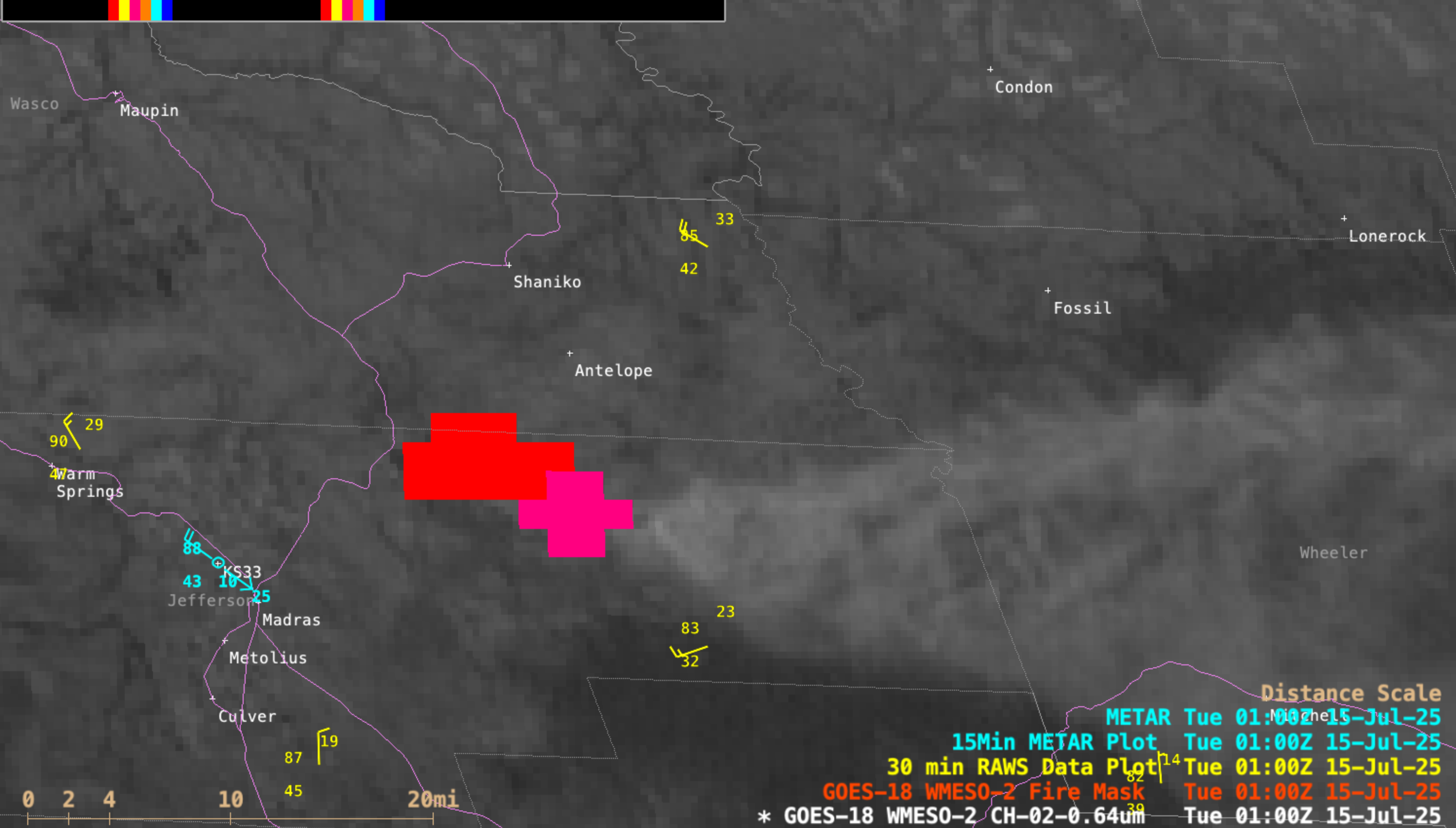
1-minute GOES-18 Visible images with an overlay of the Fire Mask derived product, from 1401 UTC on 14 July to 0300 UTC on 15 July; highways are plotted in violet [click to play MP4 animation]
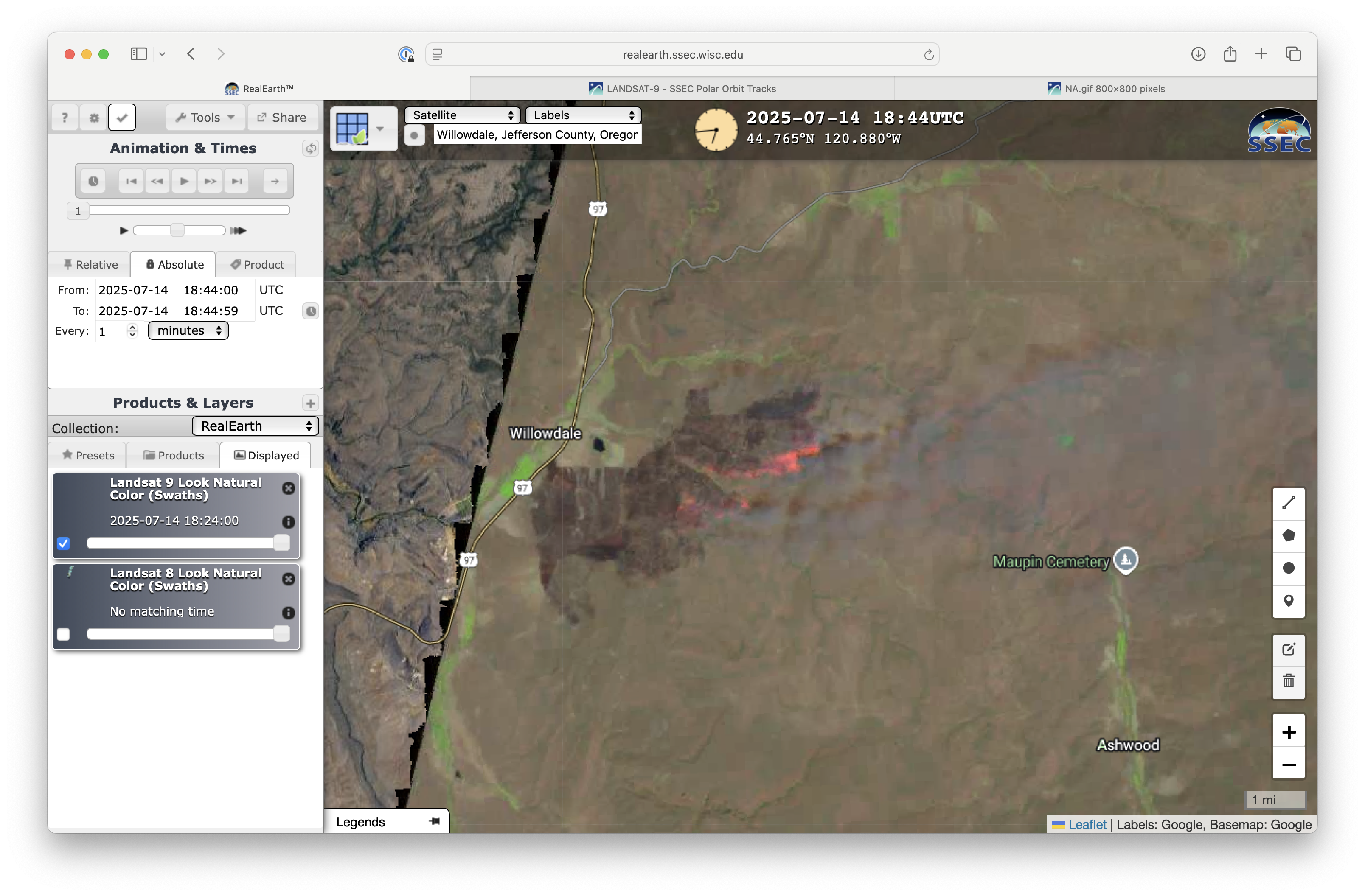
Landsat-9 Natural Color RGB image at 1844 UTC on 14 July [click to enlarge]
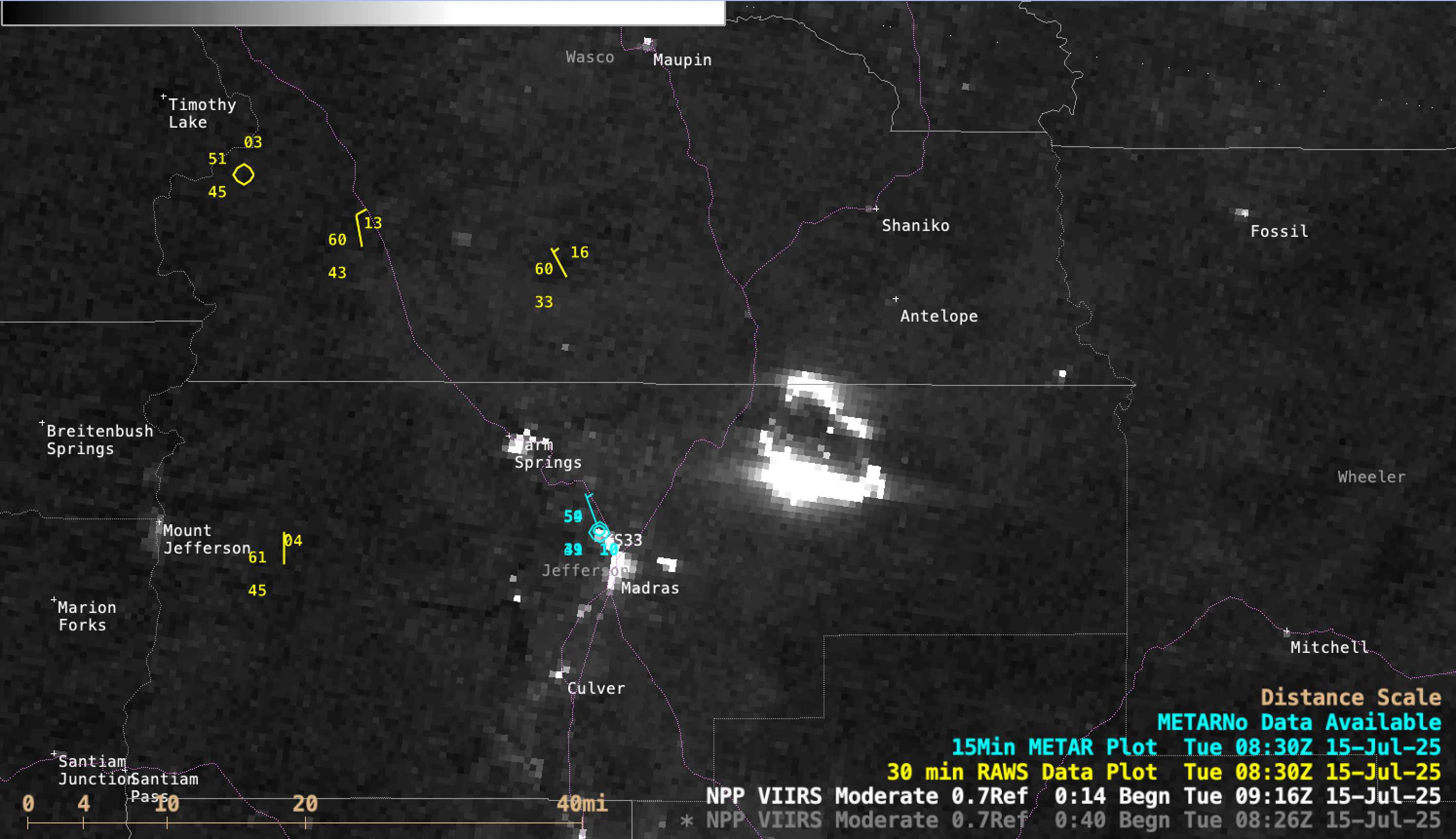
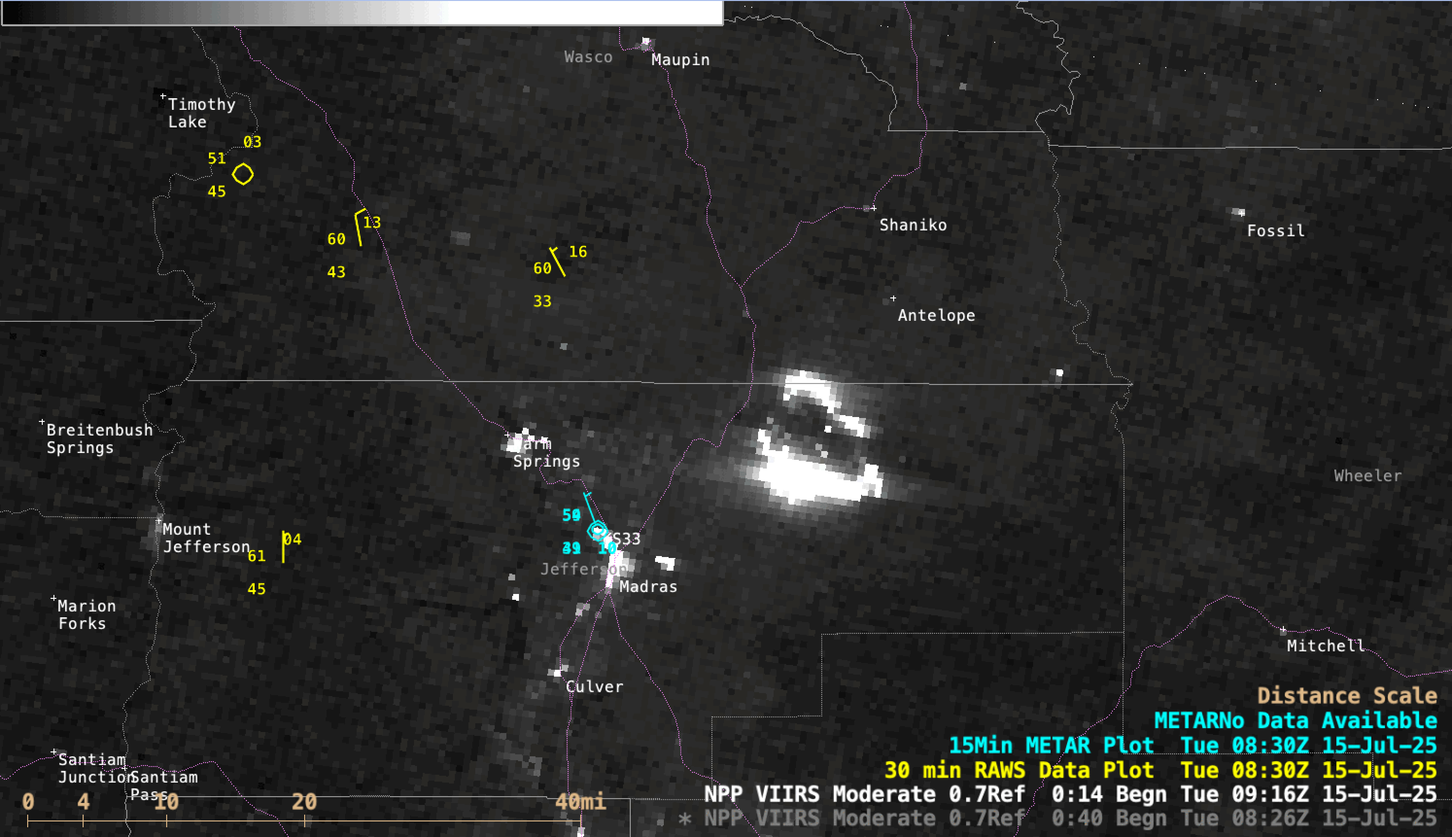
NOAA-20 (mislabeled as NPP) VIIRS Day/Night Band image at 0916 UTC on 15 July [click to enlarge]
===== 15 July Update =====
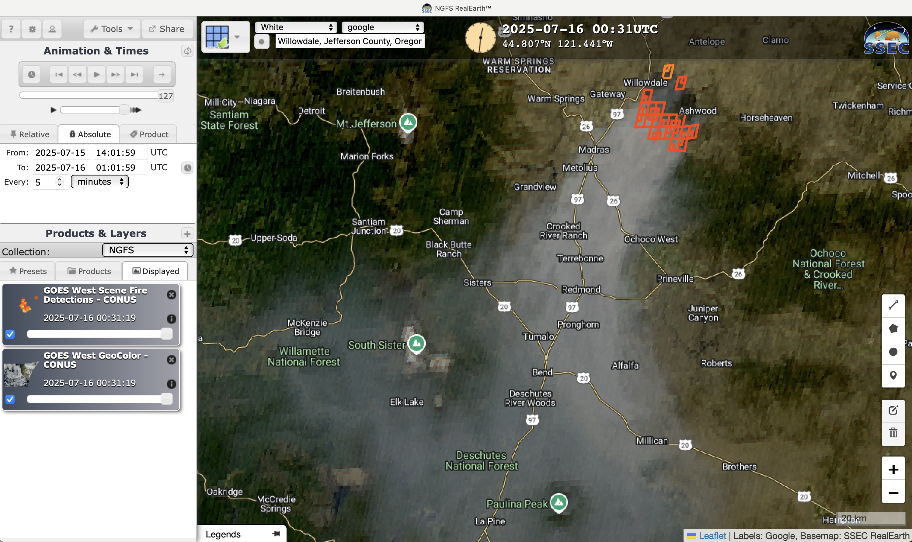
5-minute GOES-18 GeoColor RGB images with an overlay of NGFS Fire Detection polygons, from 1401 UTC on 15 July to 0226 UTC on 16 July [click to play MP4 animation]
With RAWS sites surrounding the fire reporting N-NE wind gusts in the 25-30 mph range, the GOES-18 Fire Mask (below) showed that most of the burning activity shifted to the southern flank of the Cram Fire as the day progressed. The large burn scar exhibited darker shades of gray in the Visible imagery.

5-minute GOES-18 Visible images with an overlay of the Fire Mask derived product, from 1401 UTC on 15 July to 0301 UTC on 16 July; highways are plotted in violet [click to play MP4 animation]
NOAA-20 (mislabeled as NPP) VIIRS Day/Night Band images at 0916 UTC on 15 July and 1038 UTC on 16 July [click to enlarge]
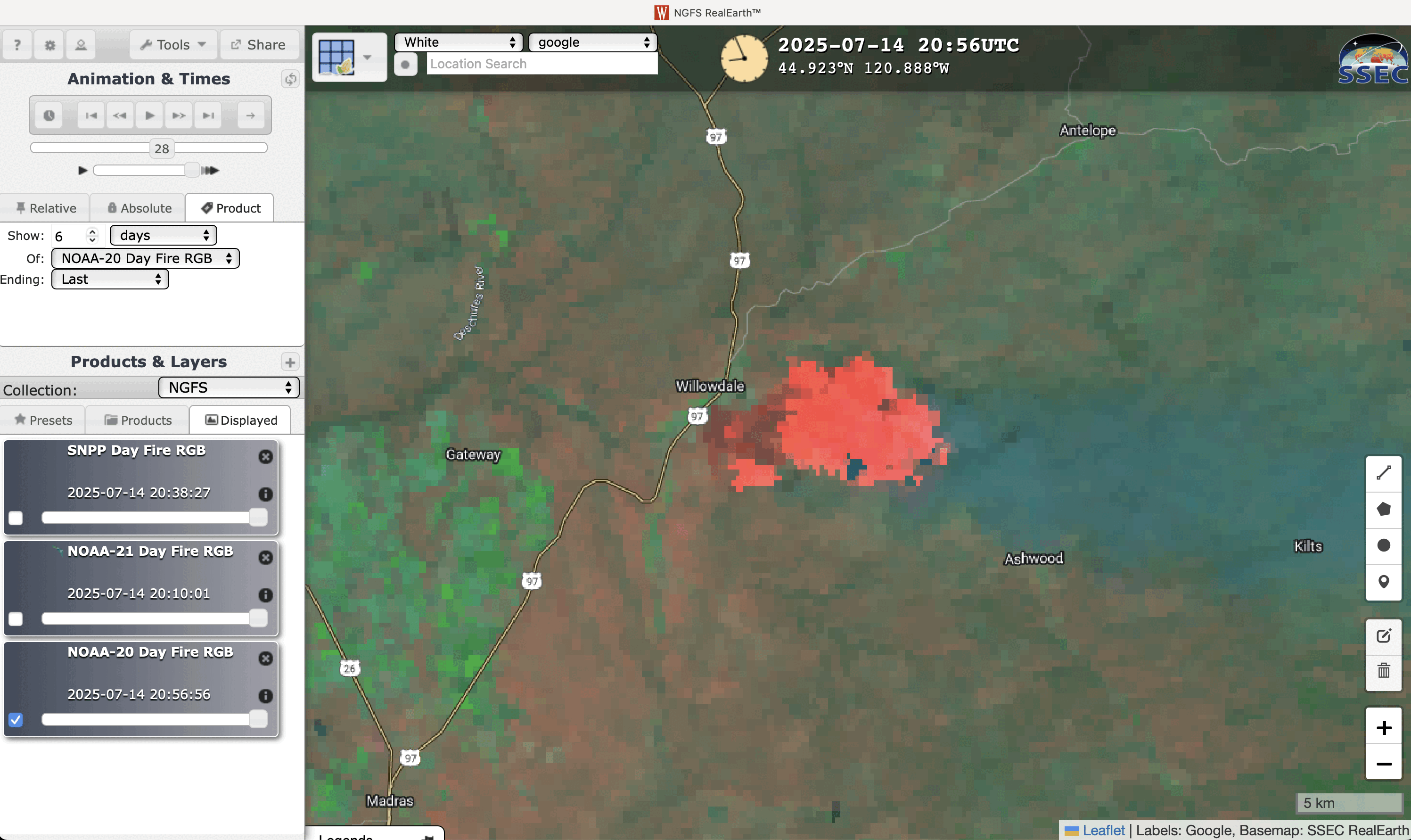
NOAA-20 VIIRS Day Fire RGB images on 14 July and 15 July [click to enlarge]
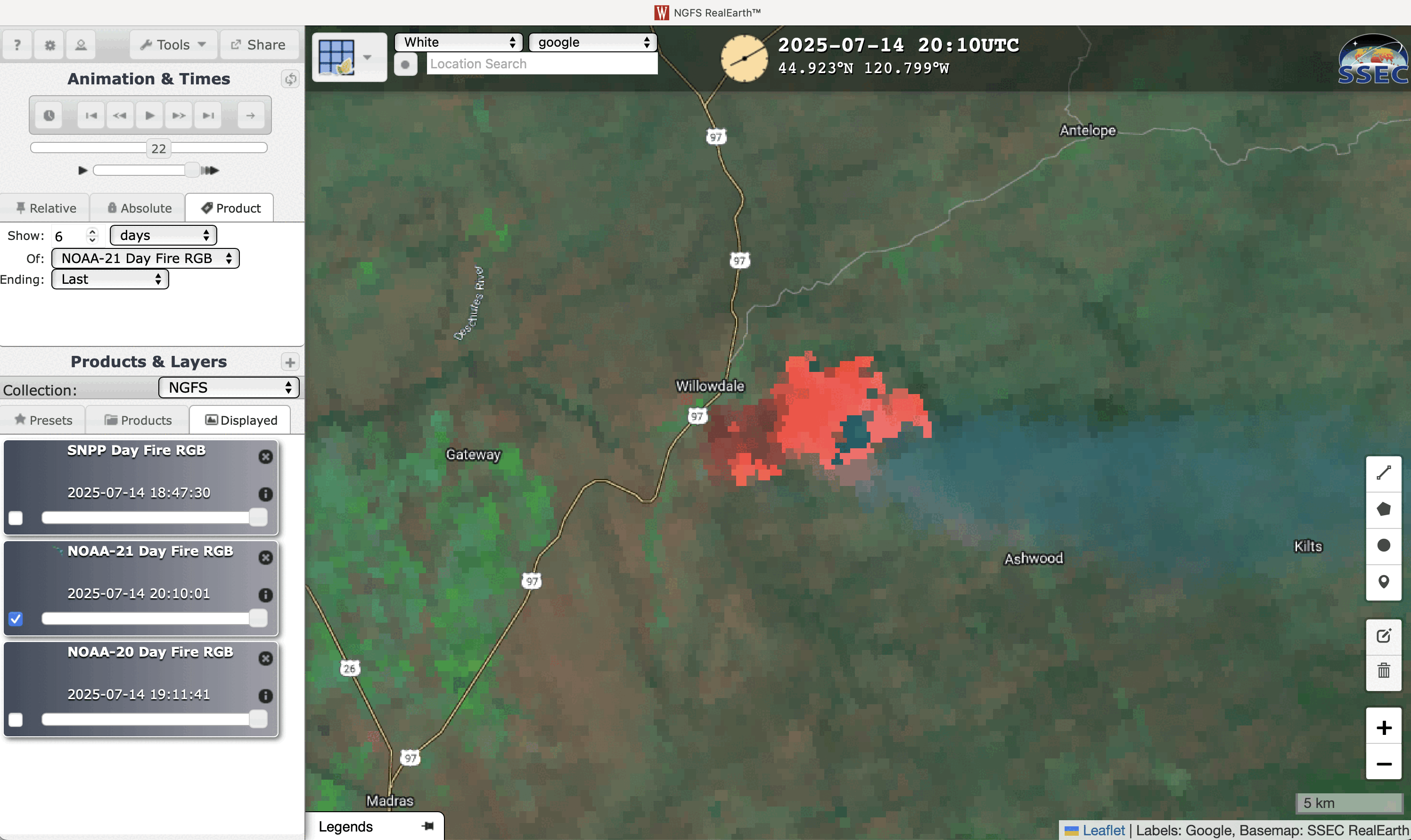
NOAA-21 VIIRS Day Fire RGB images on 14 July and 15 July [click to enlarge]
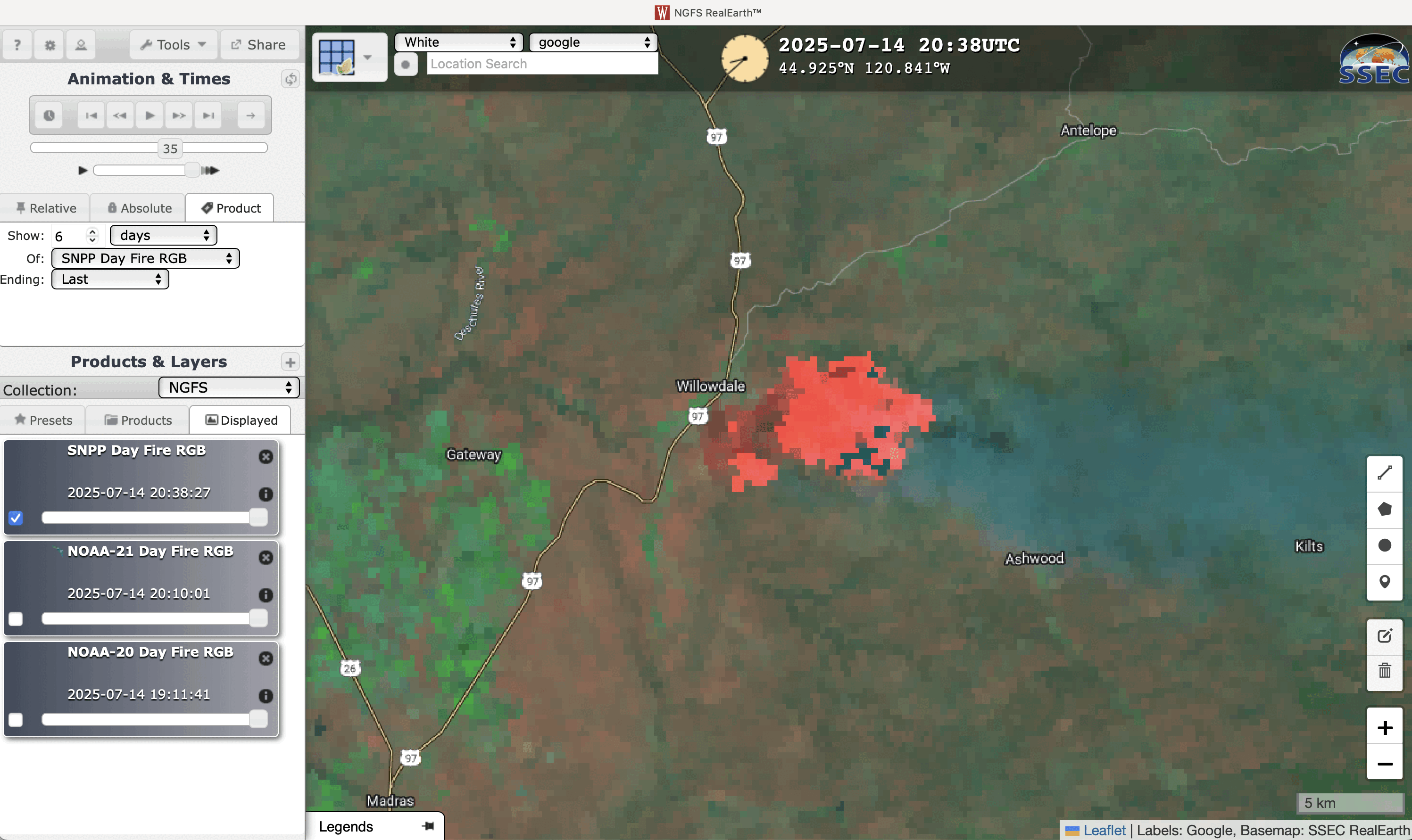
Suomi-NPP VIIRS Day Fire RGB images on July 14 and July 15 [click to enlarge]