Hurricane Wilma
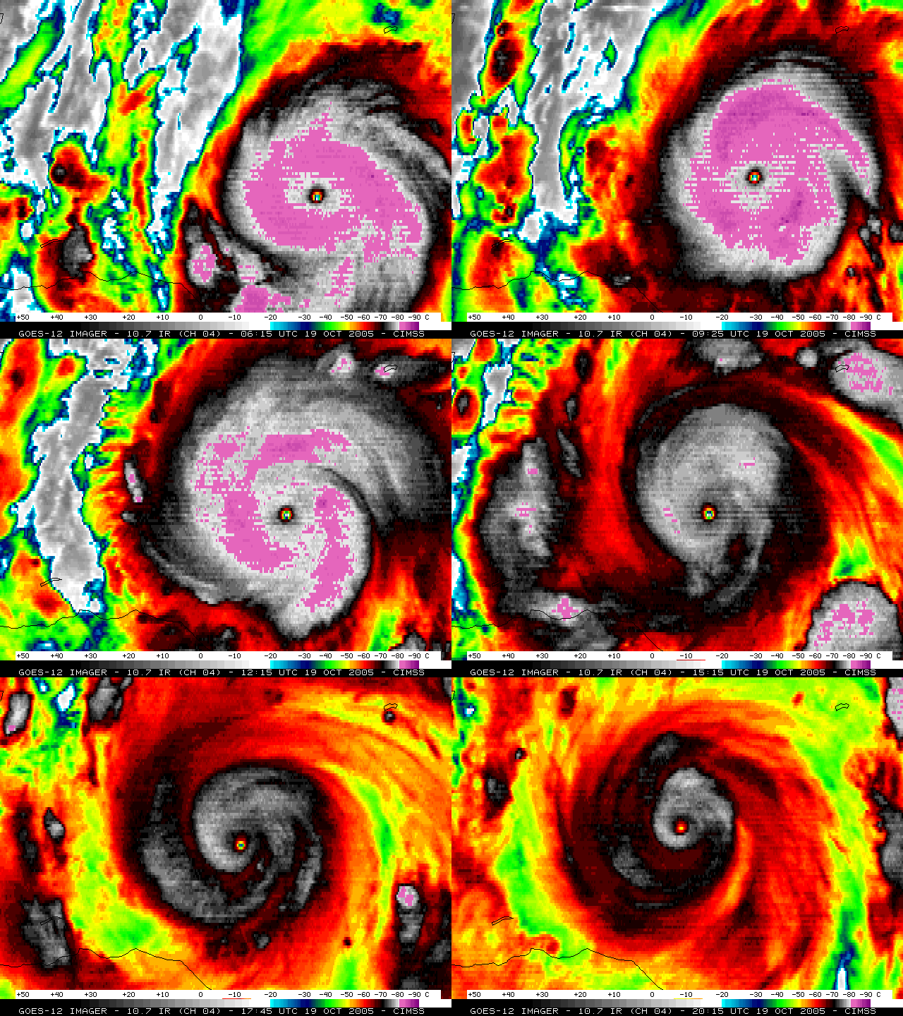
Hurricane Wilma rapidly intensified on 19 October 2005, becoming the most intense tropical cyclone ever observed in the Western Hemisphere. GOES-12 10.7 µm IR images (above; QuickTime animation) revealed cloud top brightness temperatures as cold as -87º C (darker purple enhancement) early in the day; the eye of Wilma also demonstrated a pronounced “trochoidal oscillation” or “looping motion” on the image animation.
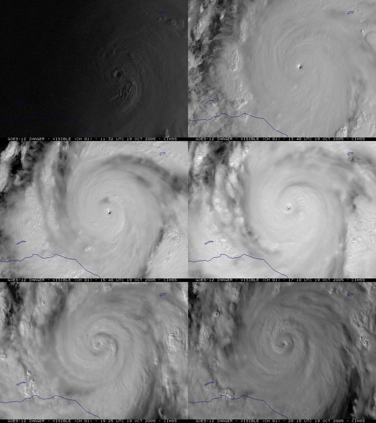
GOES-12 visible images (below; QuickTime animation) showed that a “pinhole eye” was associated with Wilma on 19 October — at its peak intensity, the pinhole eye of Wilma was only about 3 miles (5 km) in diameter, the smallest eye ever to be observed in an Atlantic hurricane. Such pinhole eyes are often observed with tropical cyclones that are rapidly intensifying.
A comparison of two GOES-12 visible images (below) shows that Wilma’s pinhole eye on 19 October grew dramatically within 48 hours, becoming much larger on 21 October. The two visible images are displayed using the same magnification and projection, and are at the same time (17:45 UTC) on those two days.
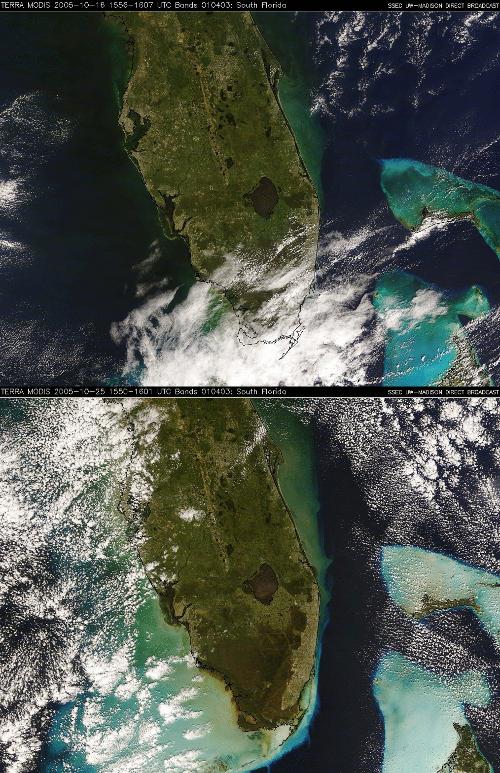
The track of Hurricane Wilma passed over southern Florida on 24 October. MODIS true color images of that region before (16 October) and after (25 October) the passage of Wilma (below) show that the turbidity of the offshore waters increased dramatically due to the strong winds and heavy wave action associated with the tropical cyclone.


