Andrea is named in the Atlantic
GOES-19 True Color imagery (from CSPP Geosphere) over the mid-Atlantic between 35o and 40oN Latitude, above, shows the circulation of Tropical Storm Andrea, a system that has been tracked for several days now. Overnight, convection developed over the storm, but that convection appears to have dissipated by mid-day on 24 June 2025. A longer (infrared) animation, below, shows an interesting interactions between two circulations. The more prominent of the two is apparent near 39oN at the start of the animation, versus the harder-to-find circulation of what would become Andrea around 35oN. Convection that develops around Andrea — that lead to the storm being named — might have been influenced by the more northerly circulation.

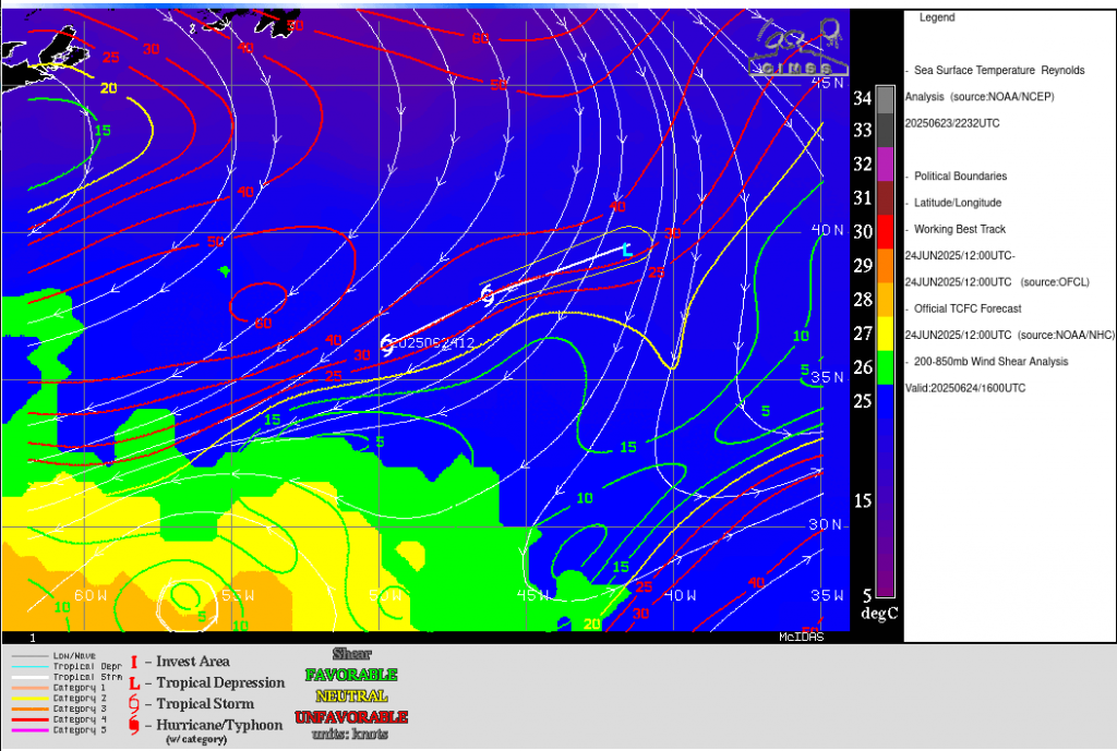
Andrea is in a hostile environment for a tropical storm as shown below (imagery from the CIMSS Tropical Weather Site). Shear is strong, and sea-surface temperatures are cooler than 25oC.
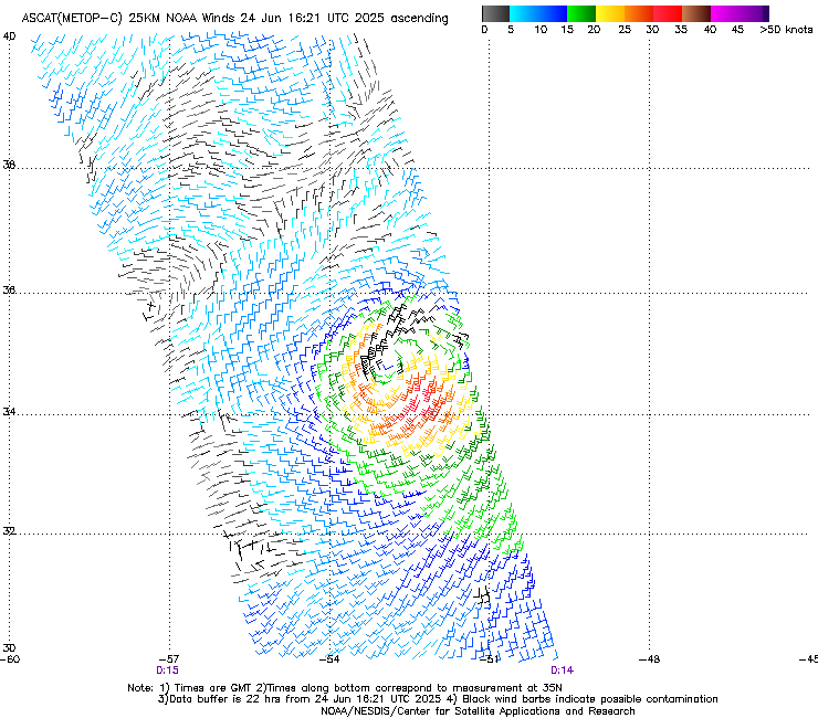
MetopB and MetopC both sampled the storm on 24 June 2025, as shown in the slow toggle below (images taken from the manati website). The compact circulation is moving to the northeast, towards colder waters.