Tornadic supercells in the western Texas panhandle
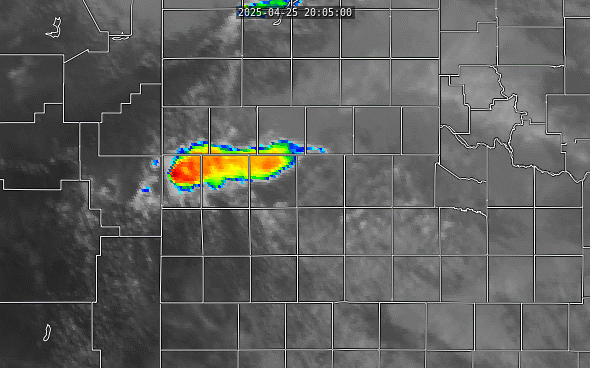
Continuing this blog’s recent theme of discussing recent events in West Texas, a tornadic supercell has formed near Muleshoe, Texas, in the panhandle region near the Texas / New Mexico border. Both CONUS and mesoscale sector scans from GOES-19 well-captured the initiation and further development of this storm.
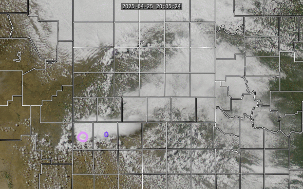
The late morning surface analysis (1500 UTC, from NOAA WPC) shows the potential for this event. Multiple boundaries are present in the high plains of Texas and New Mexico: a southward-sagging cold front and a series of westward propagating outflow boundaries from existing central plains weather systems. These outflow boundaries are shown as dashed brown lines in the surface map.
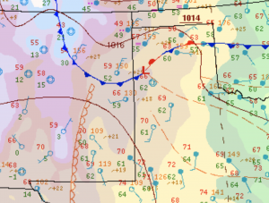
Any of these boundaries is capable of initiating convection as they propagate along their direction of travel as both cold fronts and outflow boundaries represent the leading edge of cool, dense air that can undercut and lift warmer air. It is worth noting that the panhandle air is also somewhat moister than is often seen, with dew point temperatures in the low 60s. A very strong moisture gradient can also be seen along the dryline: witness those southern New Mexico dew points in the single digits or even below zero!
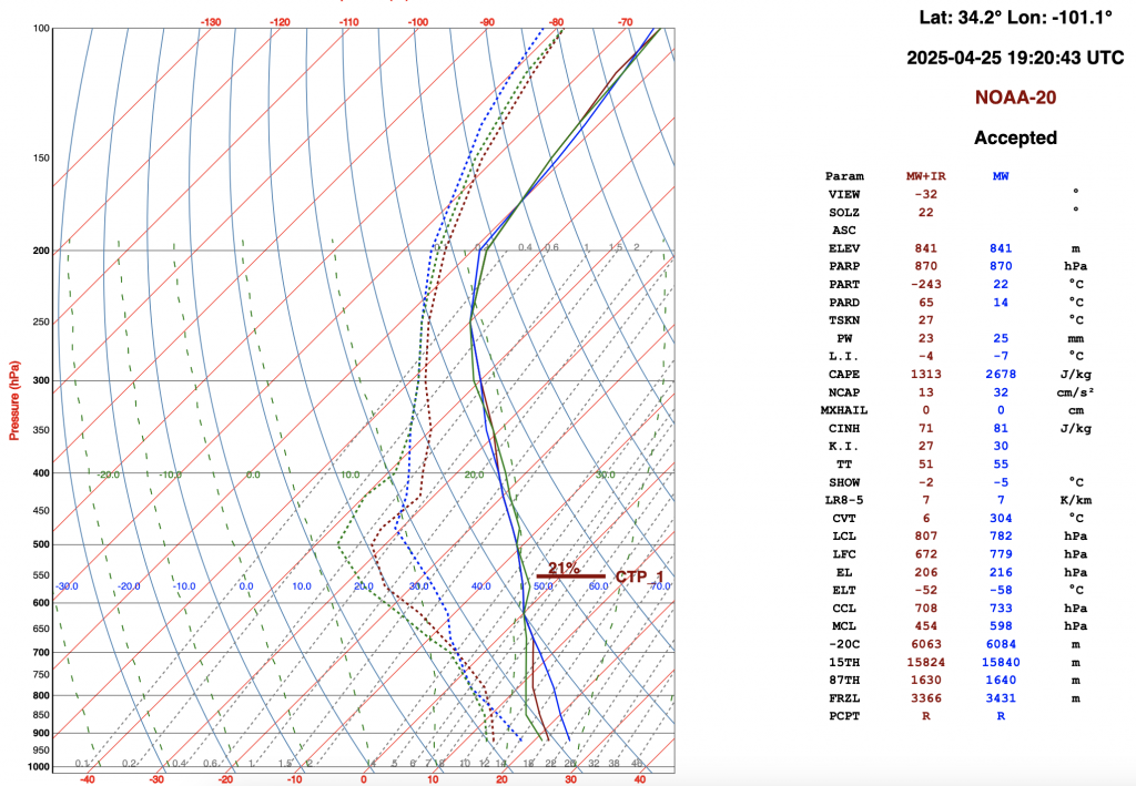
The atmosphere was primed for convection, as can be seen in a NUCAPS sounding from the early afternoon for the Texas panhandle. The best-estimate CAPE from the combined microwave and infrared sounder retrieval was 1313 J/kg at that time, which compares well with the 1900 UTC special radiosonde launched from Amarillo, which measured a mixed-layer cape of 1476 J/kg.
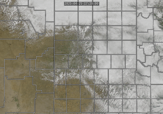
One might expect that the convection would be focused along the dryline when it is that strong. However, the GOES-19 CONUS true color satellite imagery shows that convection is focused along the cold front and outflow boundaries.
This is a somewhat unusual occurrence, as convection in this part of the continental United States is frequently induced from boundaries propagating eastward. Note that the most significant cell forms where a north-south outflow boundary intersects the east-west cold front. The constructive interference induced from these colliding boundaries can often induces stronger lifting, which is clearly evident here.
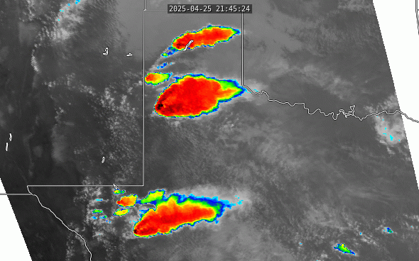
NWS and NOAA personnel coordinated to ensure that a mesoscale sector was available for this region, providing minute-by-minute snapshots of the region. The CIMSS ProbSevere product was also able to identify regions of concern for public safety and property. At 2102 UTC, a large multi-vortex tornado was reported from this cell (source: NOAA Storm Prediction Center)
By late afternoon, numerous other cells had initiated. Many of them carried the classic indicators of strong convection such as overshooting tops and enhanced V structures that can be seen on the Band 13 imagery. The largest cell in the center of the animation below was the original cell. Given the somewhat unusual direction that the initiating boundaries were propagating, it might not be too surprising that this cell is moving to the south rather than a more typical east-northeast direction as is shown in the 1 minute mesoscale imagery.
A closer look at the evolution of this cell also reveals something interesting (and somewhat unusual). With one of the factors forcing convective initiation today being the eastward movement of pre-existing boundary layers, a strong updraft formed beneath the anvil of the initial cell along one of those boundaries, forming its own overshooting top that penetrated through the anvil. It then moved westward and merged into and strengthened the existing updraft.