Warm air advection fog over Lake Michigan
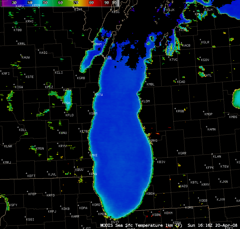
An AWIPS image of the MODIS Sea Surface Temperature (SST) product (above) indicated that the surface water temperatures over much of Lake Michigan were still in the 38-39º F or 3-4º C range (darker blue colors) on 20 April 2008. However, as a southerly flow of warm air moved across the region on the following day (21 April 2008), a large area of warm air advection fog formed over parts of Lake Michigan (due to the warm air flowing over the cold water and being cooled to temperatures at or near the dew point).Â
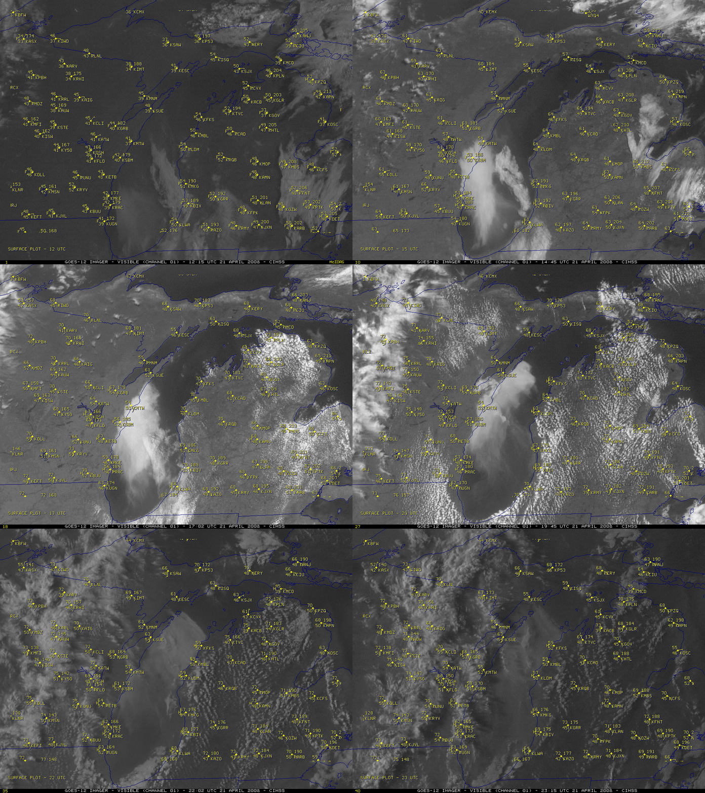
An animation of GOES-12 visible images (below) showed the movement of the fog features as they moved northward across the lake during the day. Note that after 21:00 UTC (4 PM local time), narrow fingers of fog were seen moving westward past the small islands north of Door County, Wisconsin and drifting into the northern parts of Green Bay. In addition to the lake fog features, a well-defined lake breeze could also be observed moving inland from both the western and eastern shorelines of Lake Michigan. In eastern Wisconsin, the temperatures at 19:00 UTC (2 PM local time) near the Lake Michigan shore were only 52º F (11º C) at Manitowoc (KMTW) and 55º F (13º C) at Racine (KRAC), while temperatures a short distance inland included 70º F (21º C) at Green Bay (KGRB) and 73º F (23º C) at Burlington (KBUU). Across the state of Wisconsin on 21 April, the daytime maximum temperatures ranged from 81º F (27º C) well inland at Devils Lake (station identifier KDLL) to only 49º F (9º C) at Port Washington (located east of station KETB), where to persistent fog and onshore winds during the day kept temperatures quite cool.
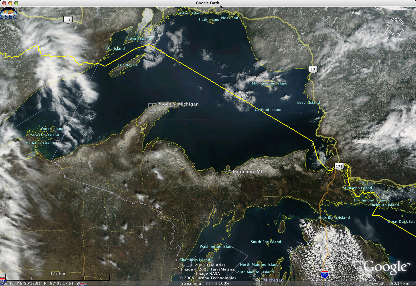
The GOES-12 visible images also suggested that significant snow cover still remained across much of the northern portion of the Upper Peninsula of Michigan on 21 April — this snow cover is more obvious on 250-meter resolution MODIS true color imagery from the SSEC MODIS Today site (below, viewed using Google Earth). A snow depth of 22 inches (56 cm) was reported that morning at Phoenix Farms, while 13 inches (33 cm) was reported on the ground at Munising. However, with daytime high temperatures later that day reaching 63º F (17º C) at Phoenix Farms and 72º F (22º C) at Munising, the snow depths on the following morning at those two sites had diminished to 16 inches (41 cm) and 8 inches (20 cm), respectively.


