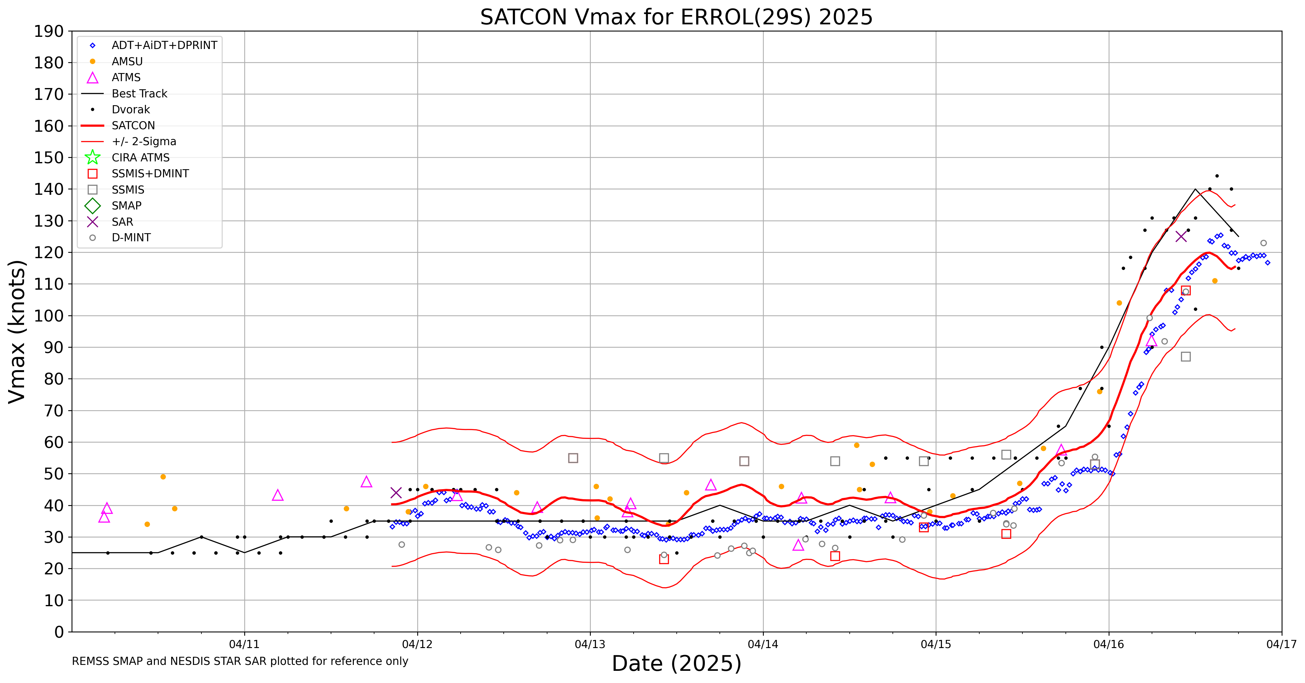
Cyclone Errol rapidly intensifies to Category 5 intensity off the coast of Western Australia

2.5-minute JMA Himawari-9 Red Visible (0.64 µm, left) and Clean Infrared Window (10.4 µm, right) images, from 2302 UTC on 15 April to 0942 UTC on 16 April [click to play animated GIF | MP4]
A NOAA-20 VIIRS Day/Night Band image valid at 0503 UTC (below) provided a higher-resolution view of the 10-mile diameter pinhole eye.
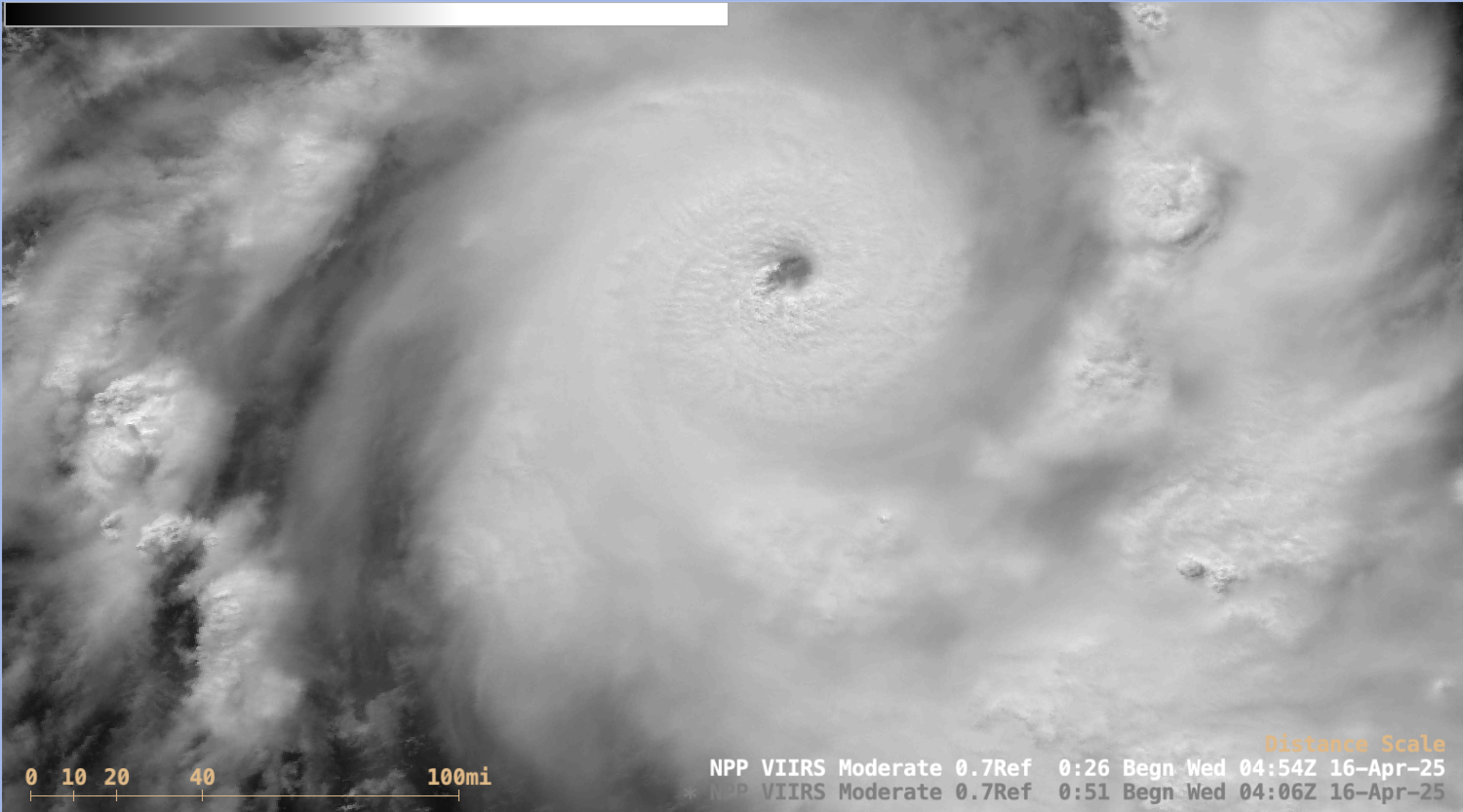
NOAA-20 VIIRS Day/Night Band (0.7 µm) image valid at 0503 UTC on 16 April [click to enlarge]
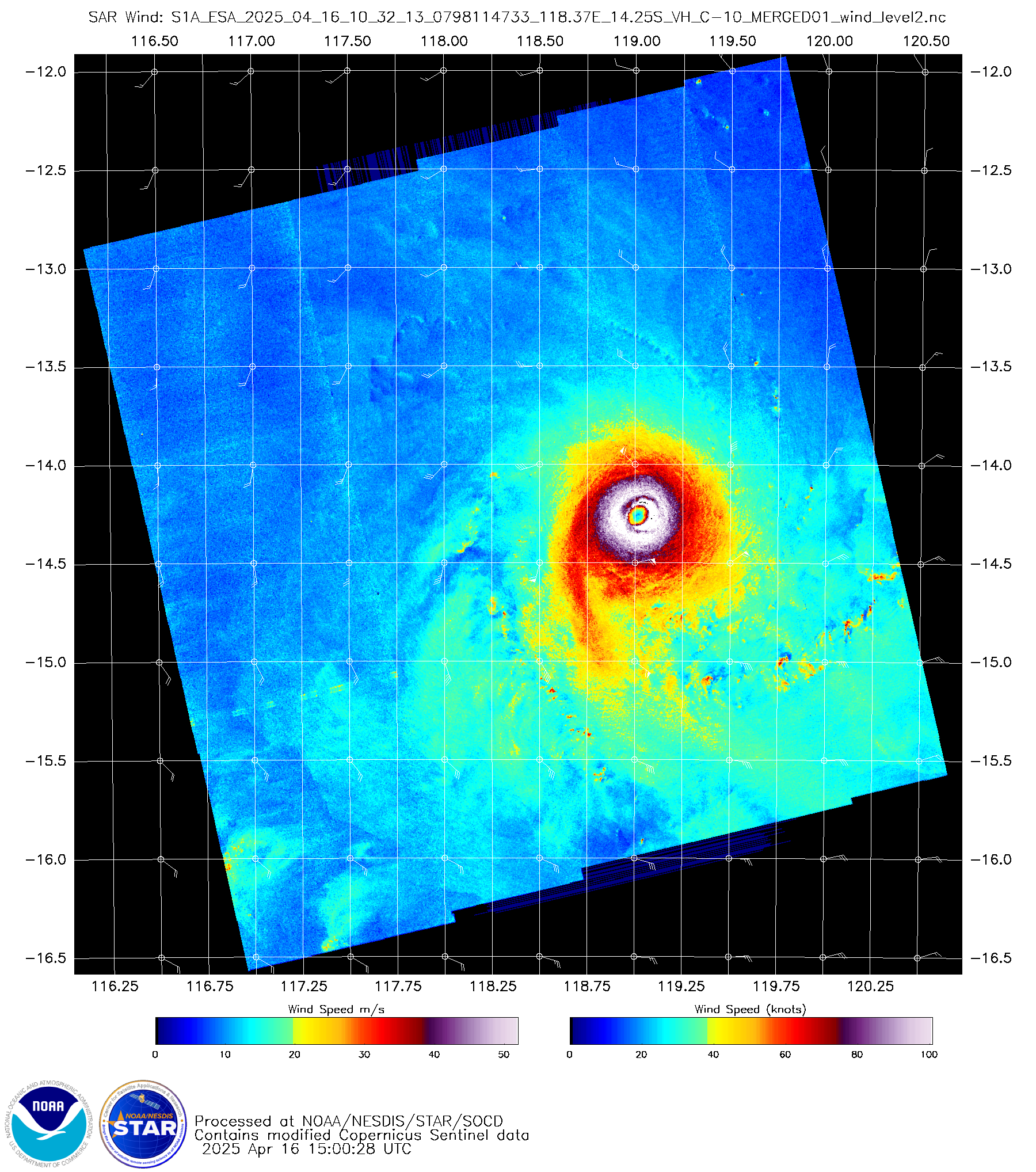
Sentinel-1A SAR image at 1032 UTC on 16 April [click to enlarge]
Plots of deep-layer wind shear centered on Errol, from 2100 UTC on 15 April to 1500 UTC on 16 April