Detection of a prescribed burn near Flagstaff, Arizona using GOES-18 and GOES-19: NGFS vs FDCA
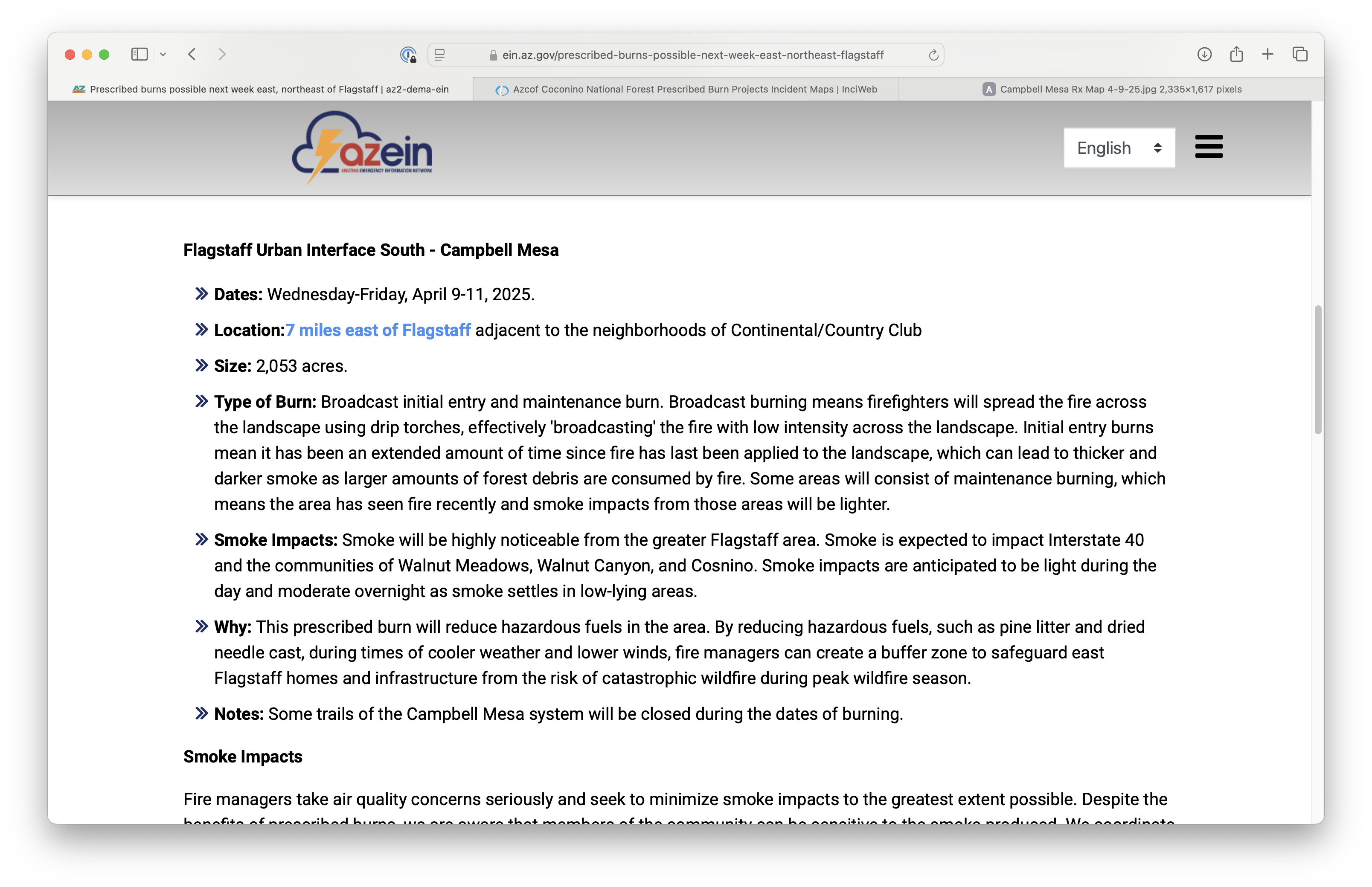
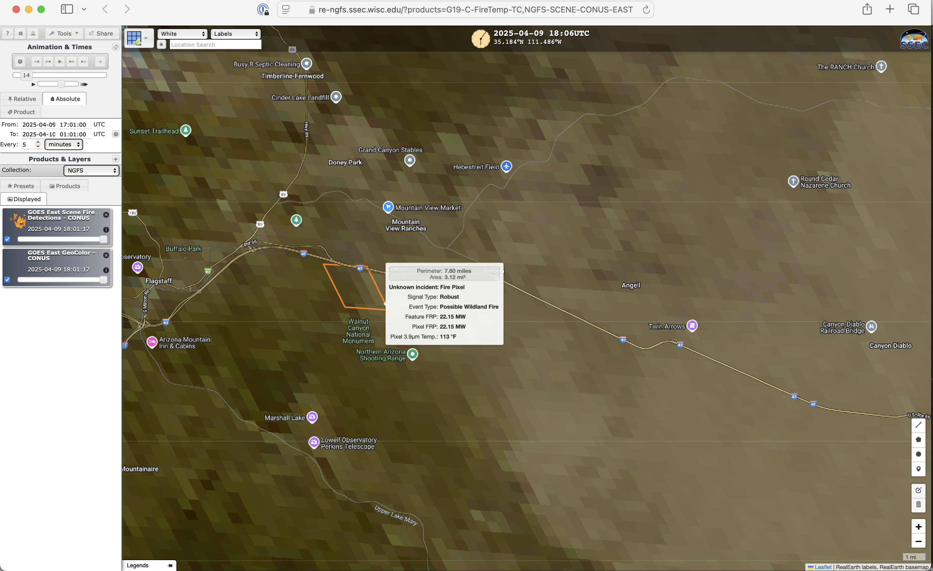
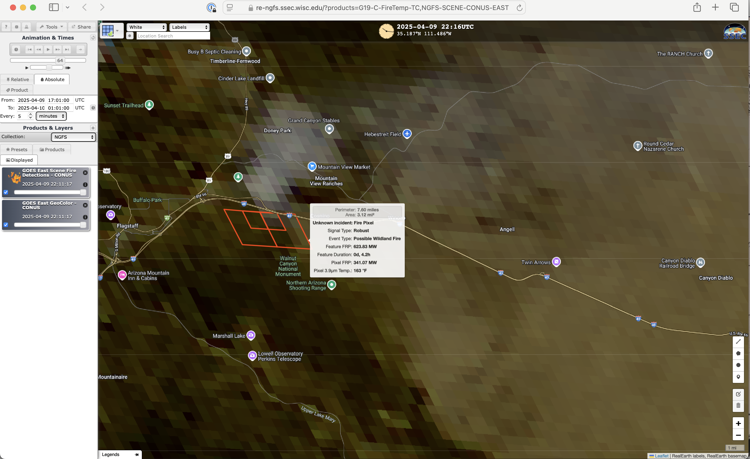
The Campbell Mesa prescribed burn occurred just east of Flagstaff, Arizona on 09 April 2025. Given that this location is approximately midway between the views of GOES-18 (GOES-West, with a satellite zenith angle for Flagstaff of 48.72 degrees) and GOES-19 (GOES-East, with a satellite zenith angle for Flagstaff of 56.13 degrees), this fire served as a good opportunity to compare detection using the Next Generation Fire System (NGFS) and the currently-operational Fire Detection and Characterization Algorithm (FDCA).
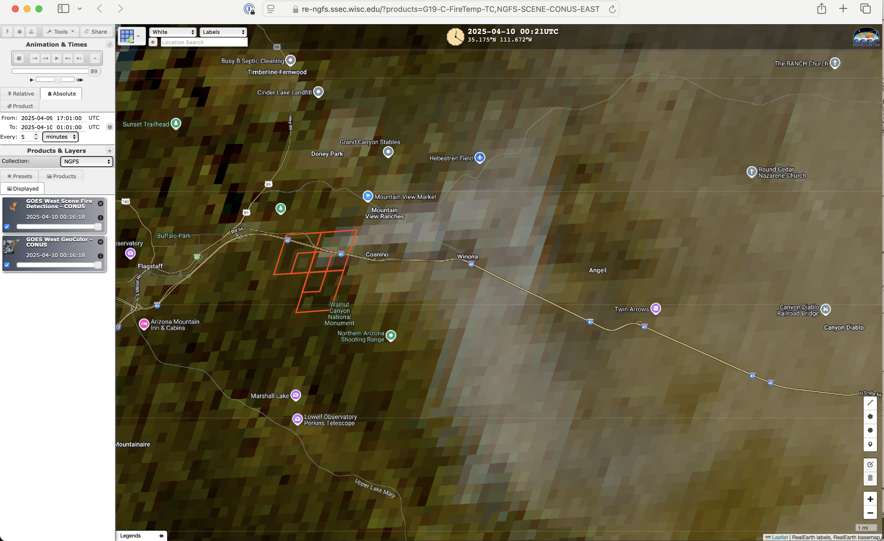
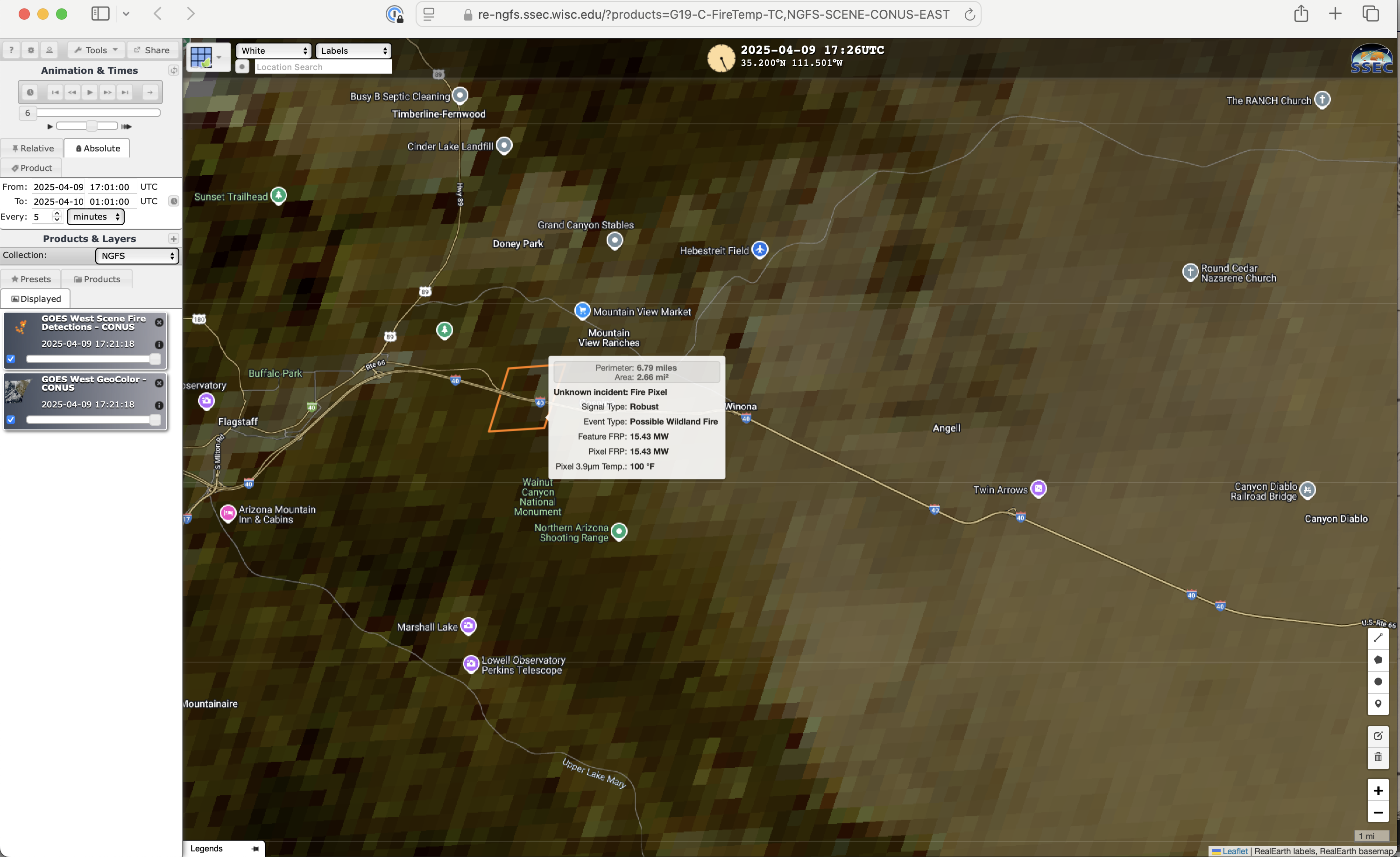
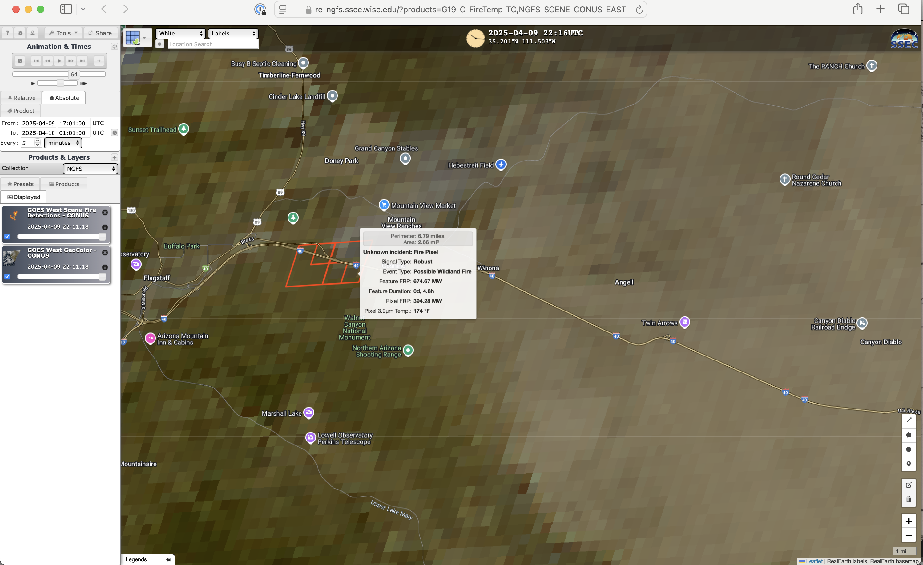
GOES-18 (GOES-West) GeoColor RGB images with an overlay of NGFS fire detection polygons, from 1701 UTC on 09 April to 0101 UTC on 10 April [click to play MP4 animation]
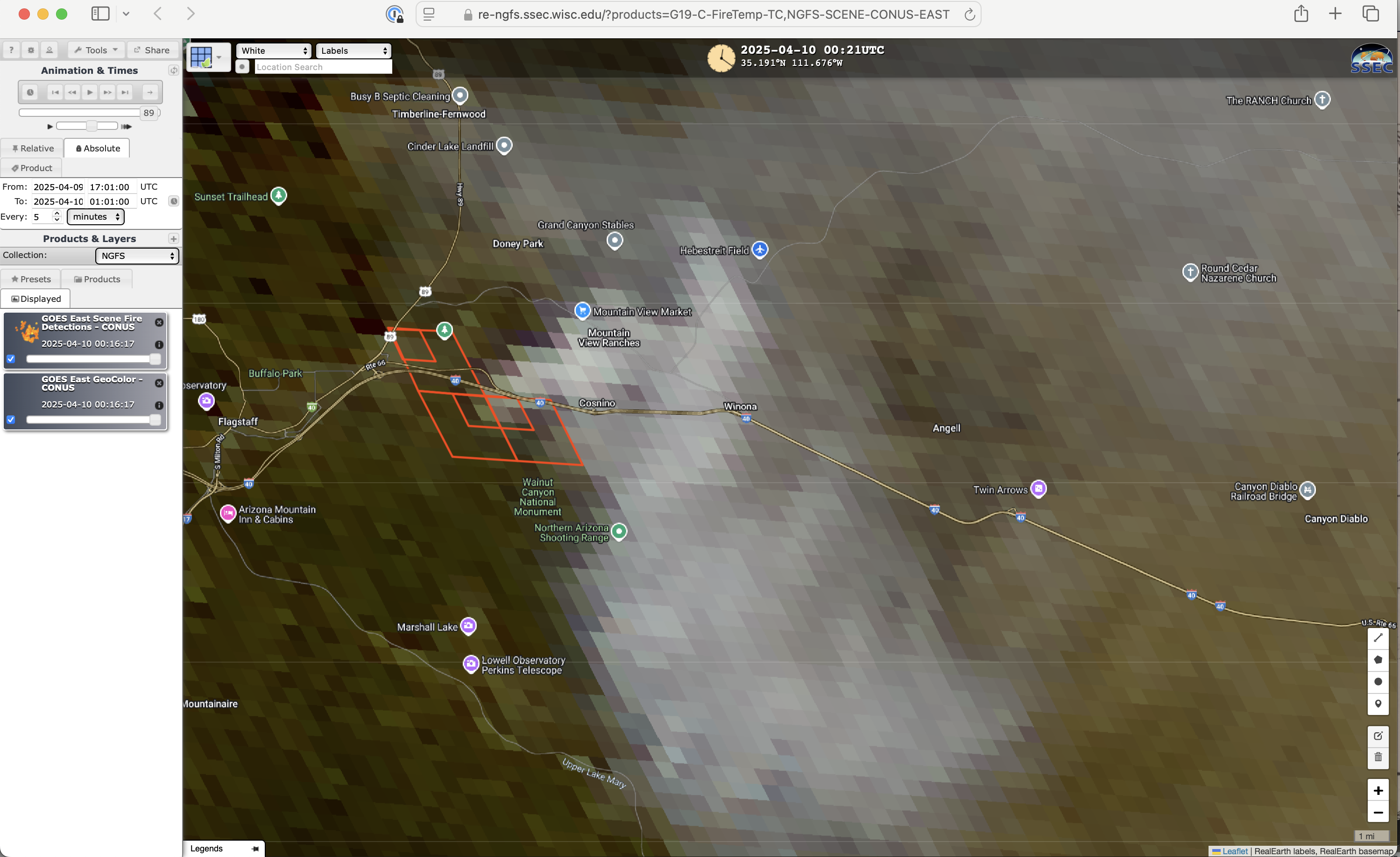
GOES-19 (GOES-East) GeoColor RGB images with an overlay of NGFS fire detection polygons, from 1701 UTC on 09 April to 0101 UTC on 10 April [click to play MP4 animation]

GOES-19 True Color RGB images, from 1701 UTC on 09 April to 0126 UTC on 10 April [click to play animated GIF | MP4]
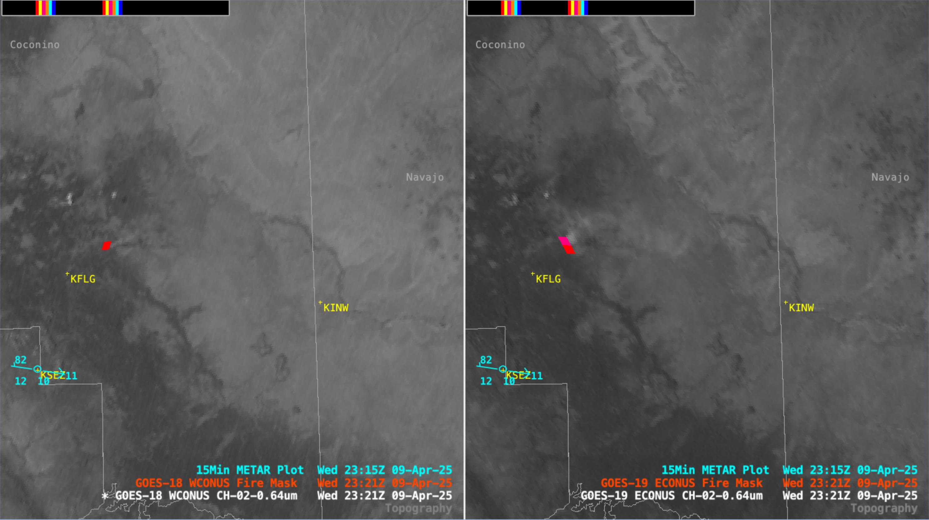
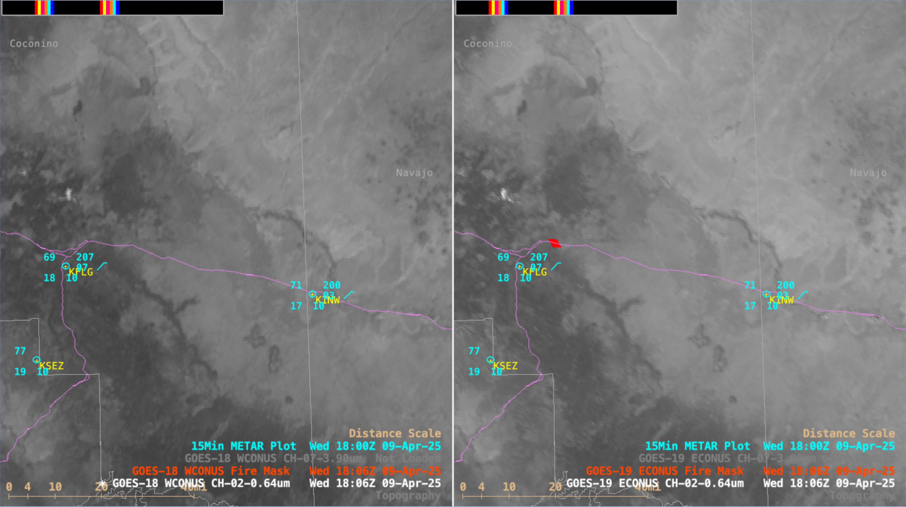
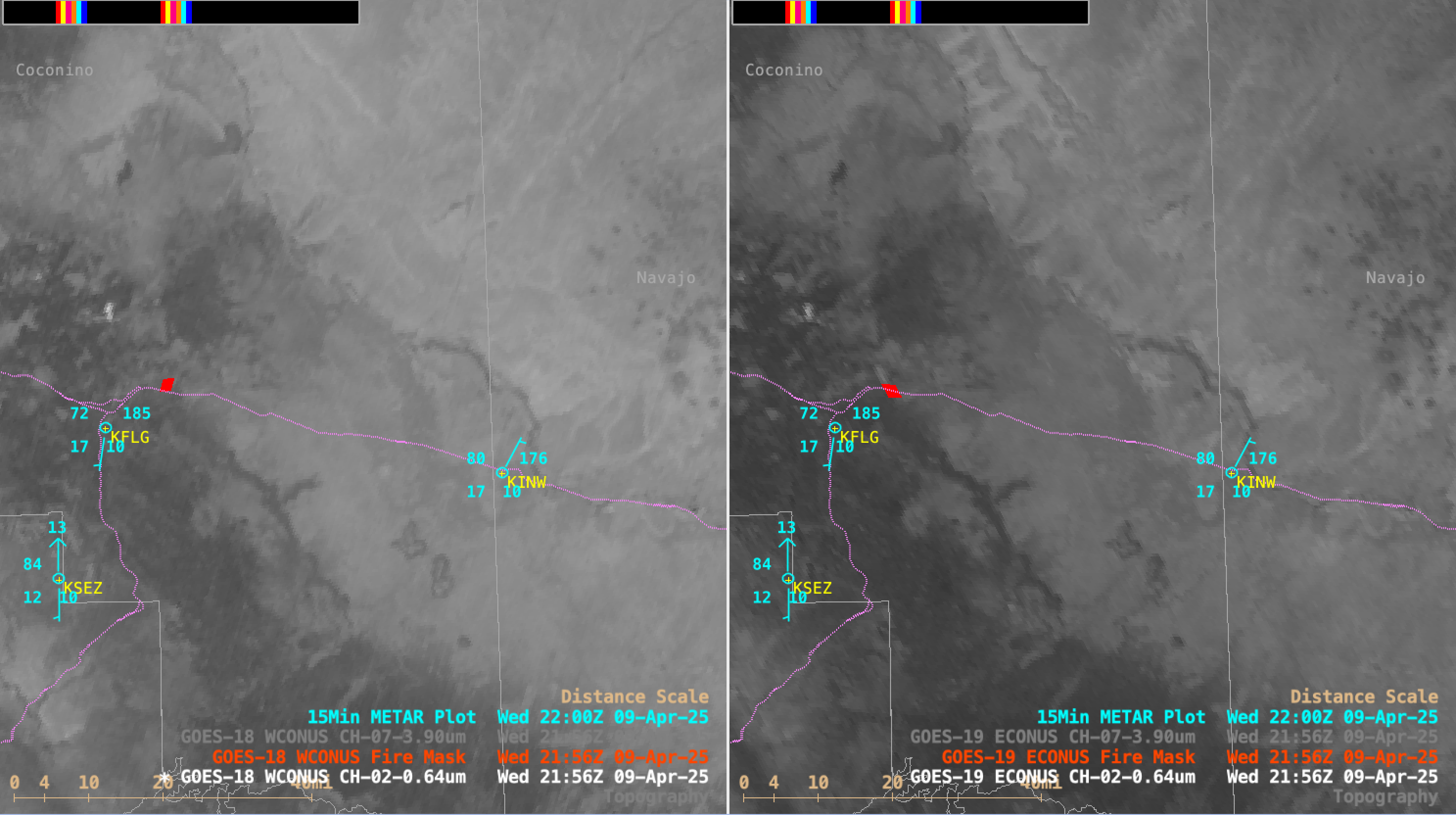
Visible (0.64 µm) images with an overlay of the FDCA Fire Mask derived product from GOES-18 (left) and GOES-19 (right), from 1656 UTC on 09 April to 0031 UTC on 10 April; Interstate highways are plotted in magenta [click to play MP4 animation]
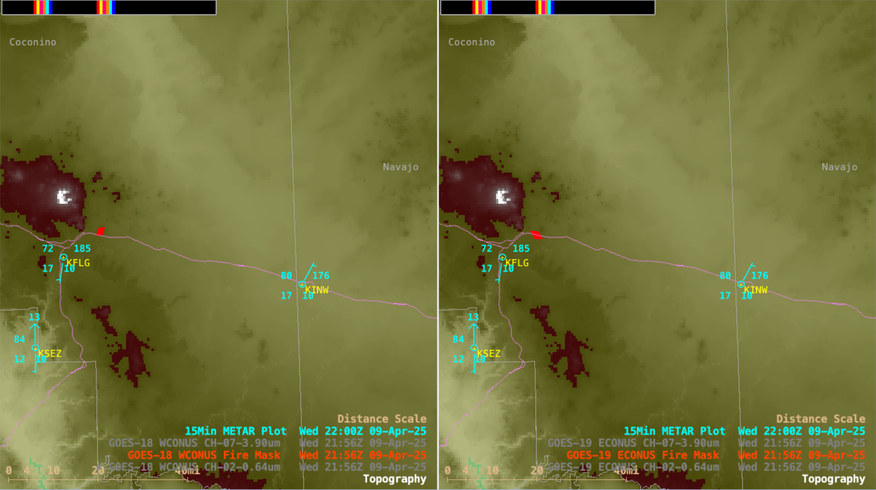
Topography images with an overlay of FDCA Fire Mask pixels at 2156 UTC on 09 April, from GOES-18 (left) and GOES-19 (right); Interstate highways are plotted in magenta [click to enlarge]