Blowing dust: from New Mexico and Texas, all the way to Wisconsin and the UP of Michigan
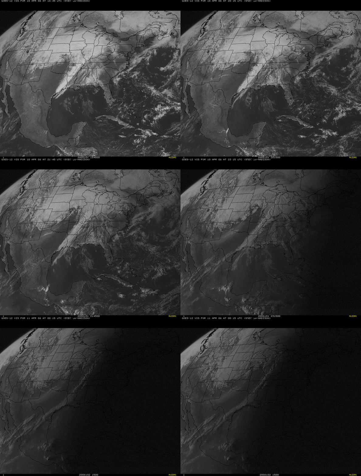
An animation of GOES-12 (GOES-East) visible channel imagery (above) showed the development of an elongated plume of blowing dust over the south-central US on 10 April 2008. The dust plume originated in eastern New Mexico and western Texas, and was being drawn northeastward into the circulation of a large and powerful mid-latitude cyclone that was centered over the central Plains states.
Also note the haziness that was seen moving northward across the western Gulf of Mexico — this was due to smoke from widespread fires that had been burning in parts of southern Mexico and Central America (NOAA Hazard Mapping System fire and smoke product).
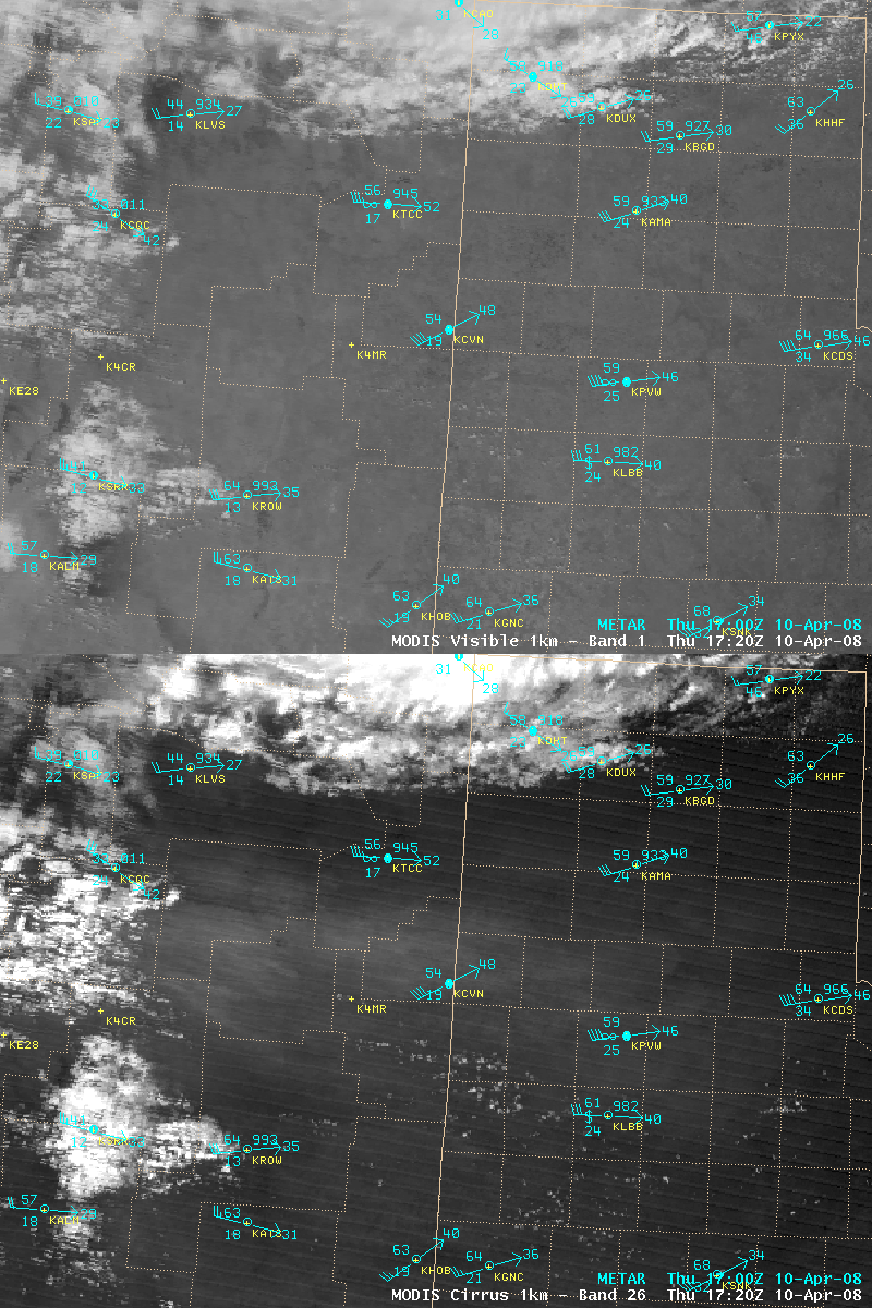
AWIPS images of the MODIS visible and “cirrus detection” channels (above) showed the early stages of formation of the dust plume over the Texas / New Mexico border region at 17:20 UTC (11:20 AM local time) on 10 April. At that particular time, the blowing dust was not yet readily identifiable on 1-km resolution MODIS visible imagery (nor on 250-meter resolution MODIS true color imagery); however, a subtle light gray “dust signal” was evident on the 1.4 µm near-IR “cirrus detection” image (since that channel is very sensitive to the presence of particles that are efficient scatterers of light).
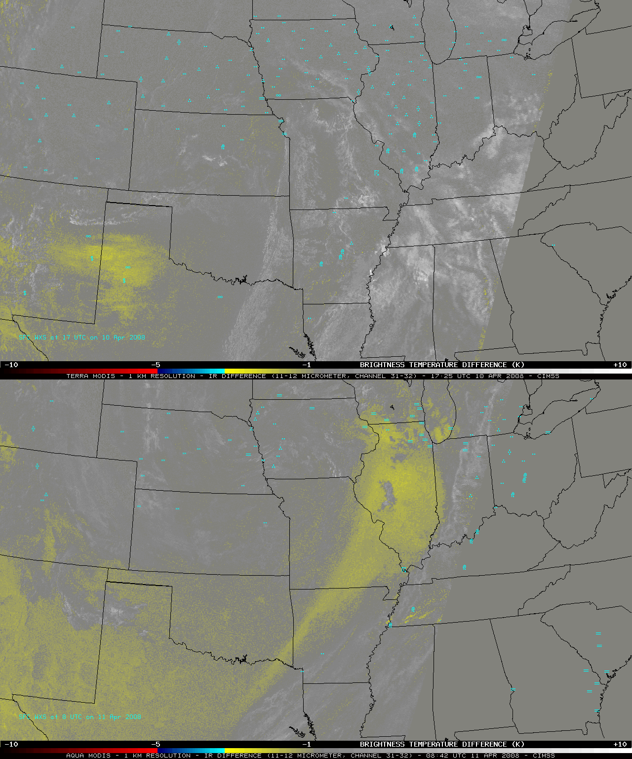
The conventional method used to detect airborne dust or sand is to calculate the difference in brightness temperatures between the 11.0 and 12.0 µm IR channels; higher concentrations of dust exhibit a brighter yellow signal (a more negative temperature difference) on such a MODIS IR difference product (above). The dust feature was obvious over New Mexico and Texas on the first image (17:25 UTC on 10 April), with the second image (08:42 UTC on 11 April) showing the dust reaching from northeastern Texas to far southern Wisconsin. Note that a “false positive” dust signal (lighter yellow colors) appears over parts of the western US on the IR difference product, due to the high emissivity of the soils found over certain regions.
The GOES-West (GOES-11) imager has the 11.0 µm and 12.0 µm IR channels used to calculate this type of IR difference product, but the GOES-East (GOES-12 ) imager lacks the 12.0 µm channel — so using this IR brightness temperature difference technique to detect airborne dust (or volcanic ash) over the eastern US is only possible using data from either the GOES sounder or the polar-orbiting NOAA AVHRR and Terra/Aqua MODIS instruments.
The strong winds associated with the large storm system in the central US transported the dust rapidly northeastward, helping it to reach northern Illinois and southern Wisconsin. Backward air mass trajectories calculated using the NOAA Air Resources Laboratoty HYSPLIT model (above) verified the rapid transport of dust from New Mexico and Texas all the way to southern Wisconsin during the 24-hour period from 12 UTC on 10 April to 12 UTC on 11 April. In fact, there were public reports of dust-laden moisture seen on cars in southern Wisconsin (in the La Crosse, Madison, and Racine areas) on the morning of 11 April — some of the dust aloft was scavenged by falling precipitation overnight and brought down to the surface.
A similar event of blowing dust from Texas reaching southern Wisconsin occurred back in December of 2003 (CIMSS GOES Gallery | National Weather Service Milwaukee/Sullivan).
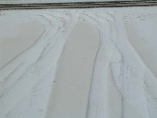
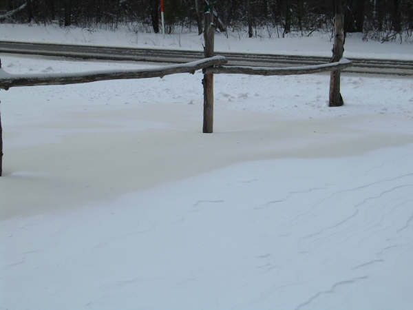
UPDATE: The National Weather Service forecast office at Green Bay, Wisconsin received photos of “dirty snow” (below) that fell near Lac du Flambeau in far northern Wisconsin on 11-12 April. In addition, the NWS forecast office at Marquette, Michigan passed along a report of “brown snow” that fell on 11 April at Marenisco in the Upper Peninsula of Michigan.
(Photos courtesy of Linda Albers, NWS Cooperative Observer at Lac du Flambeau, Wisconsin)


