|
|
|
|
|
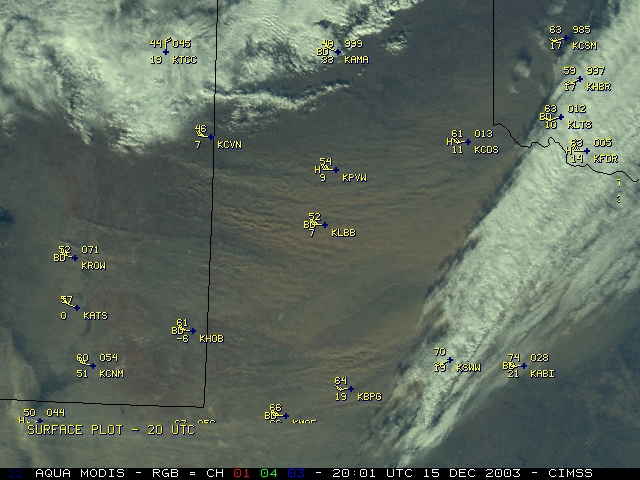
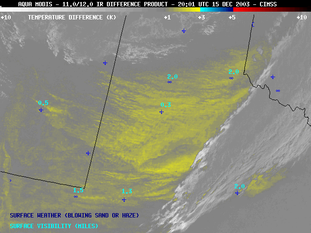
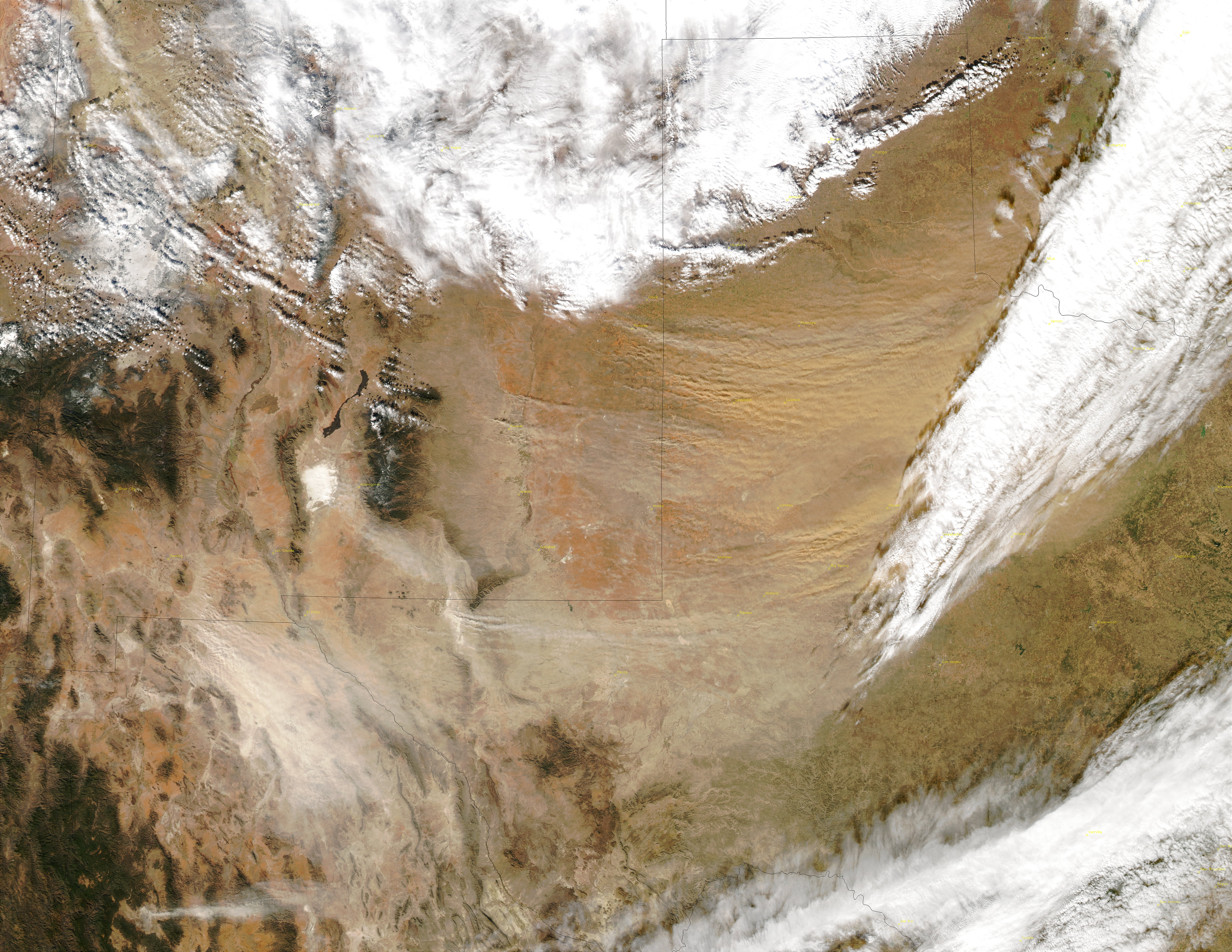
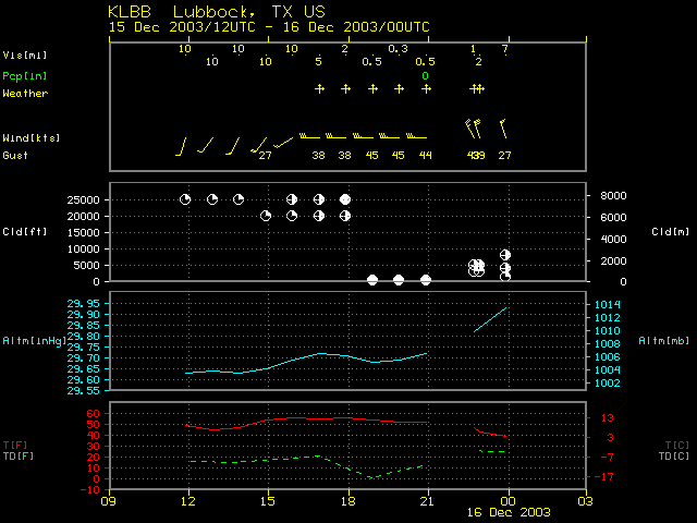
A major dust storm affected much of New Mexico and Texas on 15 December 2003 (photo), with surface winds gusting to 45-65 knots and reductions in surface visibility down to 1/4 mile at Lubbock, Texas. The airborne dust/sand takes on a definite reddish hue in the Aqua MODIS 3-channel "true color" image composite (above, left). A larger 250-meter resolution (3.7 MB file) version of the MODIS true-color image is available on the SSEC MODIS Image Gallery. The large areal coverage of the blowing sand/dust is confirmed by the Aqua MODIS 11.0-12.0 micrometer IR difference product (also known as the "split-window difference product" -- above, right), with the airborne particulate matter exhibiting a signal of +1 to +3 degrees K (yellow enhancement), even to the east of the middle to upper level cloud band located over northwest Texas.
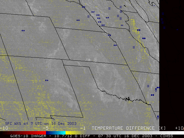
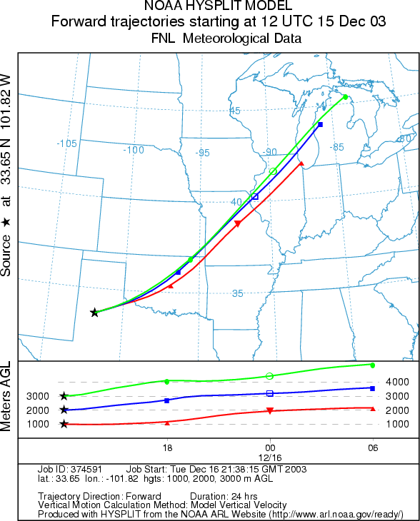
Strong soutwesterly flow in the lower to middle troposphere quickly transported much of this airborne sand/dust toward the Great Lakes region during the overnight hours on 15-16 December, as revealed by the NOAA GOES-10 10.7-12.0 micrometer IR difference product animation (below, left). Note that the 12.0 micrometer channel has been replaced by a 13.3 micrometer channel on GOES-12, eliminating the airborne dust/sand tracking capabilities of the GOES-East satellite. 24-hour forward air mass trajectories (below, right) calculated using the NOAA ARL HYSPLIT model verifly this rapid northeastward transport -- air parcels originating over Lubbock TX at 1000m, 2000m, and 3000m arrived over the southern Great Lakes region by 12:00 UTC on 16 December. On the morning of 16 December, there were several public reports of "red rain" falling over southeastern Wisconsin, northeastern Illinois, and lower Michigan, as well as parts of Arkansas and Tennesee.
|
|

