Ice leads in the eastern Beaufort Sea
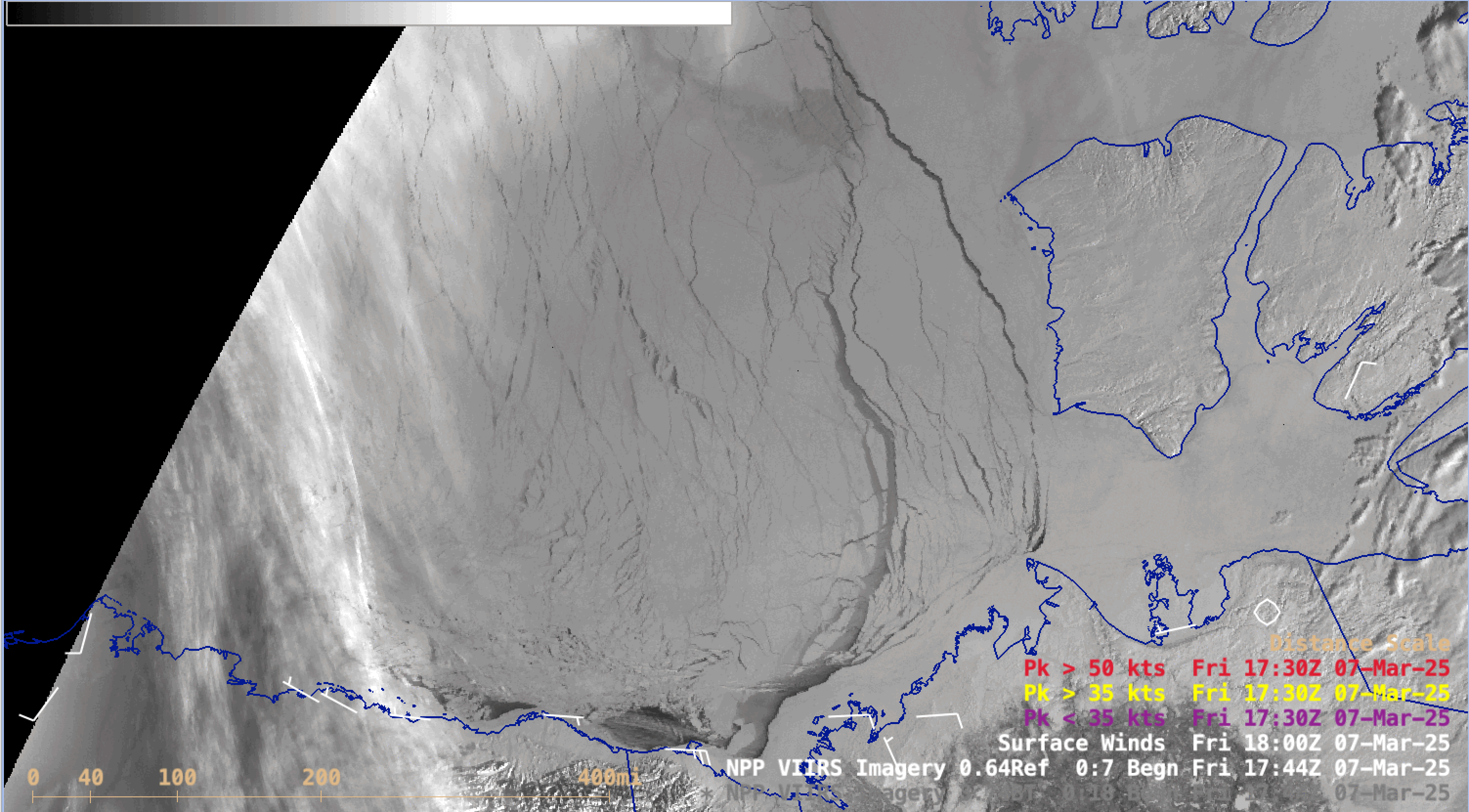
Suomi-NPP VIIRS Visible images from 07-11 March [click to play animated GIF | MP4]
Suomi-NPP VIIRS Shortwave Infrared images (below) provided a view of the ice leads and polynya during both the nighttime and daytime hours during the 07-11 March period.

Suomi-NPP VIIRS Shortwave Infrared images from 07-11 March [click to play animated GIF | MP4]
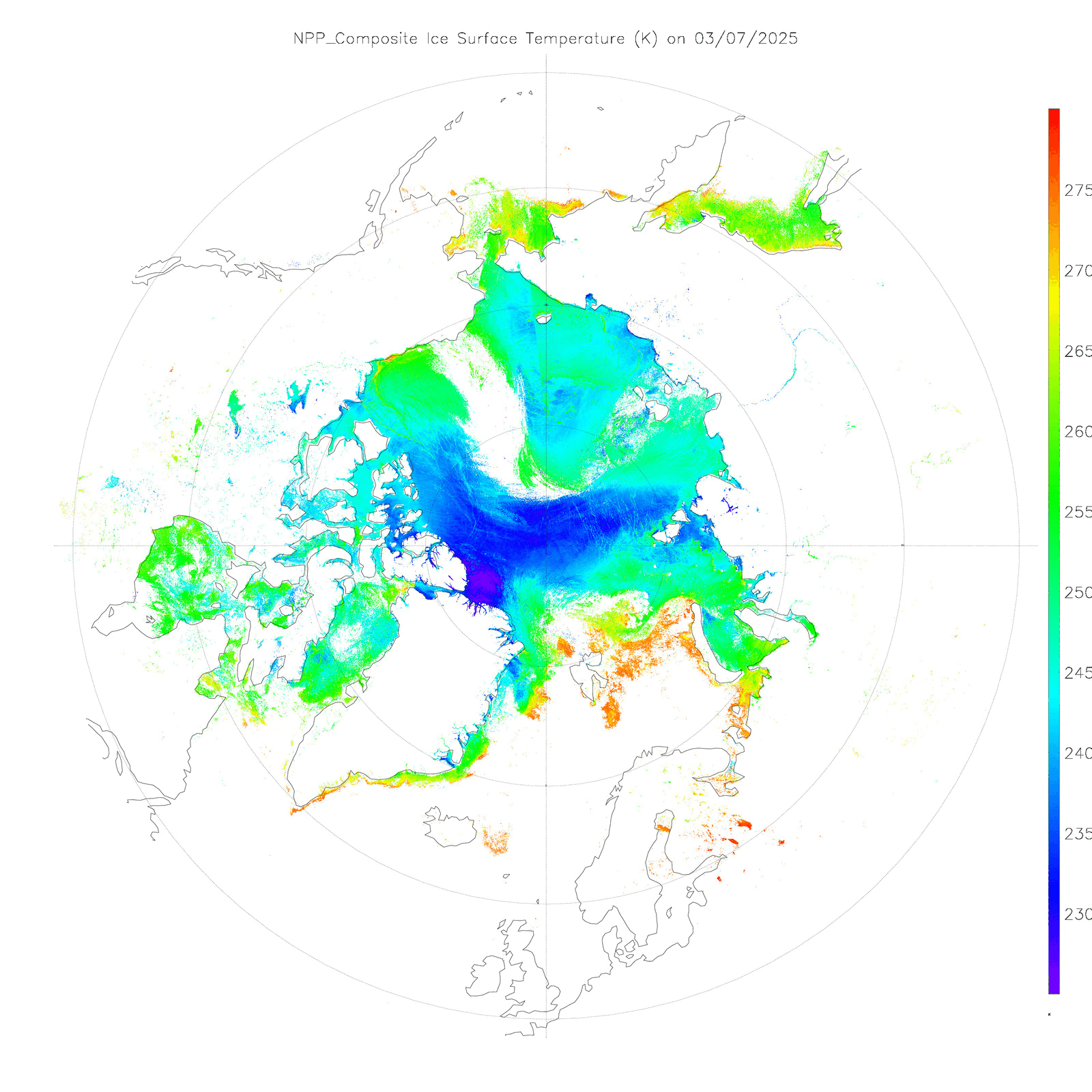
Daily Suomi-NPP VIIRS Composite Sea Ice Temperature product, from 07-10 March [click to enlarge]
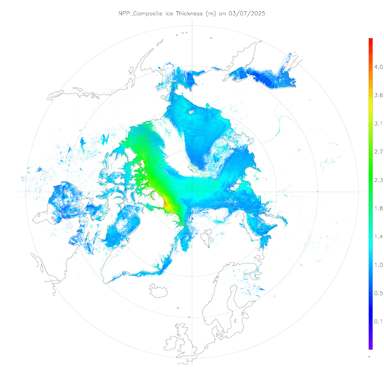
Daily Suomi-NPP VIIRS Composite Sea Ice Thickness product, from 07-10 March [click to enlarge]
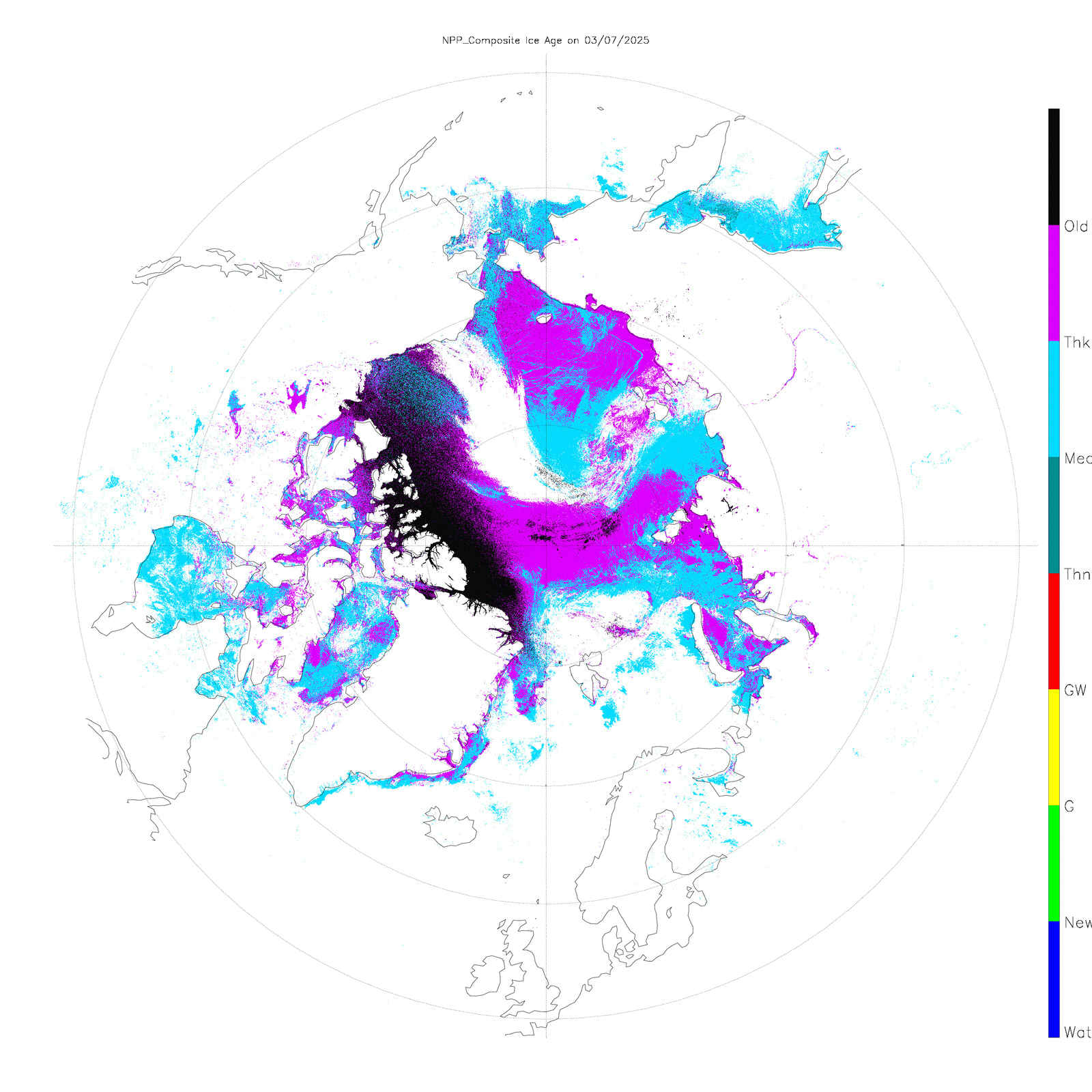
Suomi-NPP VIIRS Composite Sea Ice Age product, from 07-10 March [click to enlarge]
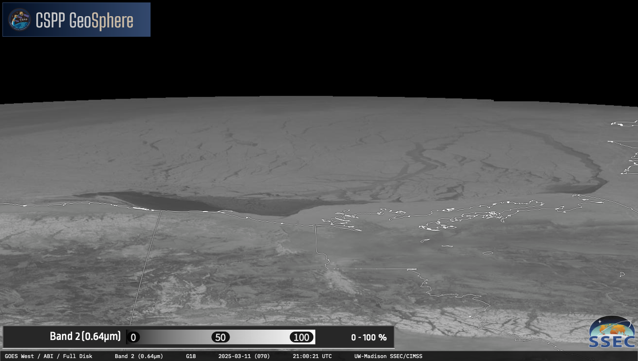
GOES-18 Visible images from 07-11 March [click to play MP4 animation]

Ice Stage on 03 March and 10 March [click to enlarge]
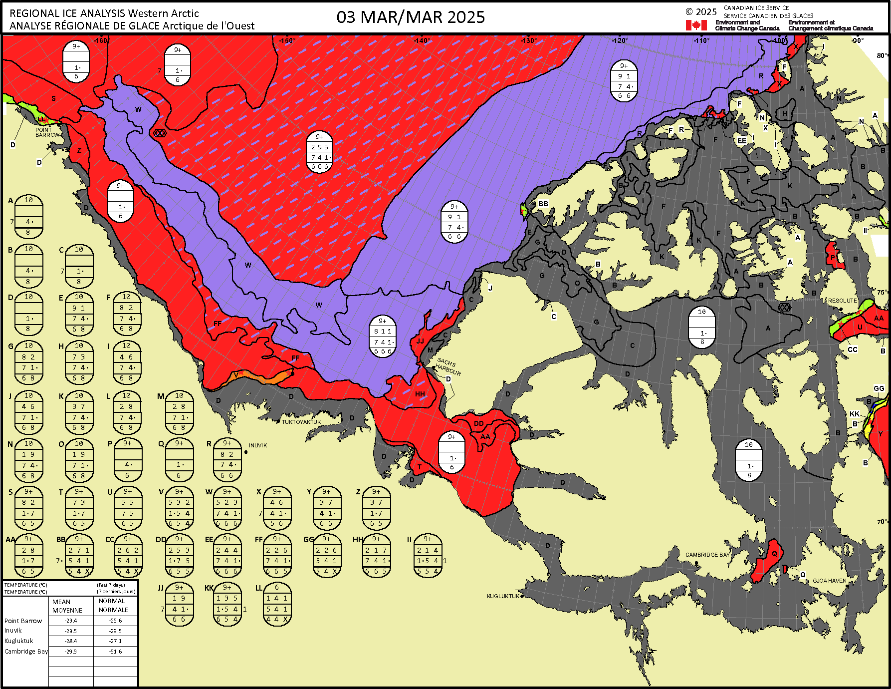
Ice analysis on 03 March and 10 March [click to enlarge]