Severe weather in Arkansas
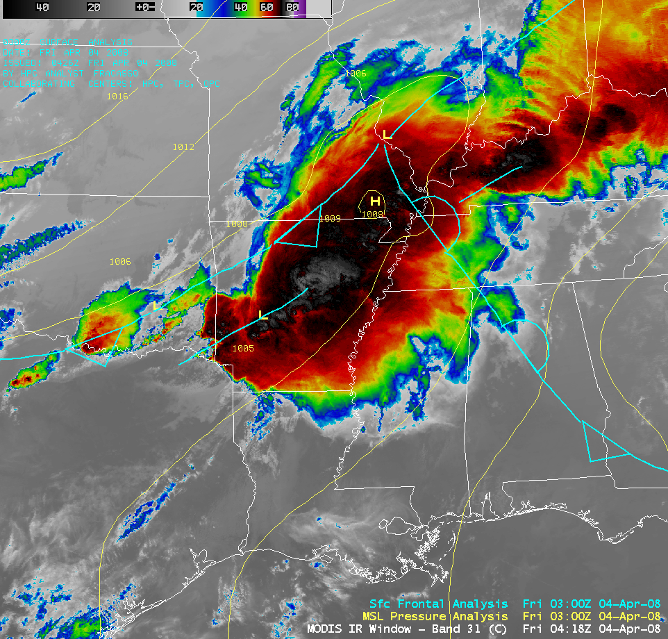
Severe convection developed in the warm sector of a cyclone that was moving through the mid-Mississippi River Valley region, producing widespread reports of heavy rain, damaging winds, hail, and tornadoes on the evening of 03 April 2008 (SPC storm reports | NWS Little Rock AR report). An AWIPS image of the MODIS 11.0µm IR channel (above) shows the surface frontal positions and mean sea level pressure analysis at 03 UTC (10 PM local time).
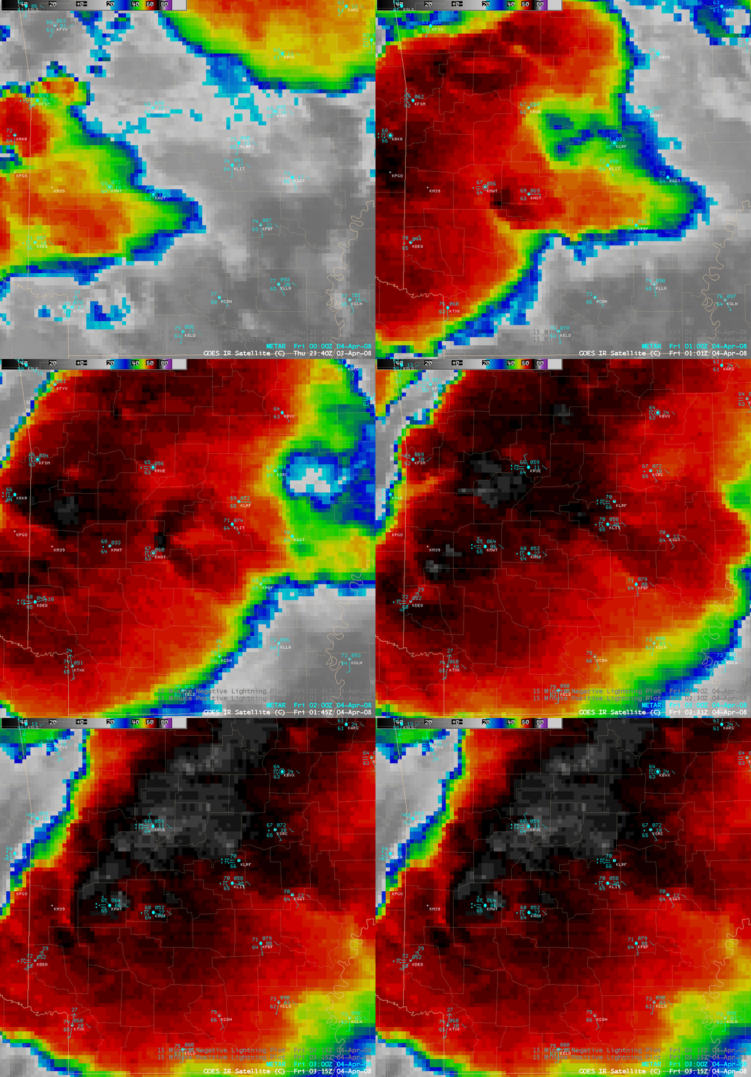
AWIPS images of the GOES-12 10.7µm “IR window” channel (above) shows that a well-defined “enhanced-V signature” developed in the vicinity of Hot Springs, Arkansas (station identifier KHOT) after 01:15 UTC (8:15 PM local time) — hail of 1.75 inches in diameter was reported at Bonnerville (located just southwest of Hot Springs) around 01:10 UTC (8:10 PM local time). Heavy rain (6.44 inches) fell at Glenwood (also located southwest of Hot Springs). This enhanced-v storm then continued to move northeastward toward the Little Rock area (station identifier KLIT), where it produced tornadoes that damaged parts of Little Rock during the 02:50-03:10 UTC (9:50-10:10 PM local time) period — one tornado actually forced the staff of the National Weather Service Forecast Office at North Little Rock Airport to take cover for a short time while the storm moved close to the facility. The second-highest wind gust on record (64 mph) was also recorded at North Little Rock Airport during this event.
Cloud to ground (CG) lightning strikes plotted on the GOES-12 IR imagery (above) revealed that a cluster of CG strikes was associated with the vertex of the enhanced-v signature on satellite imagery. As is typically the case, this storm was negative strike dominant, with positive strikes making up less than 10% of the total cloud to ground lightning strikes.
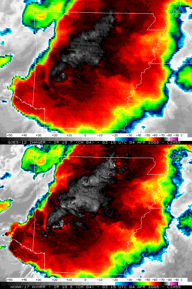
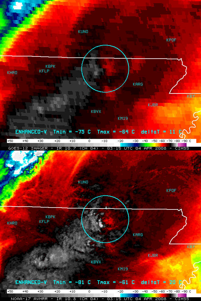
A comparison of 4-km resolution GOES-12 IR imagery with 1-km resolution NOAA-17 AVHRR IR imagery (above) demonstrates the improved storm top temperature detection capability of the polar-orbiting AVHRR instrument. In particular, a closer view of the developing enhanced-v signature near the Arkansas/Missouri border region (below) shows finer detail in the temperature fields and the magnitude of the enhanced-v cold/warm cloud top temperature couplet (-81ºC/-61ºC on the AVHRR image, versus -75ºC/-64ºC on the GOES-12 image).


