Snow cover in the Upper Midwest, and ice in Lake Michigan
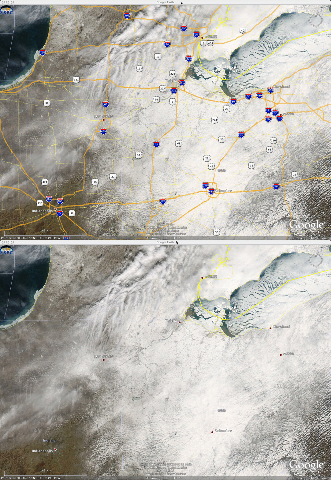
MODIS true color images (viewed using Google Earth, above) showed that significant snow cover still remained over parts of the Upper Midwest region (especially across northeastern Ohio) on 11 March 2008. With the highway overlays removed, you can better see that several of the smaller towns across northeastern Ohio have a slightly darker appearance than the surrounding rural areas, due to the higher concentration of trees, buildings, and roadways in those urban areas. Also note the widespread ice that covered much of Lake Erie (in the upper right portion of the images), as well as along the southern shore of Lake Michigan (in the upper left portion of the images).
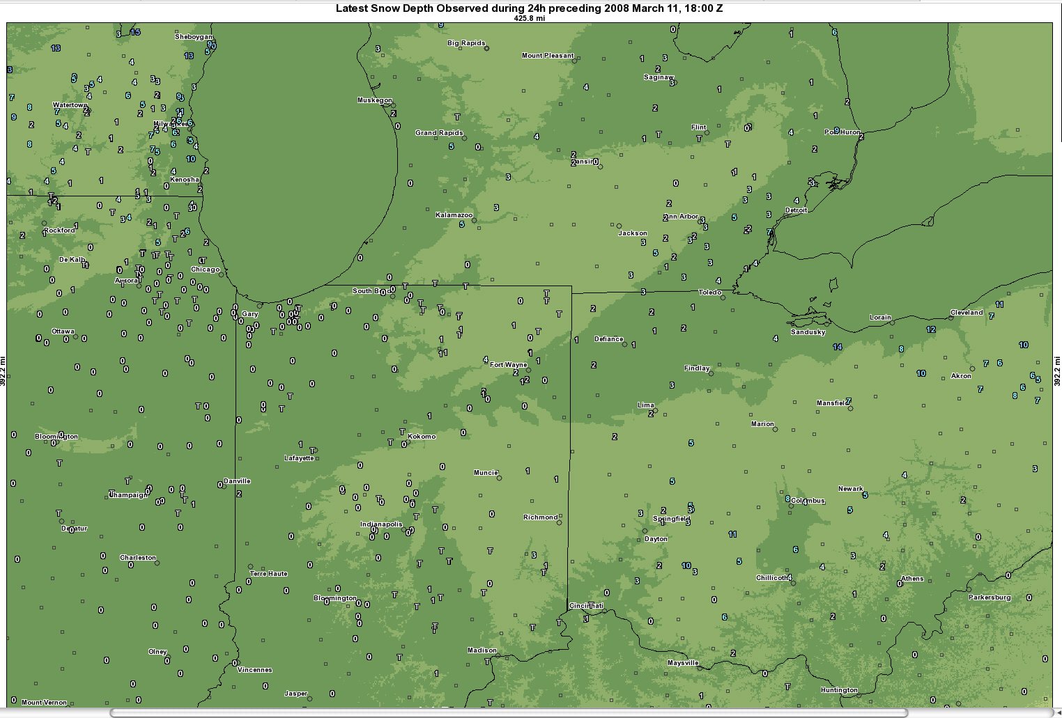
The National Operational Hydrologic Remote Sensing Center (NOHRSC) snow depth data (below) confirmed that many locations in eastern Ohio still had significant snow cover (as deep as 10-14 inches, with 4 inches on the ground at Toledo and 8 inches on the ground at Columbus) — however, not far to the west there was no snow on the ground in parts of Indiana (Indianapolis had zero snow depth, thus that area exhibited a light brown appearance on the MODIS true color imagery).
===============================================
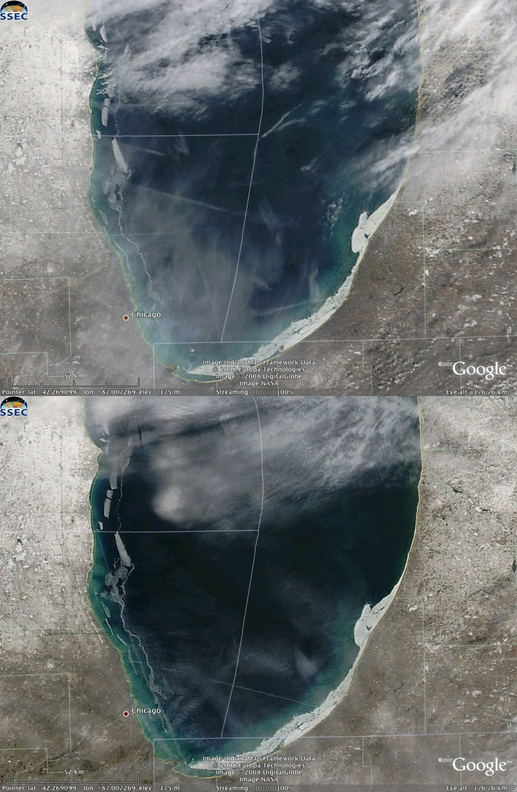
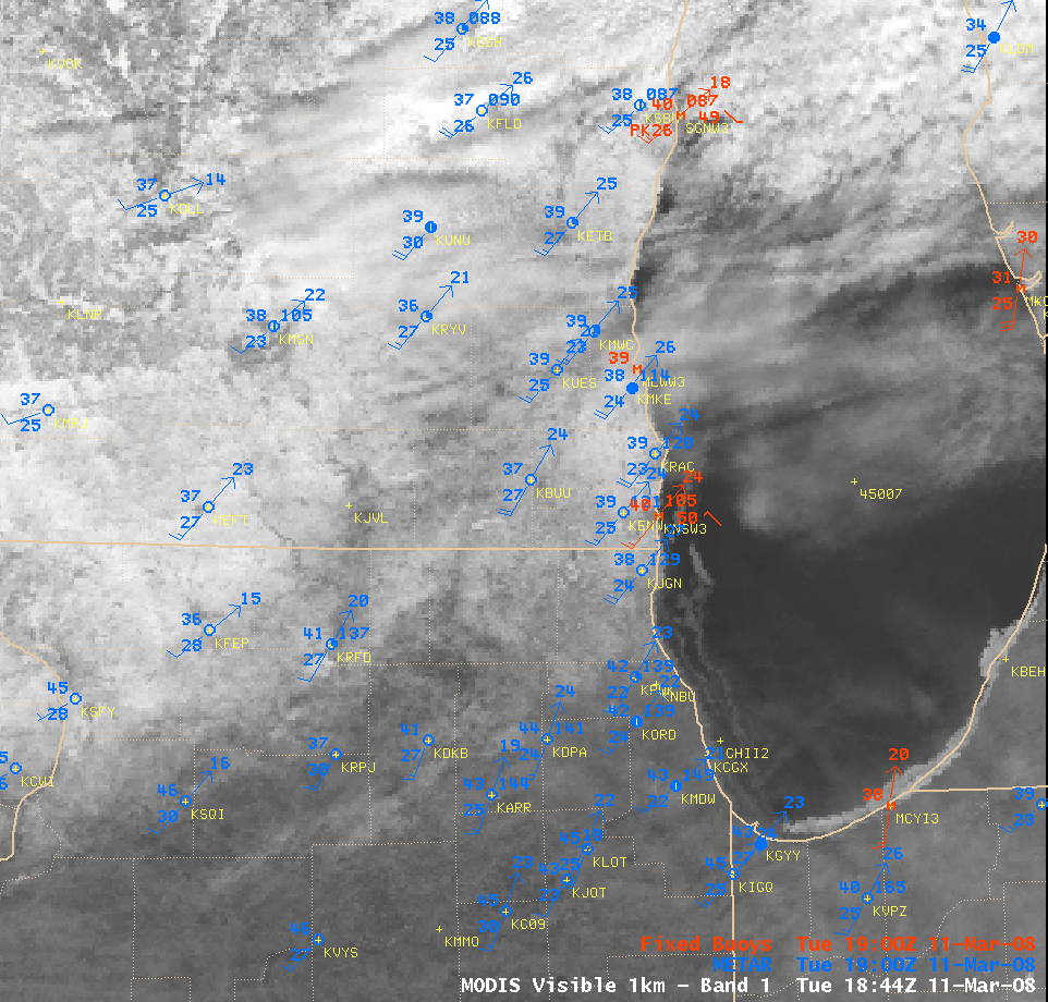
An AWIPS image of the MODIS visible channel (above) showed the coverage of narrow ice features that were floating in the nearshore waters of southern Lake Michigan on 11 March (as was also pointed out by the National Weather Service forecast office at Milwaukee/Sullivan). Southwesterly winds at the surface were increasing during the day and gusting to 20-25 knots in some locations, allowing air temperatures to rise into the upper 30s to low 40s F over the snow-covered areas of southern Wisconsin and northern Illinois.
The effect of these gusty southwesterly winds on the offshore ice could be seen when comparing 2 consecutive MODIS true color images (viewed using Google Earth, below) — the time difference between the 2 images is about 101 minutes (the earlier Terra MODIS image time was around 17:11 UTC or 12:11 PM local time; the later Aqua MODIS image time was around 18:52 UTC or 1:52 PM local time), and the ice is seen to drift some distance to the northeast during that short time interval. The long, narrow, straight cloud features that also appear in the images are aircraft contrails.

[Image source: Liam Gumley, SSEC/CIMSS]


