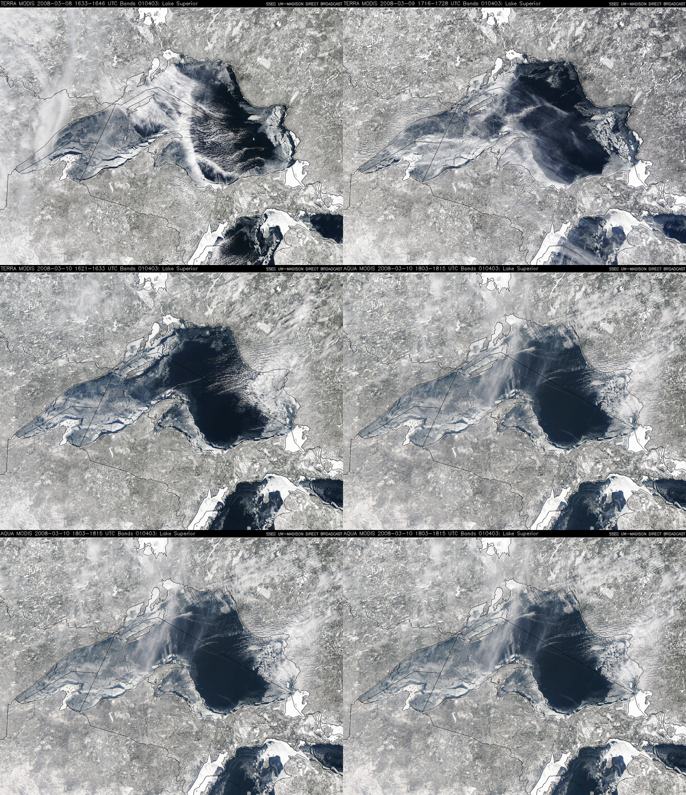
Ice in Lake Superior
A sequence of Terra and Aqua MODIS true color images from the SSEC MODIS Direct Broadcast site (above) reveal that widespread ice that had formed in parts of Lake Superior during the 08 March – 09 March – 10 March 2008 period. There are 2 images from each of those 3 days, with the Terra and Aqua images on each day separated by less than 2 hours — and even in that short time, you can see some movement of the ice features due to surface winds blowing across the lake and shifting the ice fields (plus the change in wind direction from day to day moved the ice features in different directions). Temperatures across northeastern Minnesota, northern Wisconsin, and the Upper Peninsula of Michigan had been fairly cold during the first week of March 2008, with minimum temperatures of -33º F (-36º C) at Embarrass, Minnesota and -26º F (-32º C) at Upson, Wisconsin on 07 March, and -31º F (-35º C) at Herman, Michigan on 08 March. While somewhat impressive, the ice coverage over Lake Superior did not match that seen back in February/March 2003.


