|
|
|
|
|
|
|
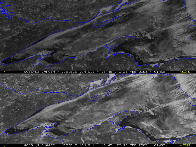
1000-meter resolution GOES-08 and GOES-12 visible imagery (above) shows the extent of pack ice that had begun to increase on Lake Superior during mid-late February 2003, when colder than normal temperatures were experienced across the western portion of the Great Lakes region. The newer GOES-12 satellite's visible channel data showed the ice pack with greater clarity, due to degradation of the visible detectors in the older GOES-08 satellite (which was launched in 1994).
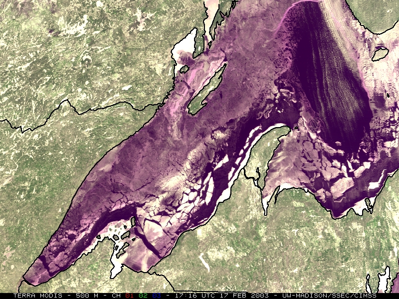
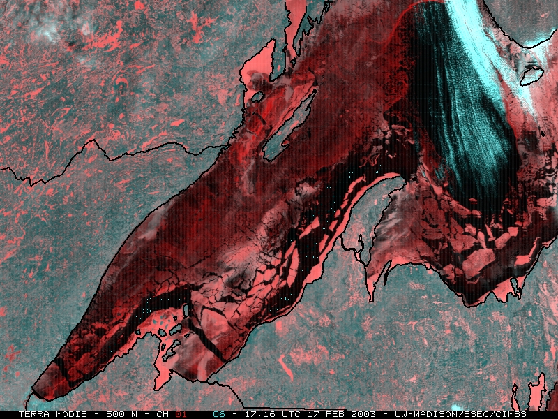
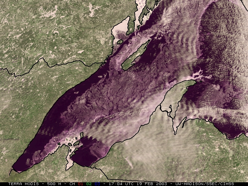
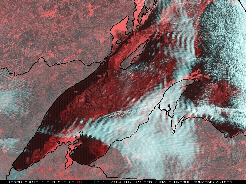
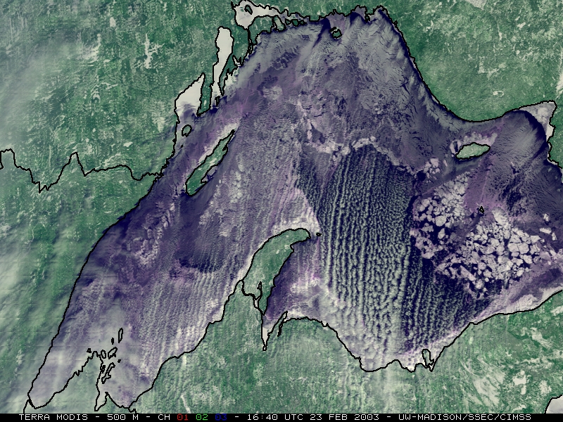
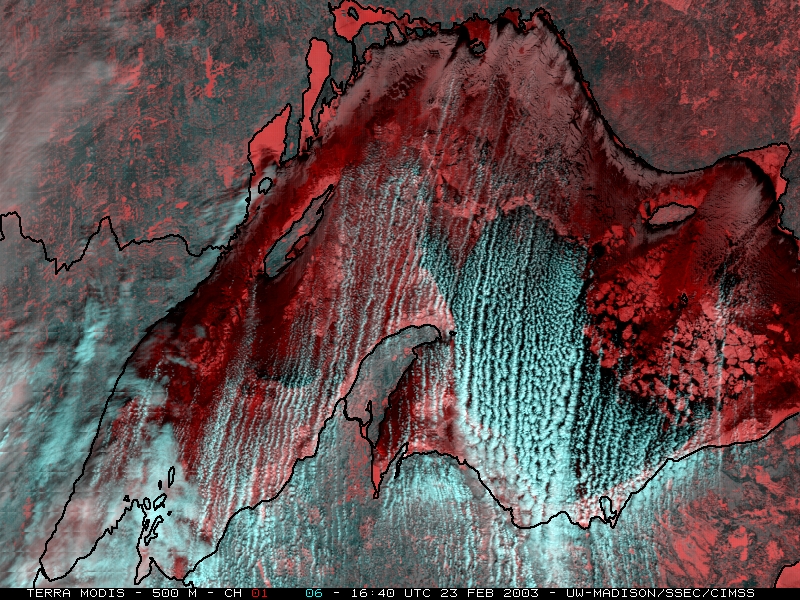
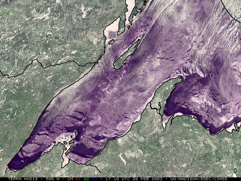
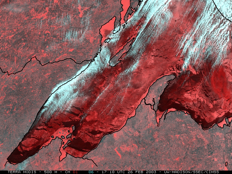
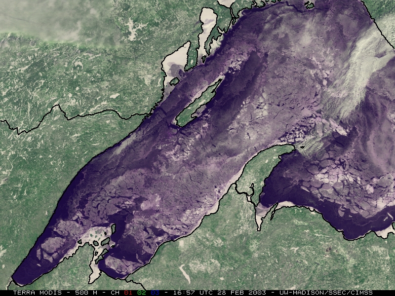
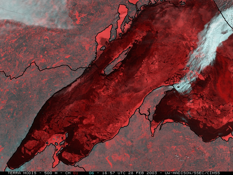
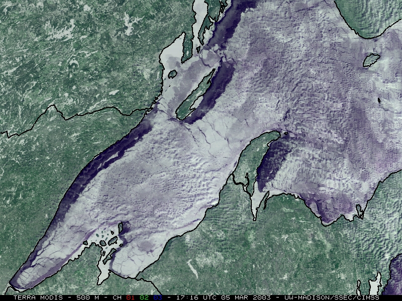
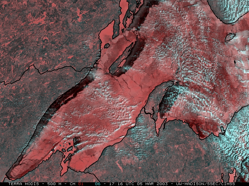
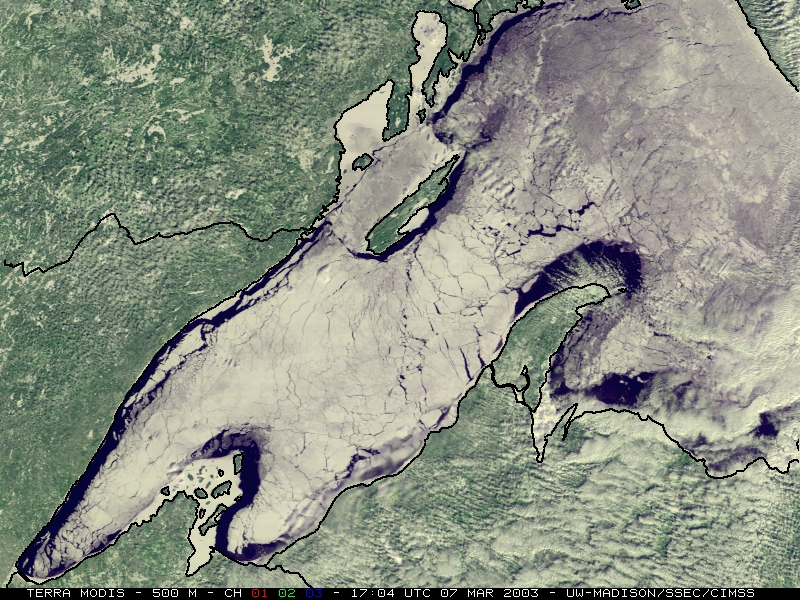
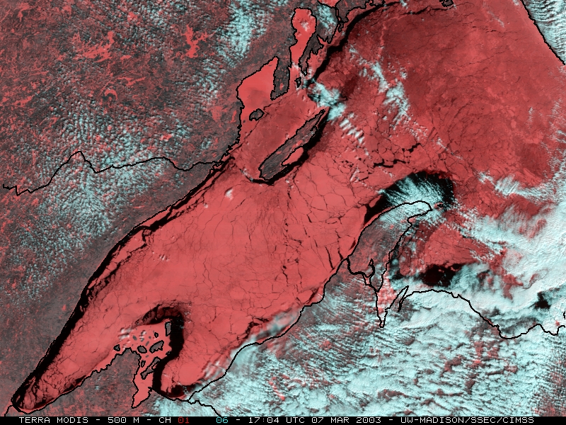
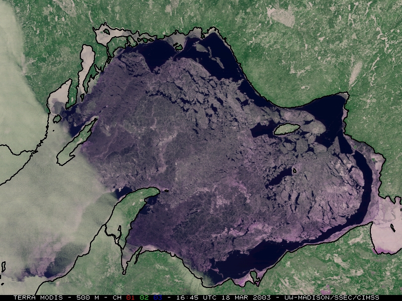
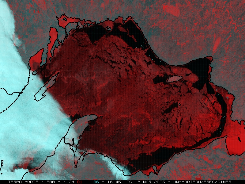
500-meter resolution Terra MODIS RGB composite imagery (below) shows the lake ice in further detail (a result of better spatial resolution), and also demonstrates how the use of multi-spectral imagery helps to distinguish the ice features from any areas of cloudiness that were present on various days. The channels 01/06 composite images show clouds as bluish-white, with snow/ice having a pink/red enhancement. Larger versions (1.3 MB file size) of the 17 February, 07 March, and 22 March Terra MODIS composite images are also available on the SSEC MODIS Image Gallery.
|
|
|
|
|
|
|
|
The extent of the lake ice began to increase again after a few days of very cold temperatures -- overnight minimum temperatures on 25 February included -36 F at Tower MN, -34 F at Upton WI, and -29 F at Marquette MI.
|
|
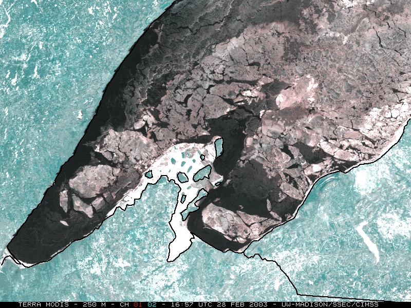
250-meter resolution MODIS composite images are also available from 28 February, centered near Bayfield, Wisconsin and Houghton, Michigan.
|
|
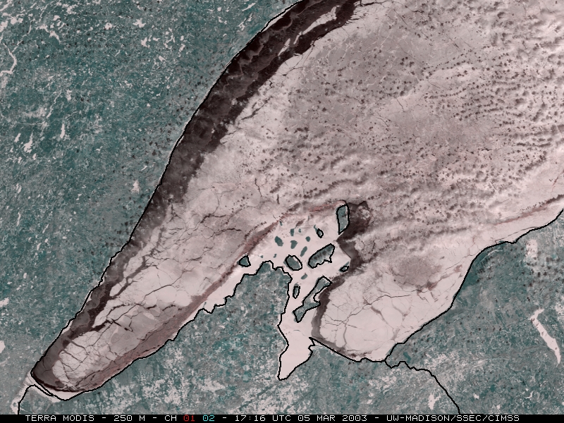
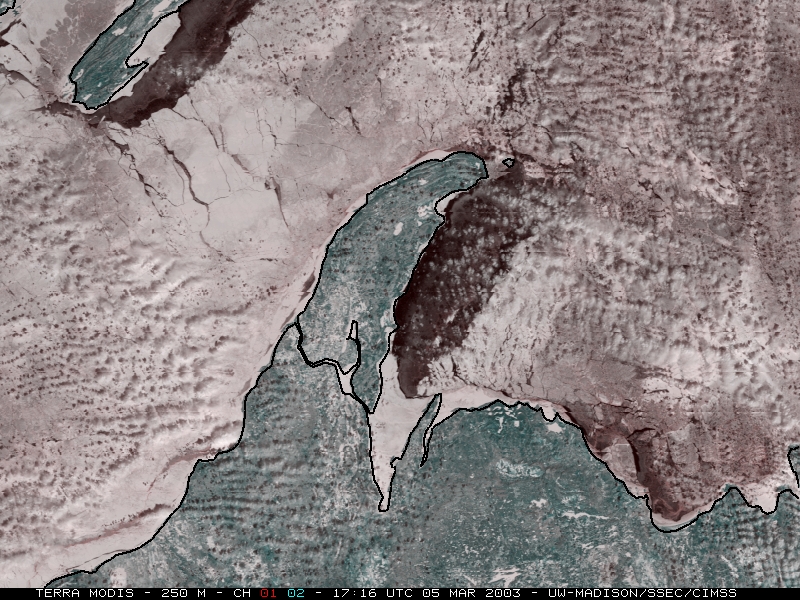
The ice continued to thicken during the record cold temperatures experienced in early March -- on 03 March it was -42 F at Ewen MI, and Marquette MI dropped to -30 F, setting a new record low for the month of March. Minimum temperatures on 05 March included -39 F at Tower MN, and -29 F at Clarksburg and Mohawk MI. 250-meter resolution MODIS composite images are also available from 05 March, centered near Bayfield, Wisconsin and Houghton, Michigan.
|
|
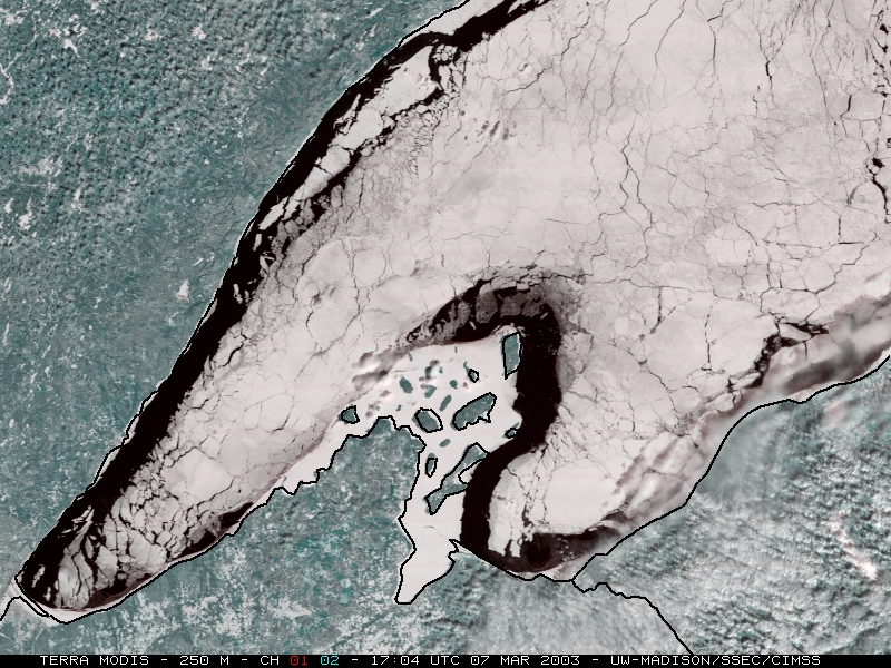
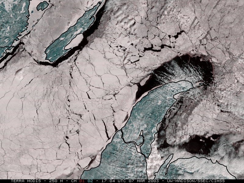
The ice continued to thicken as record cold temperatures persisted -- minimum temperatures on 06 March included -26 F at Marquette MI and -32 F at Clarksburg MI. 250-meter resolution MODIS composite images are also available from 07 March, centered near Bayfield, Wisconsin and Houghton, Michigan.
|
|
Despite several days of record warm temperatures in mid-March (high temperatures in the 60's and 70's F across the Great Lakes region), a significant amount of ice remained in Lake Superior.


